


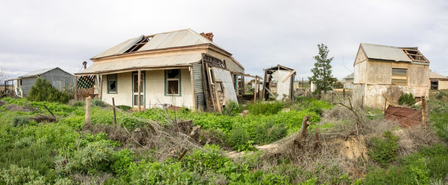
SEPTEMBER 2014: Jervis Bay, NSW


JUNE to AUGUST 2014: To Darwin by Dirt
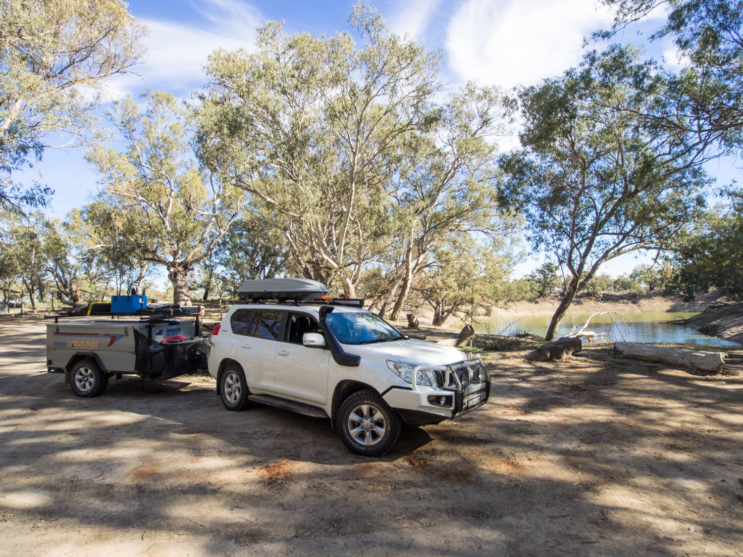
In 2014 I was luck enough to take some time of work and take a trip from Sydney to Darwin exploring all this great country has to offer. The trip was covered in several issues of 4WD Touring Australia. The photos and the stories can be found here:
- The Darling River Run
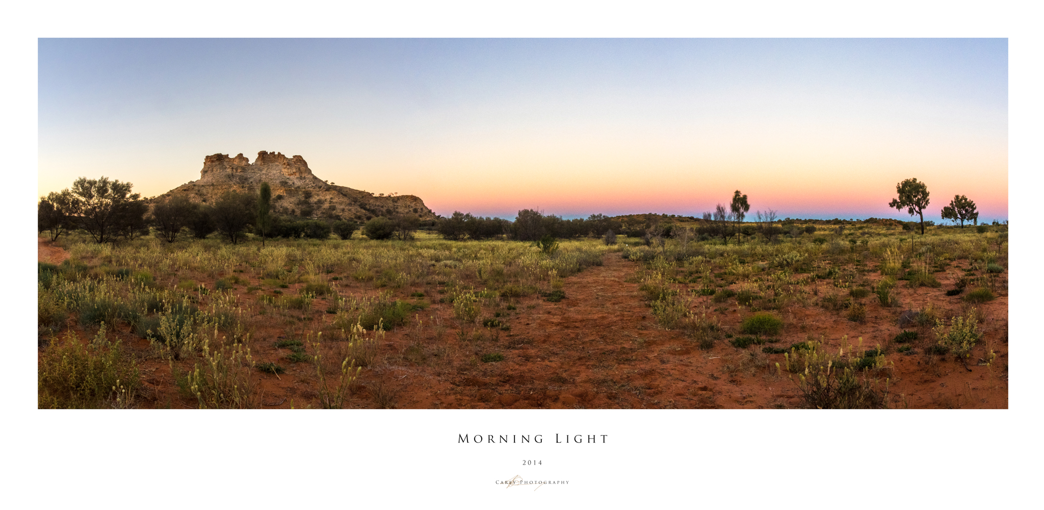
- The Frome Track from Yunta to the Gammon Ranges, The Oodnadatta Track, The Old Ghan to Finke River
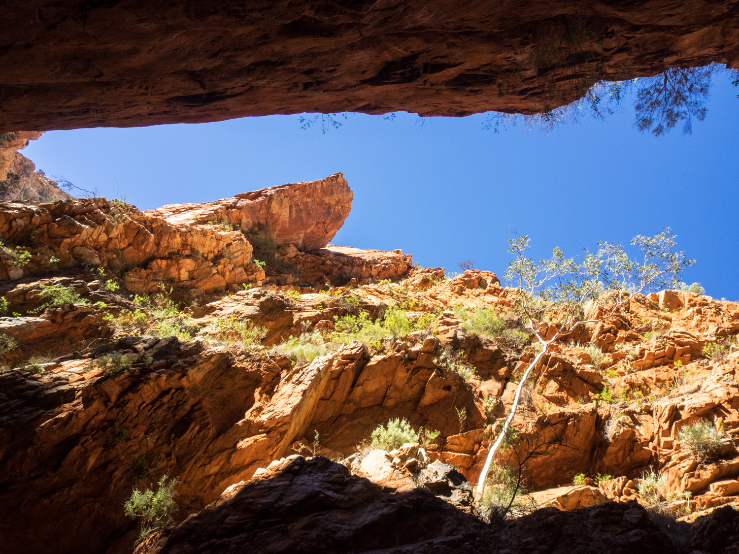
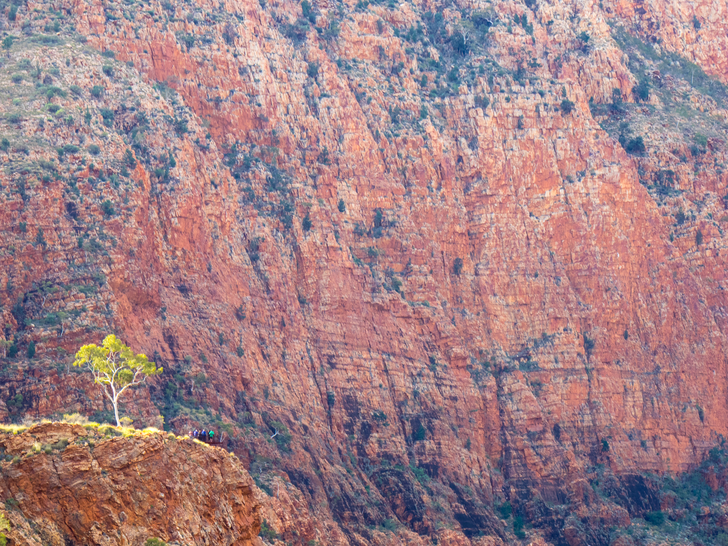
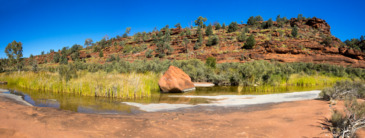
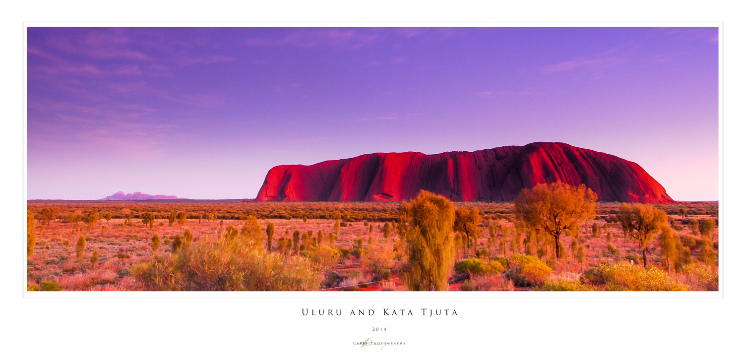
- The West MacDonald Ranges and Kings Canyon, Uluru and Kata Tjuta
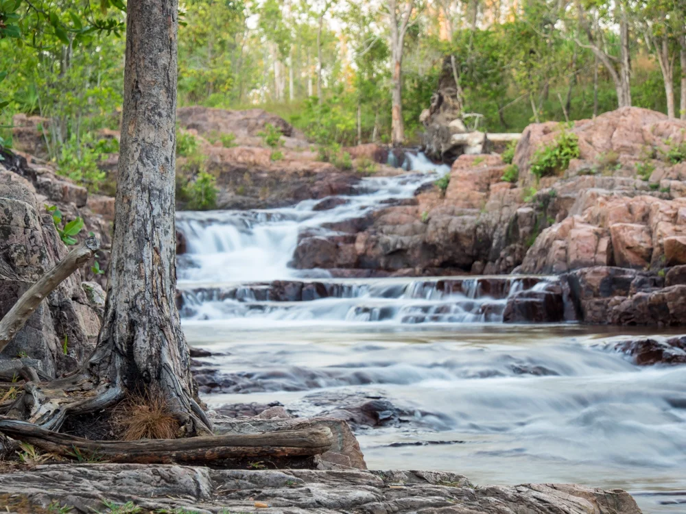
- Nitmaluk, Kakadu and Litchfield National Park
- The Savannah Way and Lawn Hill National Park
- Birdsville and Walkers Crossing
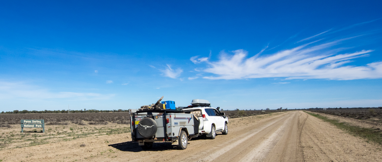
- Paroo and Currawinya
To read a daily blog of the adventure go to
http://jaysea007-darwin.blogspot.com.au/
Below is a quick video of highlights from the trip
Below are some photos from the trip but to explore more please have a look at the dedicated blog
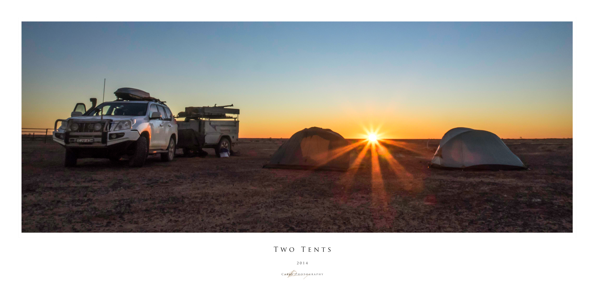
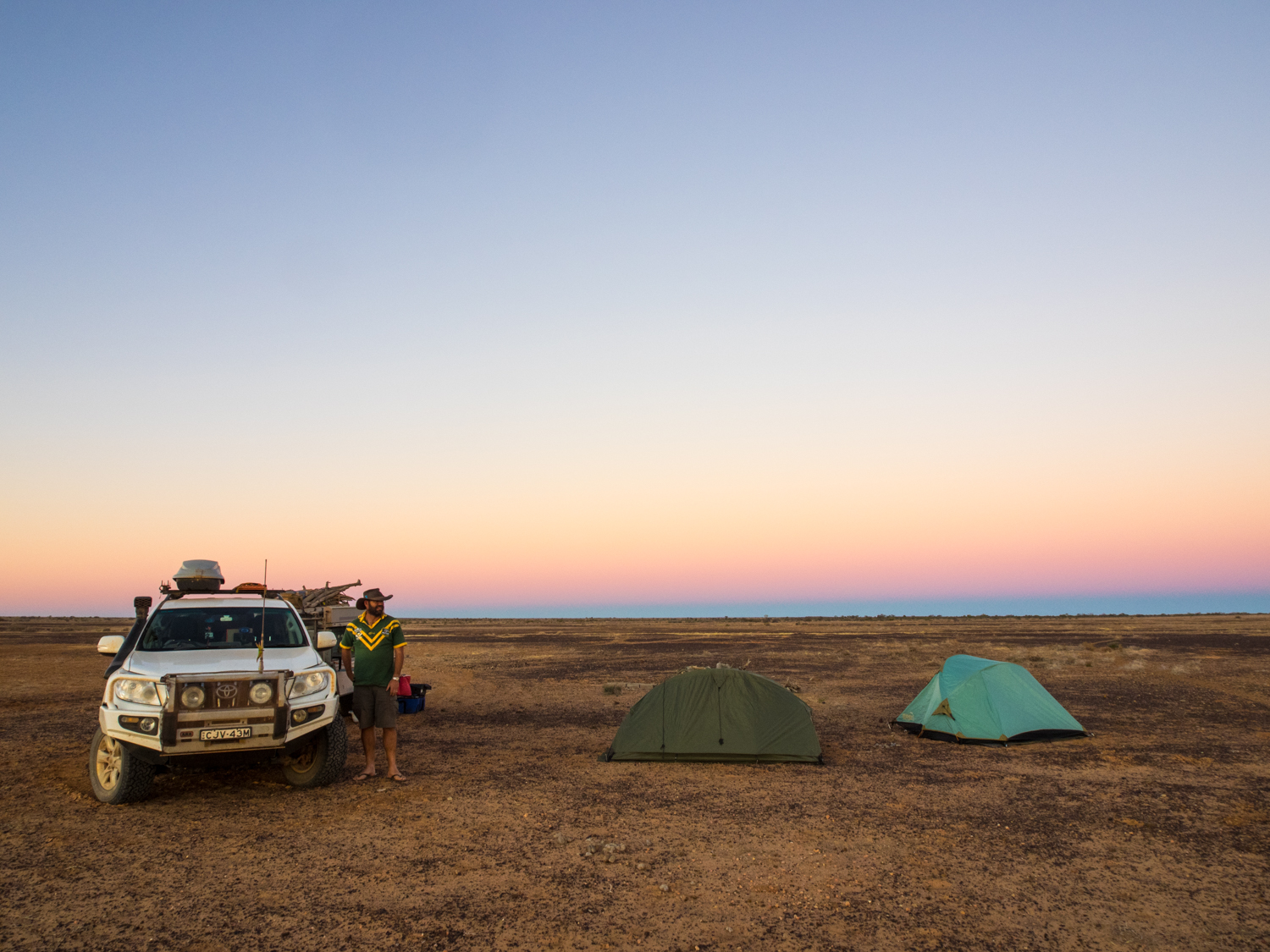
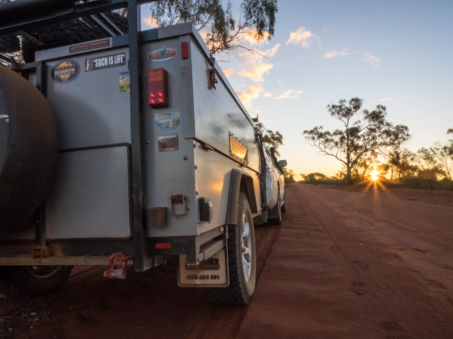
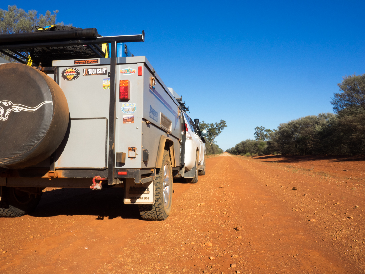
August 2014: To Darwin By Dirt - The Back of Bourke. The finale
This story was published in the October 2015 Issue of 4WD Touring Australia. This is the seventh and last part of a 3 month journey from Sydney to Darwin and back. To read a full account of the trip and view photos and videos go to To Darwin By Dirt.

“There isn’t a journey that does not change part of you”.
This is a quote that swirls in my mind as we pack up camp with the knowledge that this journey will be shortly coming to an end. Soon I will be returning to normality. Work. Traffic.
This is to be the last leg of our journey ‘To Darwin by Dirt’ and back, this time heading from Innamincka through to Currawinya National Park, Narromine and finally Sydney. What started out as an idea, a line on a map, and lots of convincing of my wife, has ended up being a three month odyssey exploring many of the best parts of this great country.
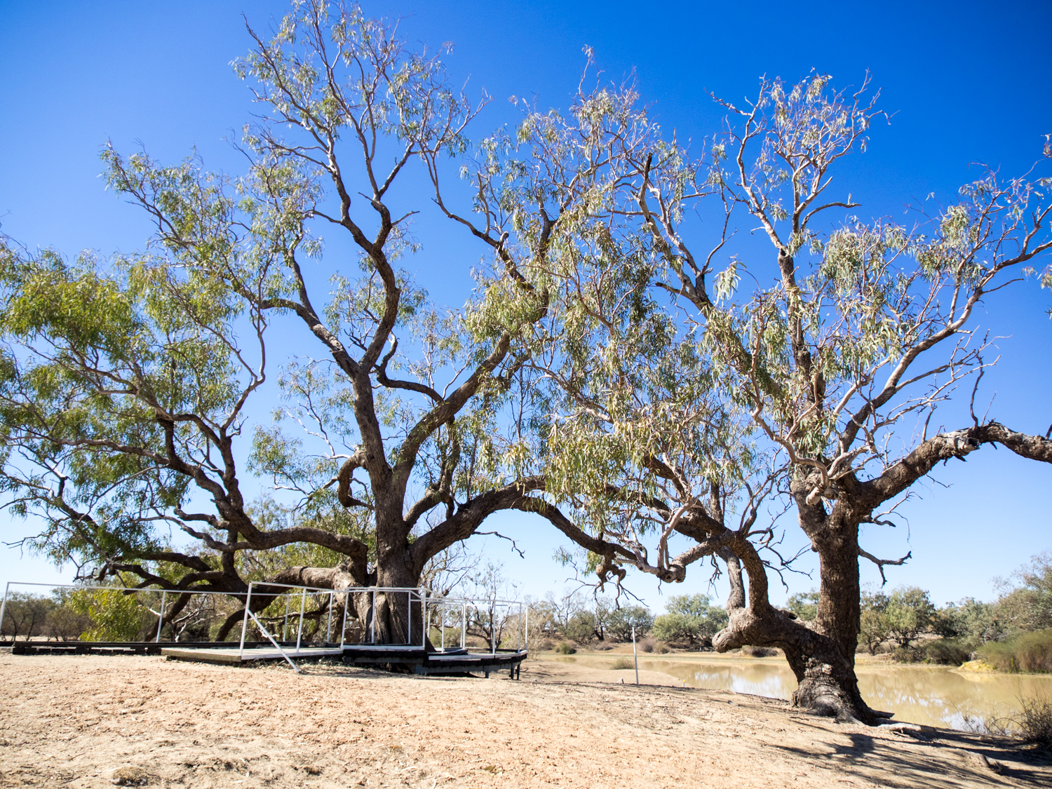
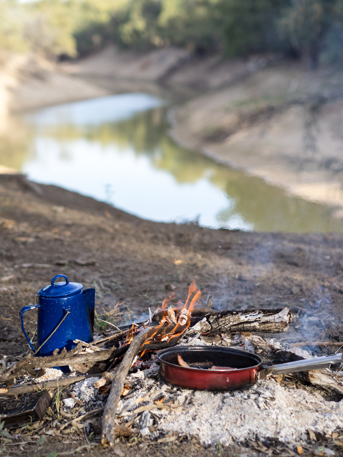
Leaving the banks of the Cooper River it is easy to see why they call this the Channel Country. Driving along the Bulloo Developmental Road to Thargomindah the road passes across the braided river channels that weave between ancient sand dunes. Looking out the window the dry cracked riverbeds hide the natural wonder that occurs when the flood pulses through becoming an ocean of water.
This interwoven water was also the lifeblood that allowed the pastoral dynasty S. Kidman & Co to be formed. Born in 1857, Kidman went on to amass 11 million hectares across the centre of Australia. To survive on this unpredictable land stock was moved around according to the seasons, largely following the same network of aboriginal trade routes connected to the river channels. Recently this immense rural property, Australia's biggest private landholding comprising almost 2 per cent of the continent, has been placed up for sale. It is sad to think that a foreign owner may ultimately own a great chunk of our country.


But I should not be surprised, as the changing reality of this land is made clear as we pass the gleaming silver pipes that make up the Jackson Oil Field. This stark metal factory is Australia's largest on-shore oilfield. We are no longer ‘riding on the sheep’s back,’ or relying on the river channels for pastoral land, as our thirst for oil and gas takes over.
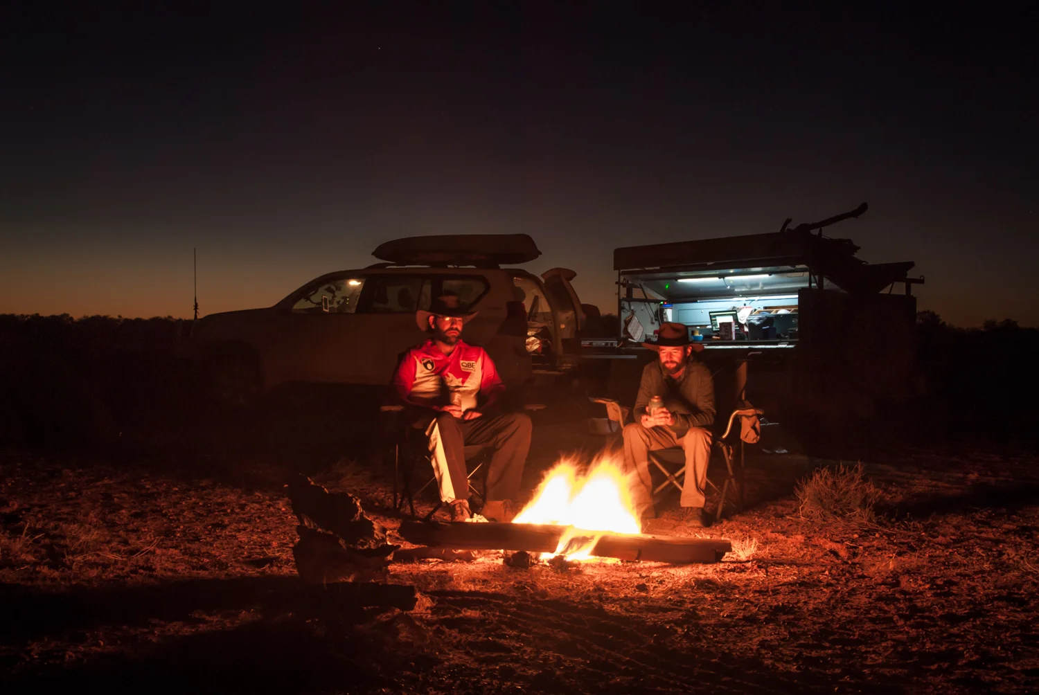
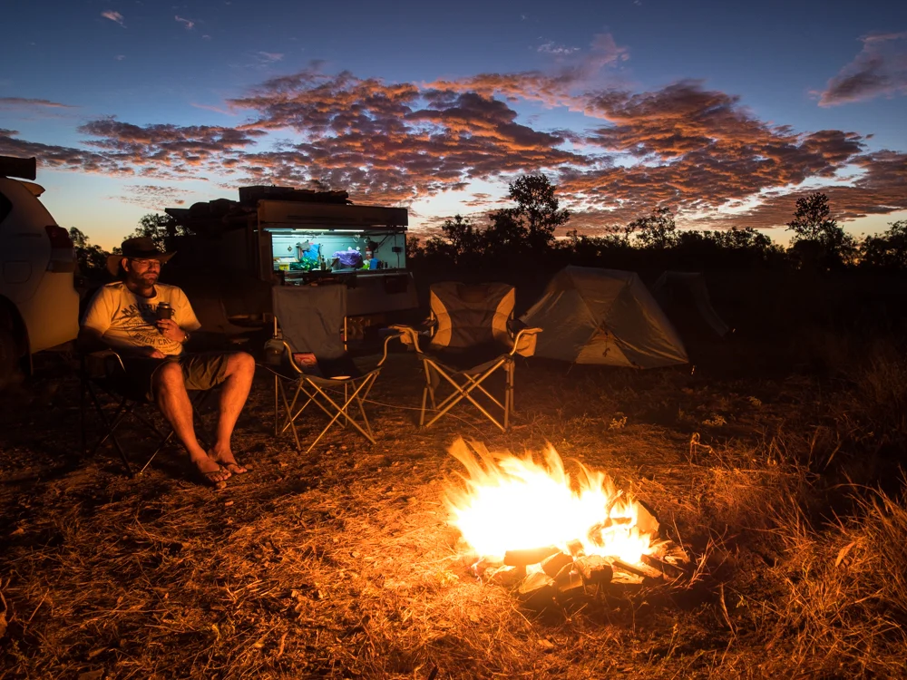
This connection between energy and the outback goes back to 1893 when it is said that Thargomindah produced Australia's first electric street lights. Thargomindah is an Aboriginal word meaning "Cloud of Dust", but as we drive down the main street there is little movement in the sleepy town to stir any. While a drink in the Bulloo River Hotel is calling, the setting sun reminds us we need to find camp before playing dodgems with the many wildlife that appear to be attracted to the bull bar during dusk.
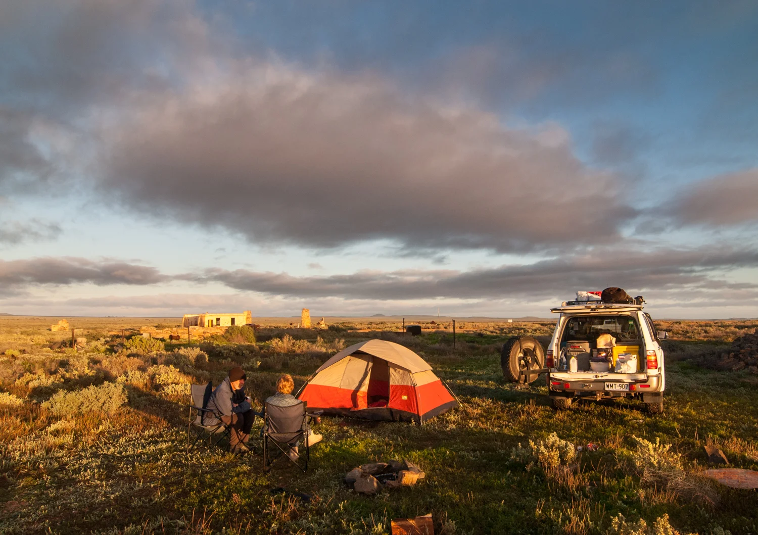
Looking for somewhere to pull over for the night we take a small track, then another, arriving at a rundown bore with the remnants of an old water trough providing a watering hole to the local wildlife. As the sounds Galahs skylarking in the trees fills the air, the reality that this will be the third last camp sets in.


Waking to another great outback sunrise we re-join the Dowling Track heading south towards Hungerford. Approximately 90km from Thargomindah we come across a sign welcoming people to Kilcowera Station. It turns out this large organically run cattle property opens its doors to travellers with bush campsites or shearers quarters for those looking for a real bed. It is a shame we missed this opportunity to meet and stay with those that truly know this land. Next time.
Continuing along the Dowling Track we eventually meet the NSW/Queensland Border where the road runs parallel to a large wire fence that was initially installed in an attempt to keep the Queenslanders from trying to enter NSW (or so I have been told). However it was later put to better use keeping the dingoes out to protect the sheep country of the north.


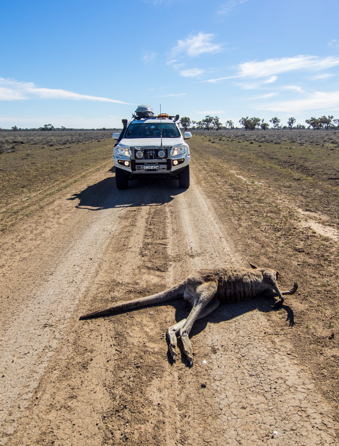
The fence also has the unintended consequence of being a barrier to other animals such as emus, kangaroos and cattle. As we make our way along the dirt track kamikaze emus who are caught between the road and fence throw themselves in front of the vehicle legs going in all directions.
Suddenly, a dark object appears from out of the mulga. The emu in mid stride sees the 4WD and in a moment of indecision it will regret elects to try to stop and turn. As I hit the breaks the next thing I see is a cloud of feathers, and the unmistakeable thud on the front bulbar, followed by that speed hump feeling. I knew this was not going to turn out good for one of us. Looking in the rear mirror a motionless lump sits in the middle of the road.
Luckily there is no damage to the 4WD or trailer despite the signs of impact on numerous parts. It is times like this when a good quality steel bull bar pays for itself. My only consoling thought is the circle of life will continue, where the numerous eagles and hawks just got another feed.

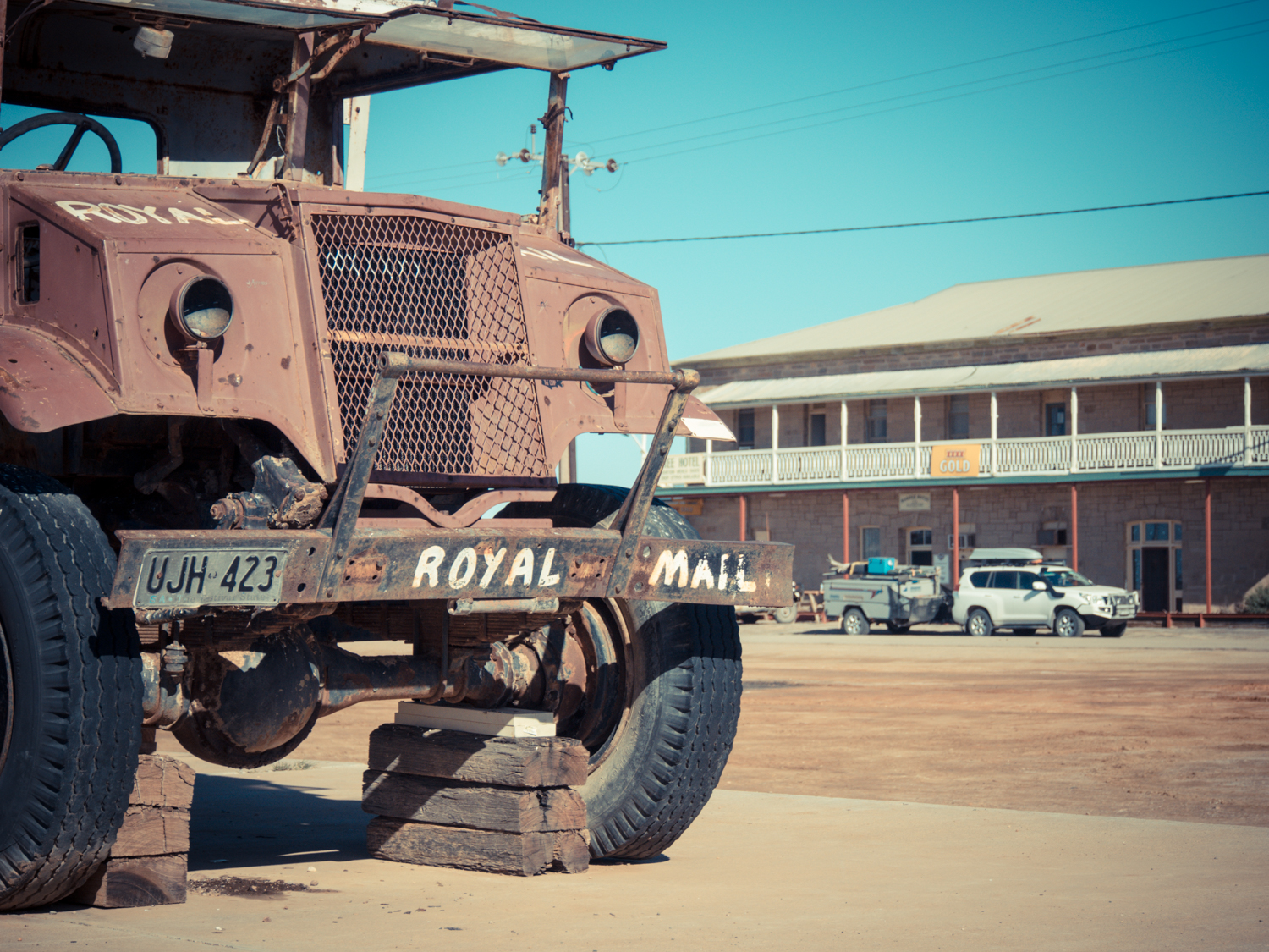
Having given our ‘last rites’, we continue on, arriving at the border town of Hungerford. With little more than the Royal Mail Hotel, it has not changed much since the Cobb and Co Coaches passed through here in 1873. Hungerford is best summed up by the famous Henry Lawson who penned a short story in 1896 about the town. “The country looks as though a great ash-heap had been spread out there, and mulga scrub and firewood planted--and neglected. The country looks just as bad for a hundred miles round Hungerford, and beyond that it gets worse--a blasted, barren wilderness that doesn't even howl. If it howled it would be a relief.”

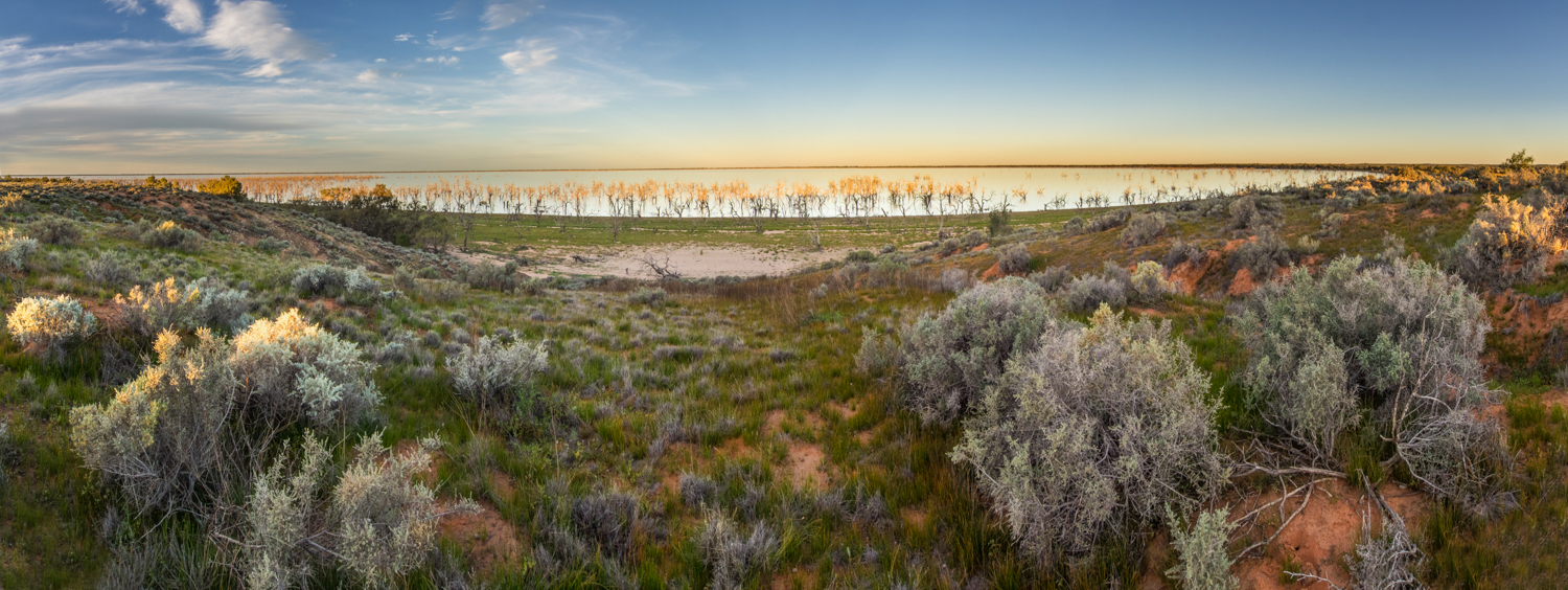
Passing through the gate, and double-checking that we closed it behind us, it is not long before we leave the ‘barren wilderness’ and find a refuge in Currawinya National Park. Currawinya is home to an enclosure that is attempting to protect the reintroduced endangered bilby. Unfortunately a few years ago flooding damaged the fence resulting in wild cats decimating the bilby population. There is news of a new program soon to be reinstalled to protect these unique Australian icons.
But Currawinya is most significant as a Ramsar Wetland site due to its importance for migratory birds. Heading along a narrow winding 4WD track through flat mulga and saltpans, we reach Lake Numalla. This freshwater lake is an immense brown soup that extends as far as they eye can see. Not far from here is Lake Wyara which is saline. While this is renowned for wading birds with a diversity rivalled only by the Kakadu wetlands, the drought conditions mean we see very little bird life.


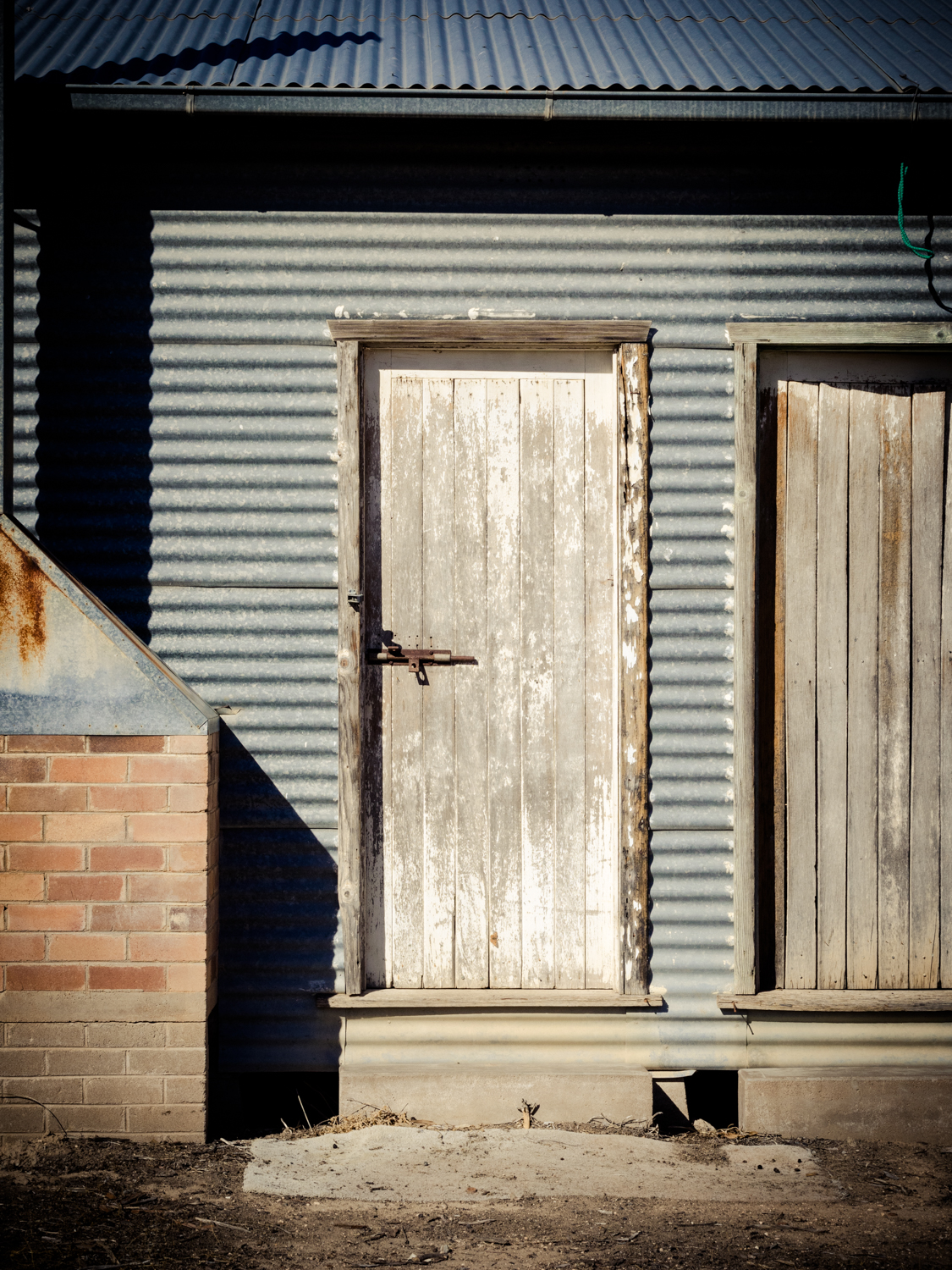
Currawinya was once a sheep grazing property until 1991, when along with the adjacent Caiwarro, it was gazetted as a National Park. Sheep were very common in the Channel Country but soon after the turn of the twentieth century the ravages of the 1890s drought and attacks by dingoes saw cattle take over. What remains is the old Currawinya woolshed. Standing inside, the dust flecks shimmer in the light and the sound of corrugated iron echo through the empty building. This is in marked contrast to the noise that must have been here as hundreds of sheep would have only just been audible over the humming of the motors running the old shearing wheels.


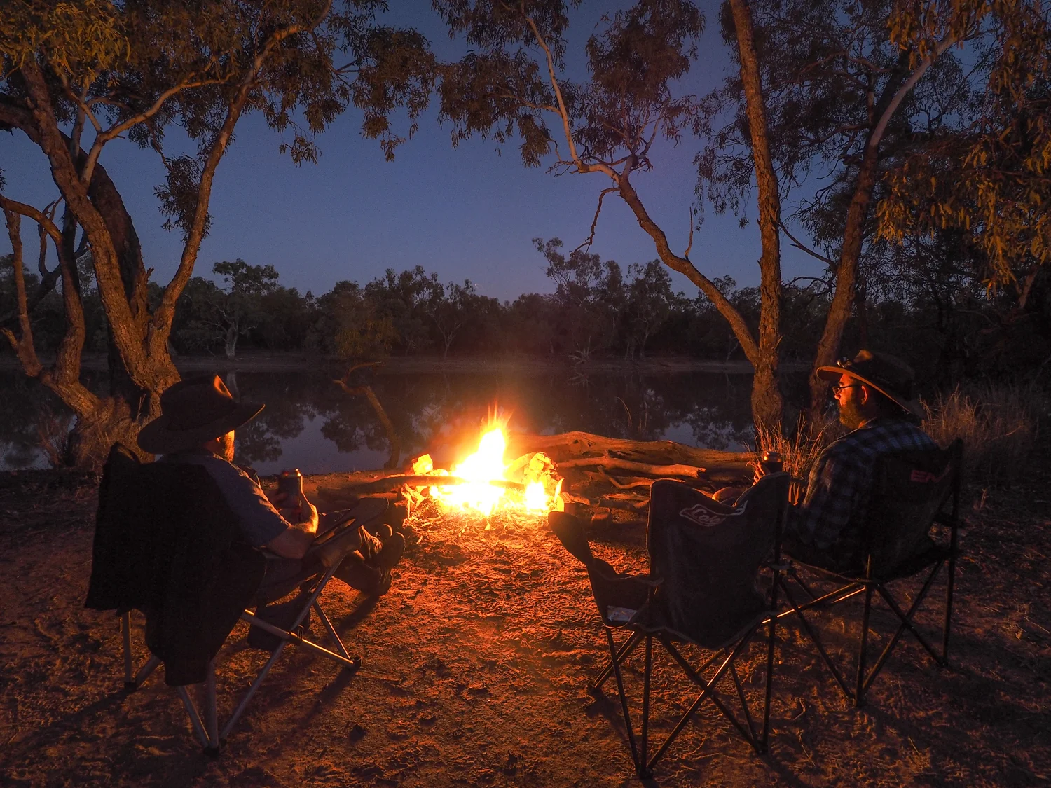
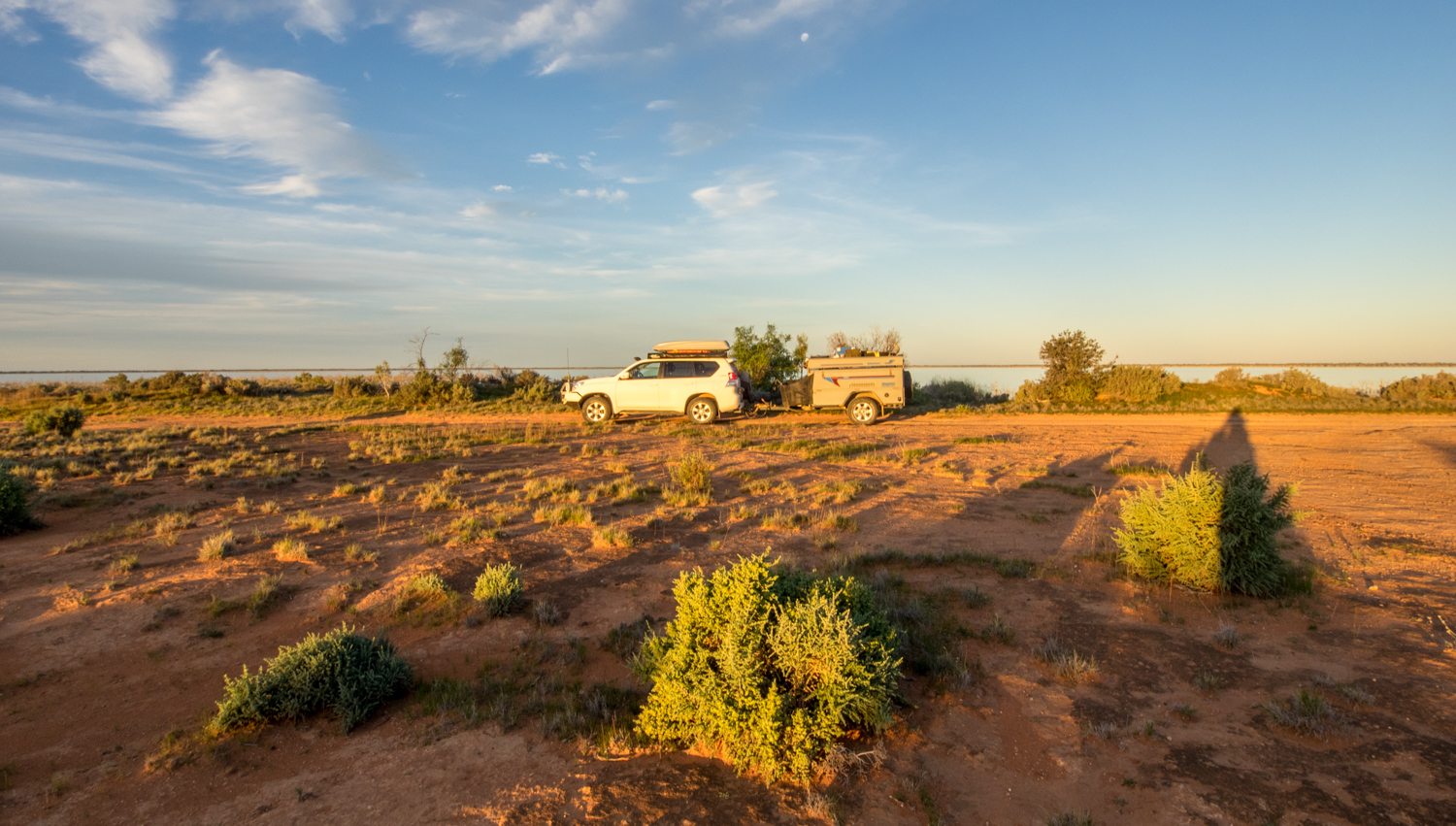
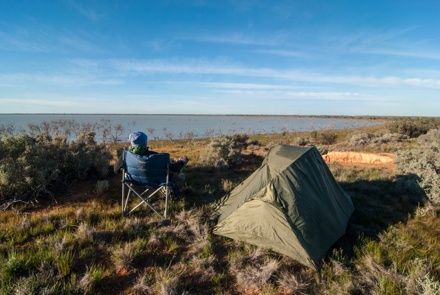
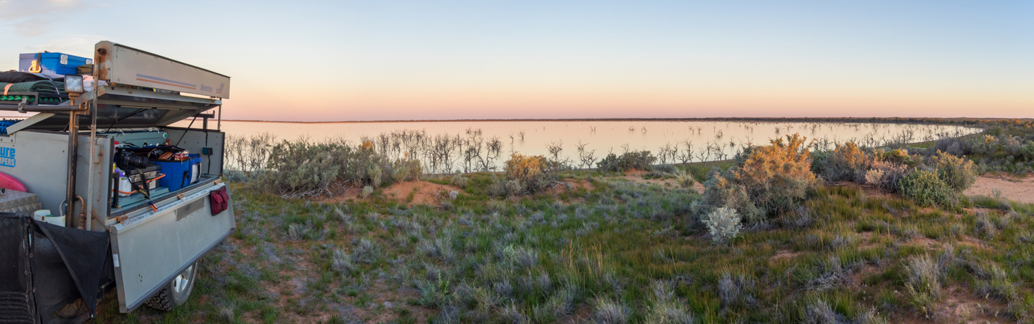
A few hundred meters from the woolshed we set up camp on the bank of the Paroo River. It is amazing to think that this river flows south-west before joining the Darling at Wilcannia, where we were almost three months ago. As the last embers of the fire light up the night I have even more appreciation of Henry Lawson’s evaluation of this part of the bush - “if I ever stand by the graves of the men who first travelled through this country, when there were neither roads nor stations, nor tanks, nor bores, nor pubs, - I'll take my hat off.”


But much like the birds that stop here temporarily as they migrate through inland Australia, we also had to continue on our migration homeward. Leaving Currawinya the dirt road is in reasonable condition allowing us to pass quickly through small towns such as Yantabulla and Fords Bridge. Reaching Bourke there is the tell tale signs our trip is coming to an end. Most noticeable we are finally back on to the black-top for good. With more people on the road I try the one finger wave to a passing traveller but I have obviously reached the threshold were this is no longer done.
The weather has also changed with large clouds forming in the sky and a strong cool wind blowing. We move in to low rolling hills with the surrounding vegetation turning green and crops of yellow canola lining the road. We push on to Narromine and search for our last bush camp and campfire by side of Macquarie River.

Waking to a brisk morning, I am already missing the warm weather of the north. The outside temperature reading in the car struggles to rise over 4 deg C. Eventually reaching Bathurst we are brutally reminded of winter again as we drive through the fine covering of snow over the hills. I have an extremely strong desire to turn the car around and head north. I wonder what Cape York is like at this time of year? But the pull of family who are waiting at home is stronger.
Weaving our way up through the Blue Mountains, the white powdery snow blankets the rolling hills. Snowflakes hang to the pine needles their crystals glistening in the sunlight. Sheep huddle together protecting themselves from the icy breeze cutting through the air. Eventually the lights of Sydney come in to view blurred by a stream of car head lights snaking their way home after a days work. There is the occasional stare from a driver, looking longingly at the 4WD with tell tale signs that it has had an adventure. It won’t be long before I am following in their congested path wishing I was some place else.


As the stream of traffic rushes by a similar stream of thoughts of the last three months come flooding back. From the remoteness of the Oodnadatta, to the awe inspiring Uluru. The wildlife of Kakadu to the people of Arnhem Land. The 4WD tracks of Lorella Springs to the fun of Big Red. There are far too many memories to grasp. But it is comforting to know that the journey will never really end while these memories remain. This is the power of Touring Australia.
Pulling in to the driveway one last quote comes to mind - “The end of a journey is only a beginning to another”.
I wonder what my next journey will be?
August 2014: To Darwin by Dirt - Birdsville and Beyond
This story was published in the August 2015 Issue of 4WD Touring Australia. This is the sixth part of a 3 month journey from Sydney to Darwin and back. To read a full account of the trip and view photos and videos go to To Darwin By Dirt.

The thousands cheer, the banners wave, The glorious sun shines down, When Burke and Wills, the gentle, brave, Set forth to seek renown. Eliza Berry 1892
Why do we explore? Is it to discover a new place or to discover something new in ourselves? Is it driven by curiosity or boredom? Many of us live within our comfort zone and don’t see ourselves in the same light as great explorers such as Hillary or Mawson. However there is an explorer in all of us, somewhere. And you don’t need to travel to the other side of the world, have expensive gear or years of training. You just need the courage to step beyond the routine.
It is with this notion of exploration that saw us follow in the shadows of two famous explorers, Robert O’Hara Burke and William John Wills, as we made our way from Mount Isa down through Birdsville and Innaminka.
One hundred and fifty five years ago, a party of courageous explorers (or fool-hardy depending on your view) set off on foot north in an attempt to be the first to cross the interior. 300km north of us is camp 119 where Burke and Wills left the remaining two expedition assistants Charles Grey and John King to make the last dash to reach the shores of Carpentaria. Having survived their journey from Melbourne they eventually decided to turn around, being so tantalising close to the coast but not quite making it. Likewise this was our turning point as we began our own journey home.

Joining the Diamantina Development Road we make the most of the narrow strip of tar quickly eating up the miles. With Bourke River, Wills Creek and King Creek to the east of us the landscape of the Channel Country slowly changes. The road, winding its way through the red rocky outcrops of the Selwyn Ranges, makes way for straight stretches disappearing in to the mirage of water appearing to lie on the road. The Gidgee trees slowly disappear leaving behind endless flat tussock grass and dry stones punctuated with the occasional ribbons of red dune. Even the sky appears to change from a rich blue to a pastel bleached white as though the colour had been stripped from the landscape along with the water. We are finally returning to desert country.
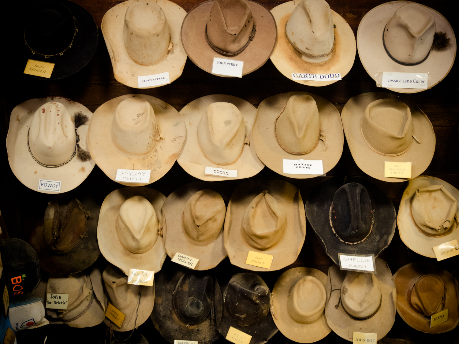
Soon we pass through Dajarra, Boulia and Bedourie, three small dots on the map. Lee Kernaghan calls these 'hat towns'. With the lyrics “there’s a pub a store and not much more, you’re living in an old hat town”, the old cowboy hats hanging in the Djarra hotel bring the song to life.


While Birdsville is not far ahead a decision is made to experience the isolation felt by Burke and Wills. So pulling off the dirt road we follow two barely visible wheel ruts across the flat bare earth finally reaching a disused windmill. In the flicker of the orange glow from the camp fire we spend the evening debating the myths and stories of their fateful journey and reliving some of our own.

My school boy memories of Burke and Wills was about heroism, scientific research and self sacrifice. But there is another story about an ill equipped team who failed in a land grab. It is an Australian tradition to create legends from our rogues and failures. Ned Kelly, Gallipoli, Waltzing Matilda. Burke was considered to be impulsive and irrational, unwilling to learn from its indigenous people and had never led a team on such a journey before. However, with the passing of time this infamous flawed trek and its associated landmarks have become a place of pilgrimage to modern day explorers.
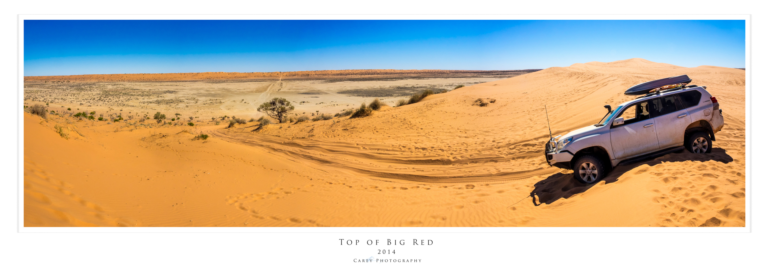
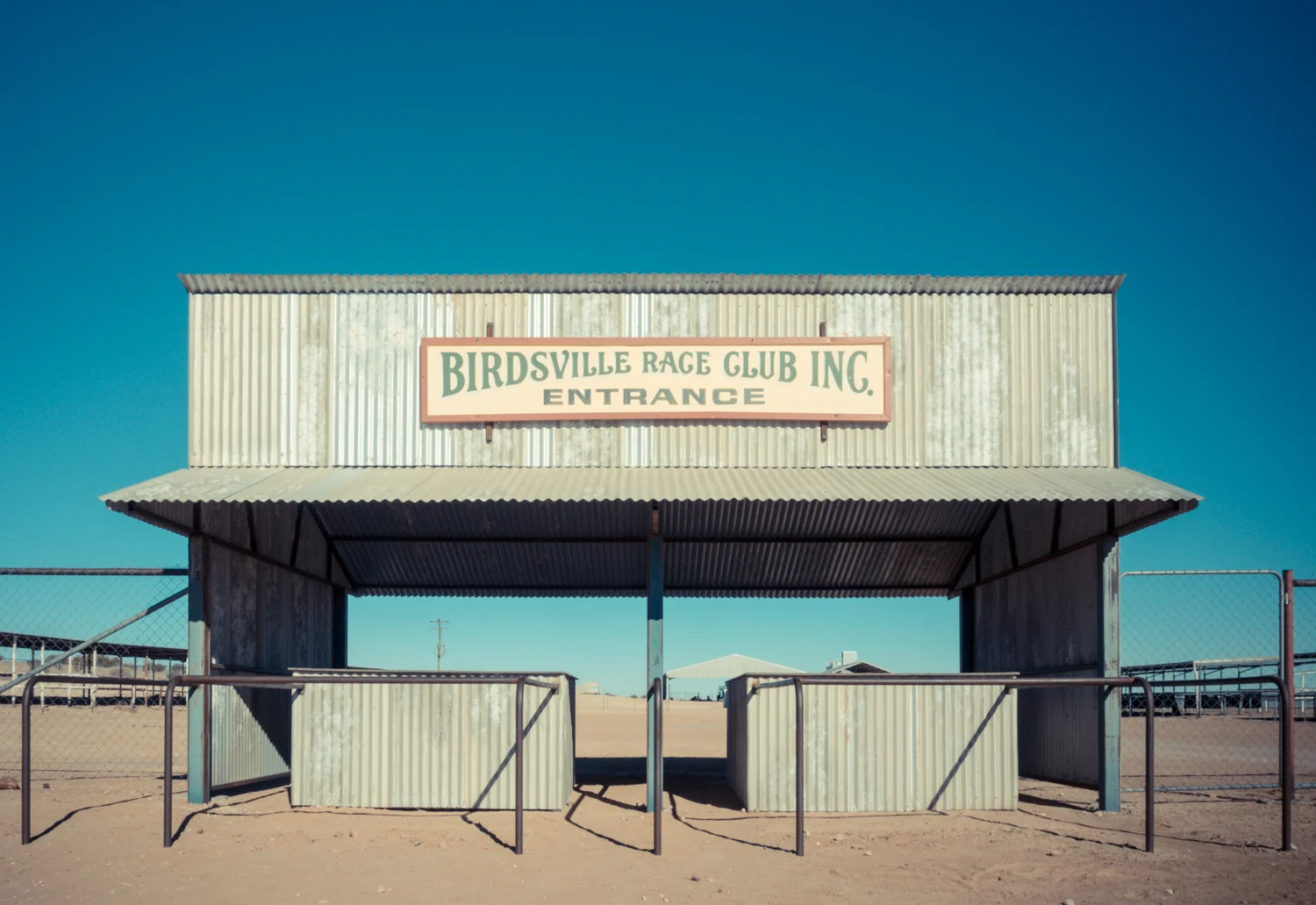
Leaving camp just as the sun begins to emerge from its slumber we soon reached camp 76 on the banks of the Diamantina River on the edge of what is now Birdsville. Birdsville typifies everything that is the outback. Its Pub, horse race and Big Red, three icons of Australia.
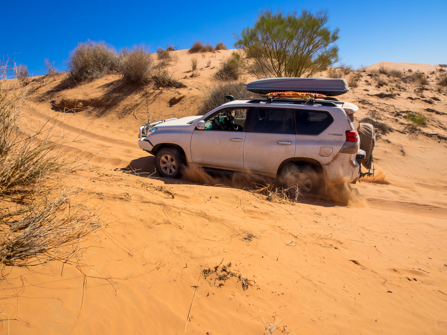
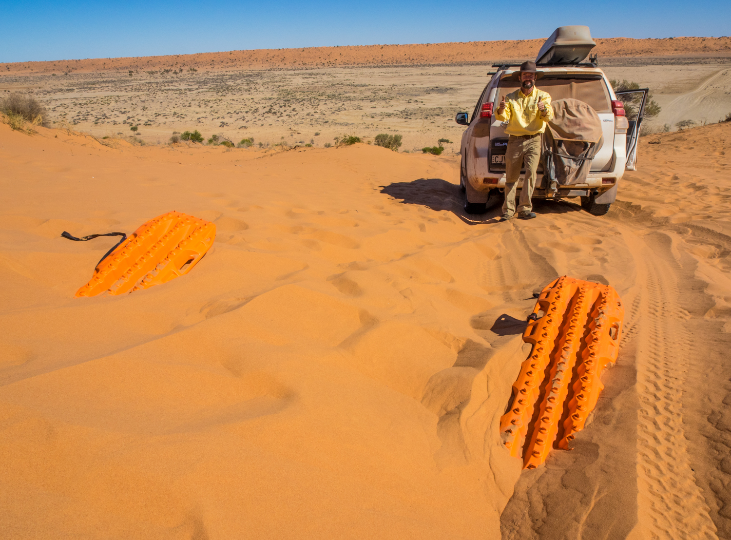
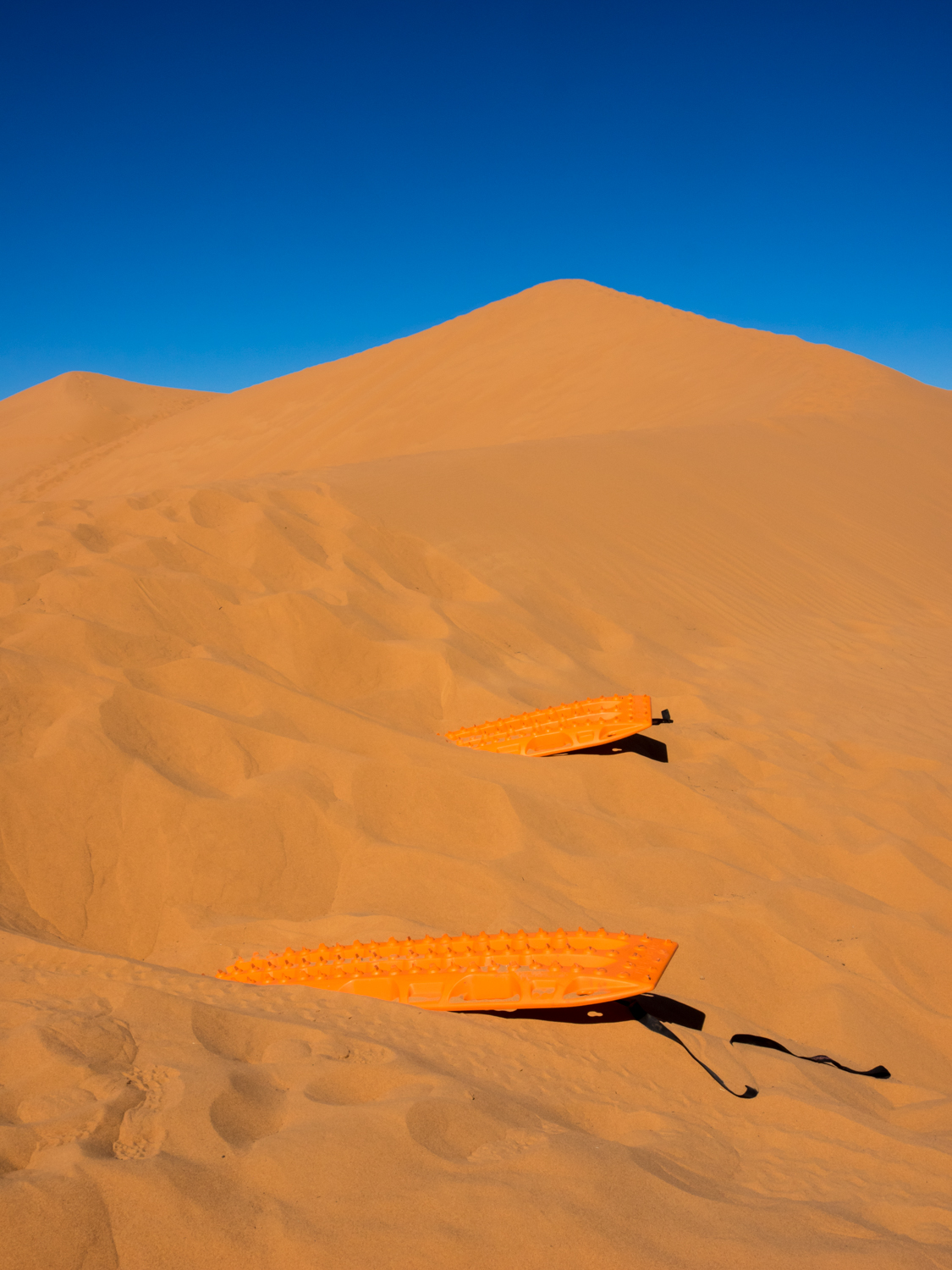
While the Simpson Desert will have to wait for another trip, we make our way to the 30 metre high sand dune that rises like a cresting wave out of the desert. When we arrive I am surprised to see no other cars attempting the climb. Not daunted, I lower the tyre pressure, point the car at the steep track, shift the car in to 4WD and hit the throttle.
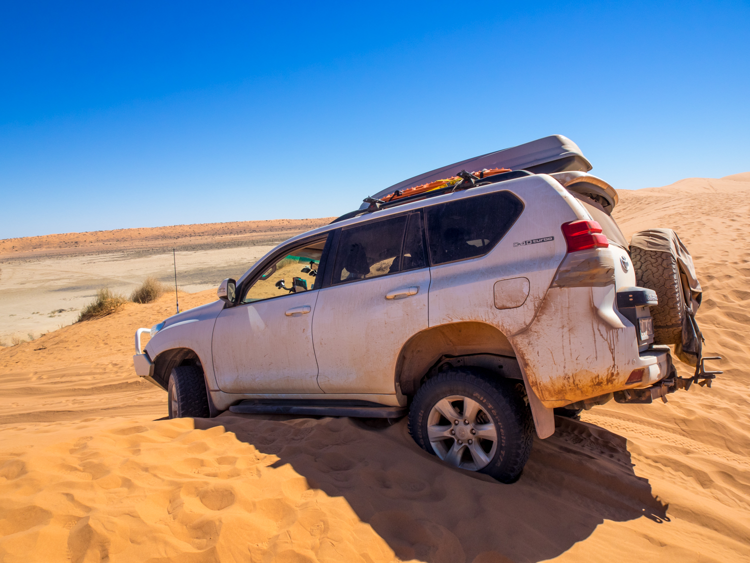
Starting back on the flat plain the car builds up speed along with the level of confidence. Then at the base of the dune the car jumps and shudders from side to side like a bucking bull. The fight begins between the spin on the tyres and the clutches of the sand. As the wheels spin and sand flies the battle between machine and nature is now at its peak. But this time nature wins with the car lodged at the crest like a playground sea-saw 2 wheels helplessly in the air, the others digging them selves in to the sand.
With no other car around to snatch us out, luckily I had my recovery gear sitting next to me. So I lean over and ask him to get out of the car and start digging. But I was more prepared than that, luckily carrying the maxtrax. After a bit of sweat, interspersed amongst the laughter, we are out and down the other side. If we were doing the Simpson there was another 1112 dunes to go!


With the adrenalin slowly disappearing it was time for a beer, and what better place to go than the Birdsville Pub. The pub has served drinks to weary travellers as far back as 1884. It is full of hats of past locals who have done their time in this harsh environment. Standing on the edge of the verandah, beer in hand, our trip may not have been as harsh as Burke and Wills but it was just as adventurous.


The town is said to have a population of 115 + or - 7000. This is largely due to the influx of travellers for the Birsdsville Races. As we stand in the middle of the race track you can almost hear the echoes of the hooves kicking up the dust and the revellers cheering on the riders, not caring who is winning but just enjoying the moment.

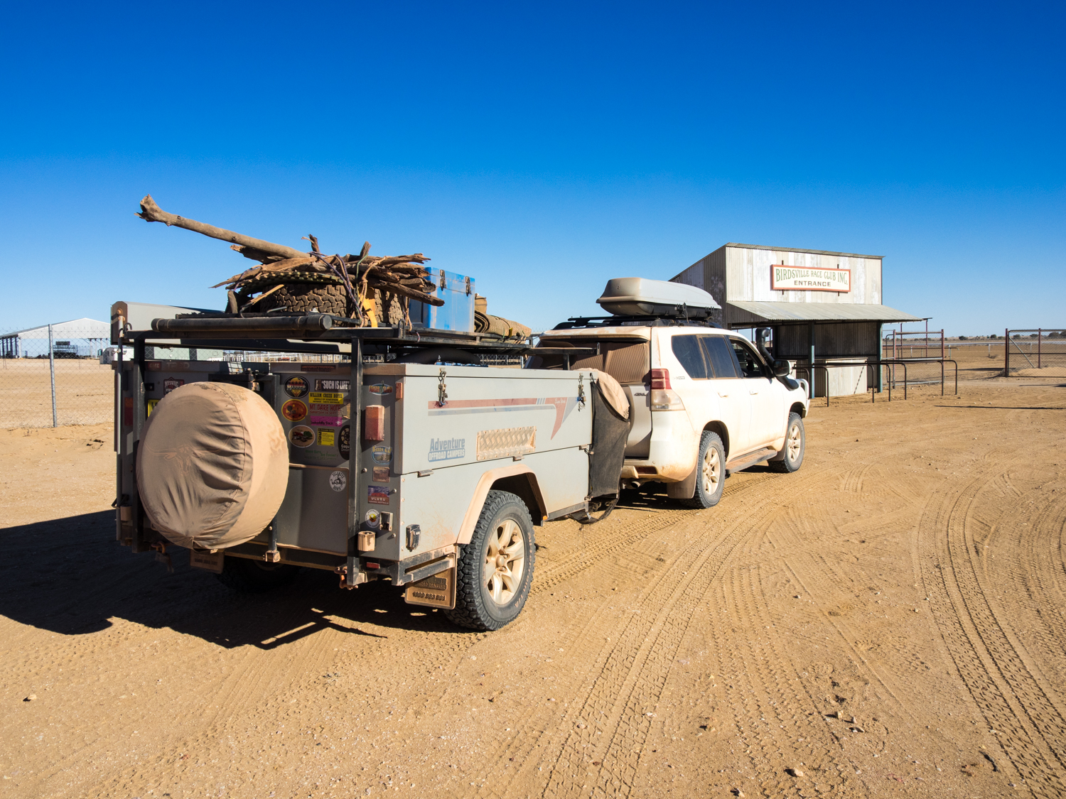


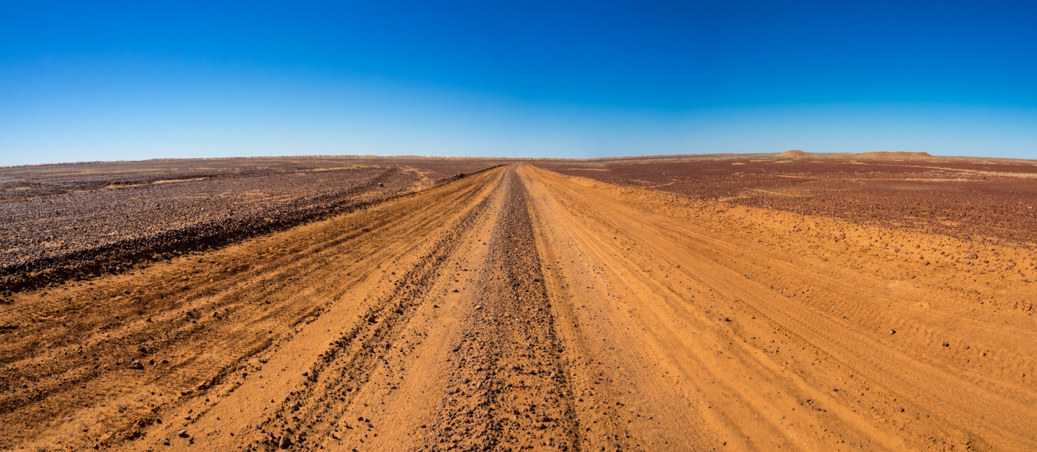
Leaving Birdsville we follow the path of cattle duffer Harry Redford who pioneered the now famous Birdsville Track. But rather than heading back to Maree, it was time to take a less travelled path following Walkers Crossing heading to Inaminka. Walkers Crossing skirts the edge of the Sturts Stony Desert and passes through the Strezeleki Desert. This remote track crosses a candy stripe of gibbers and white and red sand dunes. In between there are the gnarled eucalypts, acacias and haceas clinging to the sand waiting patiently for the rare rain to rejuvenate them.


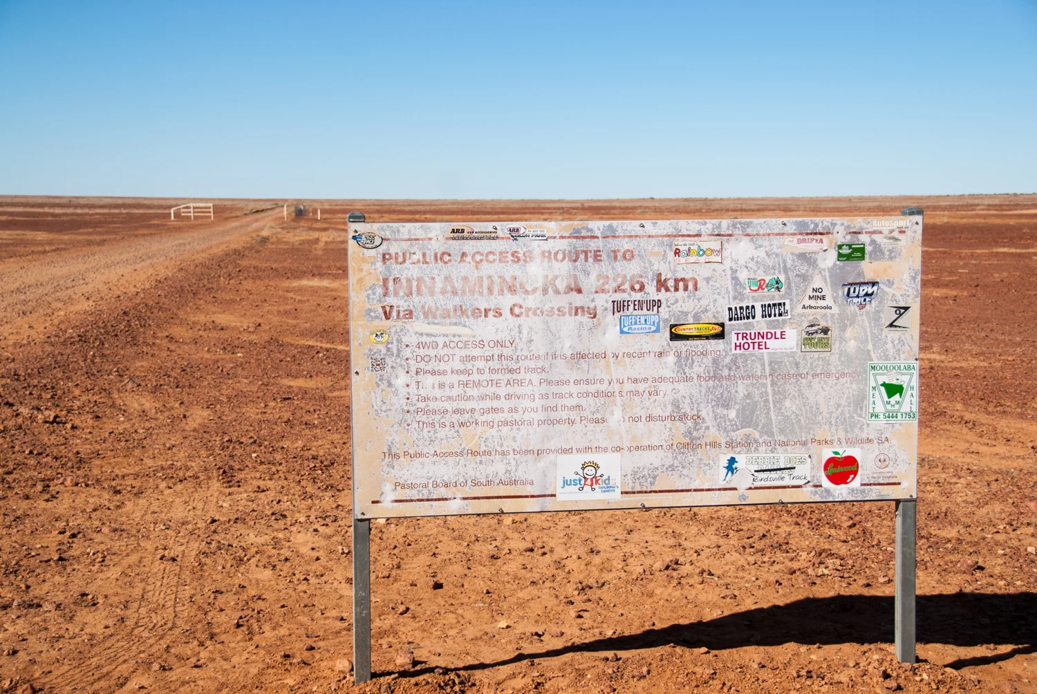


Something that Burke and Wills would not have appreciated was this sandy desert was once covered by glaciers and lakes. These have been buried for millions of years forming now valuable gas and oil fields. Unfortunately our insatiable appetite for energy has scared the landscape with numerous restricted tracks that bulldoze their way through, with little care for what is in front of it. These wide straight roads are in sharp contrast to our narrow crossing winding in and out of the creek and dunes, fitting in to the landscape not fighting against it.


The track crosses the explorers’ path until we eventually reach Grey’s grave. Charles Grey was one of the expeditions assistants and one of last 4 to head north. But Camp 58R was to be his last resting place on 4 April 1861. In the comfort of our 4WD it is difficult to fully appreciate the adversity of their journey. But it is equally difficult to understand why they didn’t make better use of the traditional owners and their knowledge of survival in this barren land.
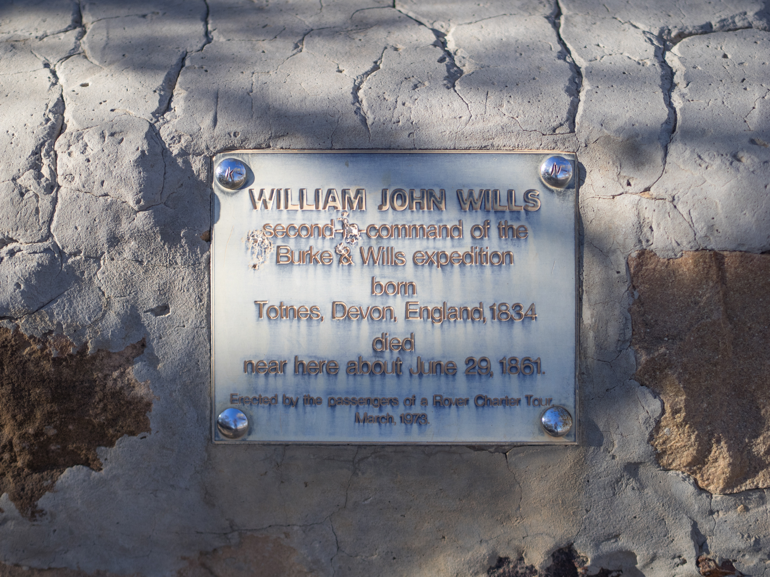
Further on we reach Will’s Grave hidden amongst the Coolabah and Bauhinia trees near the banks of the Cooper River. The lonely stone piles and pipe a monument to the fateful day in June 1861. William John Wills, who eventually became second in command, was the one who most likely was the reason for the group getting so far. His strength of character is reflected in his last letter to his father:
"These are probably the last lines you will ever get from me. We are on the point of starvation ... My spirits are excellent.
Finally reaching Innamincka it is time to refuel and visit the Innamincka Hotel. Starting out as a police station in 1882 the town has grown and shrunk with the passing of time. It is now little more than a refuelling point for car and man.
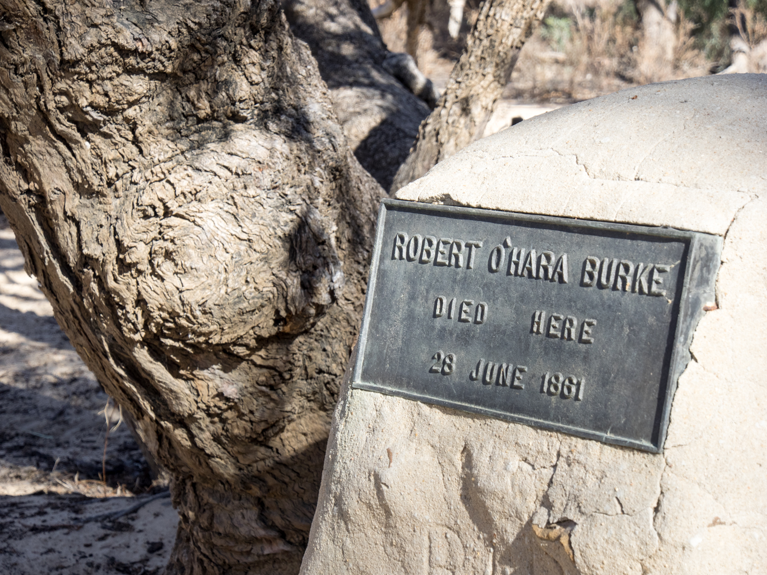
Like the early explorers seeking rest at the end of a long day we leave the dust of Inamminka behind and make camp at Cullyamurra waterhole on the bank of the Cooper Creek. Not far from here is the place of Burke’s last breath at a place now fittingly called Burkes Waterhole. The creek is a meandering ribbon of life and it is difficult to align an image of the quenching waters of the Cooper with that of a dying man. The magnificent River Red Gums that line the banks of the creek are old enough to have watched Burke slowly perish.
Following Burkes death, King, the last of the fateful four stayed with aboriginal people until he was finally found by Edwin Welch.
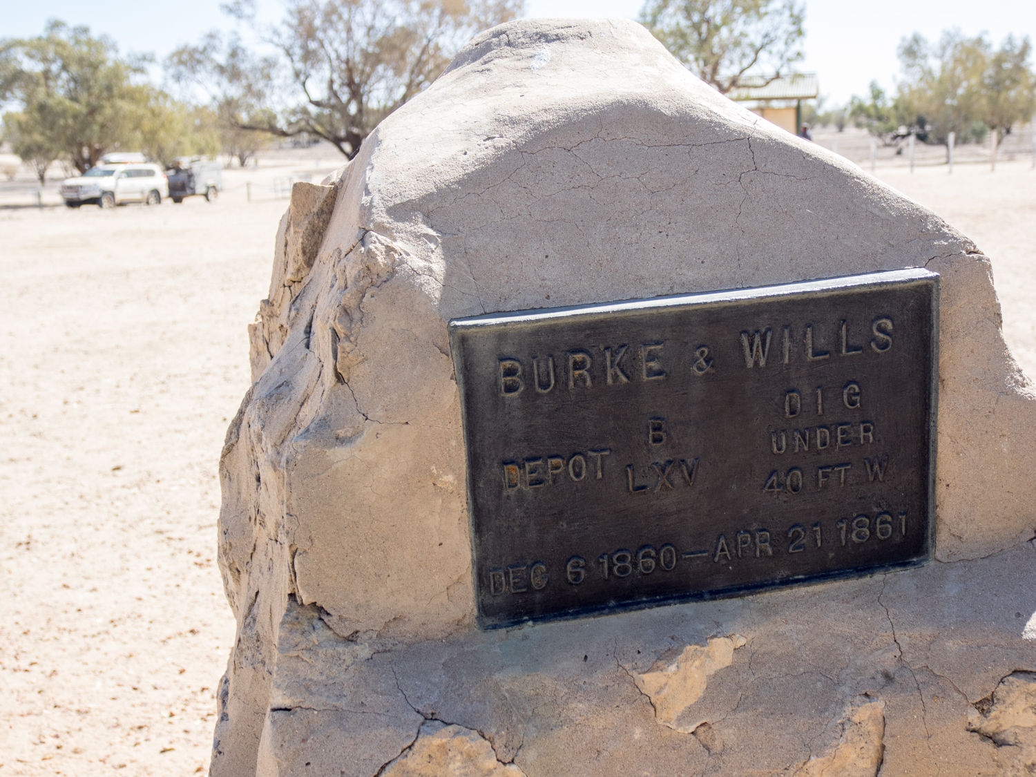
Further along the Cooper Creek we finally reach the famous Dig Tree. A month before they perished they arrived at camp 65 aiming to meet their support party. Unluckily they found it deserted, the ashes of the campfires still warm, and a tree with newly cut the words DIG. April 21, 1861. Buried below the tree a note that their lifeline had departed 9 hours earlier leaving them to their fate in the desert.

Having reached the end of their journey, it was almost time for us to end our own. While there is so much more to the story of Burke and Wills, there is also more to our story of this trip. Cutting our way between the Strezelecki and Sturt Stony Desert, we have explored parts of this land that very few see. But being an explorer is not about visiting just a physical location on a map. It is about exploring part of your own spirit and being courageous enough to step out of the routine. It is about getting out and exploring this great land, and may be, like the country balladeer Graham Rodgers sings, carving your own name in history.
Hey Burke and Wills will it ever end? Will the desert ever set your spirits free? Together with King and Gray, you carved your names into history. Graham Rodger 2005
JULY 2014: The Quamby Triangle
This story was published in the November 2015 edition of 4WD Touring Australia.

When touring it is useful to have a clear plan or itinerary on where you are going and what you plan to see. But sometimes, breaking that plan can be the best decision of all.
Take the time a mate and I were heading south from Mount Isa on the homeward leg of a trip. The car was packed and the last thing we needed to do before leaving the Isa was to fill up with fuel. Stopping at the service station I was distracted putting air in the tyres, while it appeared my travelling companion was also distracted talking to three fine young ladies. Later, inquiring the nature of the conversation (code for - were you chatting them up?) he replied that they had asked if we were going to Quamby? Unfortunately he was so distracted that he forgot to ask where Quamby was and what was there.
With the wonders of technology we did a quick search on the ipad. The good news was Quamby appeared to be only 150 km from the Isa. However the bad news - it was in the completely WRONG direction from where we were going! Searching a bit further it turned out the girls were heading to the "Quamby Rodeo"
Decision time. Do we stick to the plan and continue our journey south or break out of routine in search of a unique outback experience? Throwing caution to the wind we pointed the 4WD in the opposite direction and headed east.
45kms north of Cloncurry, Quamby was once a Cobb & Co staging post and stop over servicing the cattle and mining industries. The aboriginal meaning of Quamby is to 'stop, rest a while', which is fitting, as the only building that remains is the Quamby Pub built the 1860s. Not far past the Quamby Pub we reached a large paddock with the un-mistakeable gathering of Toyota utes, large horse floats and cattle trucks.

Rodeos may at first appear to be relegated to the hard men of the outback. However these events also bring together outback families from far and wide, to meet, share stories and escape some of the stresses of living on this harsh land. The Quamby rodeo started in 1997 and is run by the local Sports Association with all profits from the day being invested back into the local community.
We spent the next two days immersed in clouds of dust watching the amazing outback riders tackle the Bronc ride, steer wrestling and barrel race. But the pinnacle of the event is the brave (or some would say mad) cowboys that willingly hop on the back of 800 pounds of muscle with the likelihood of being thrown skyward before landing in the dirt before the 8 second bell sounds. The only thing protecting them from a hoof or bull horn ending their riding career is the bull fighters (don’t ever call them clowns) who risk their own life to allow the cowboy to ride another day.
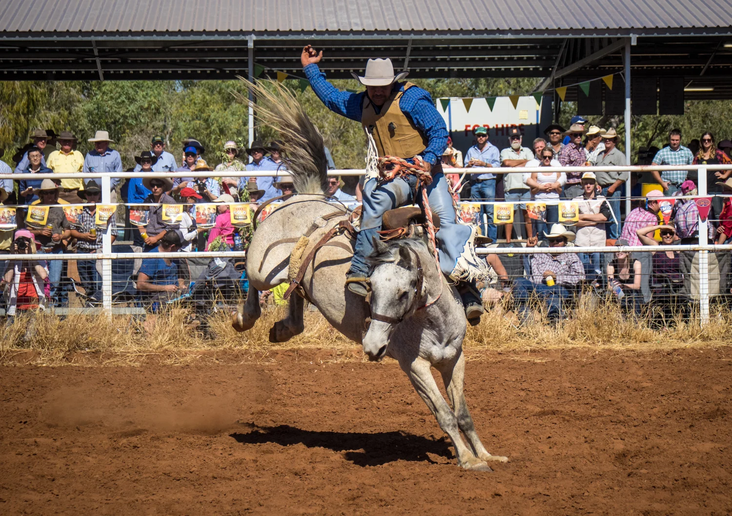


While the events take centre stage the evening is filled with the sounds of Johnny Cash and Lee Kernaghan, dancing, drinking, stumbling and more drinking. It is a time for the dusty bush clothes to be replaced with blue jeans (absolutely compulsory), long sleeve checked shirt for the cowboys and paisley shirts and jewel bedazzled belts for the filly’s. The one essential part of the uniform is the personalised Akubra hat which range from pristine 20 Gallon monsters to the battle scared dusty felt remains that have seen cattle dog pups born in them. Chatting to a lady next to us it must have been obvious to her that we were not wearing the correct attire. Leaning over she quips, “If you ever want to meet a nice girl then this is the place. Although they would not go for a city bloke like you. She will only have a cowboy.”
To me the Quamby Rodeo defines this part of the country. Resilience, mateship, community. While there are bigger events such as the Mt Isa Rodeo where over 20,000 people watch man take on beast, Quamby is devoted to a small number of outback heroes coming together to support each other.
If it was not for the three young lasses at the service station, and a willingness to throw our plans out the window, we would not have been fortunate enough to experience a truly unique part of the Australian outback soul. This experience could not be summed up any better than a local we met on the night who said: "You wouldn't want to be anywhere else in Australia tonight.
To see some more photos from the rodeo go to Rodeo images
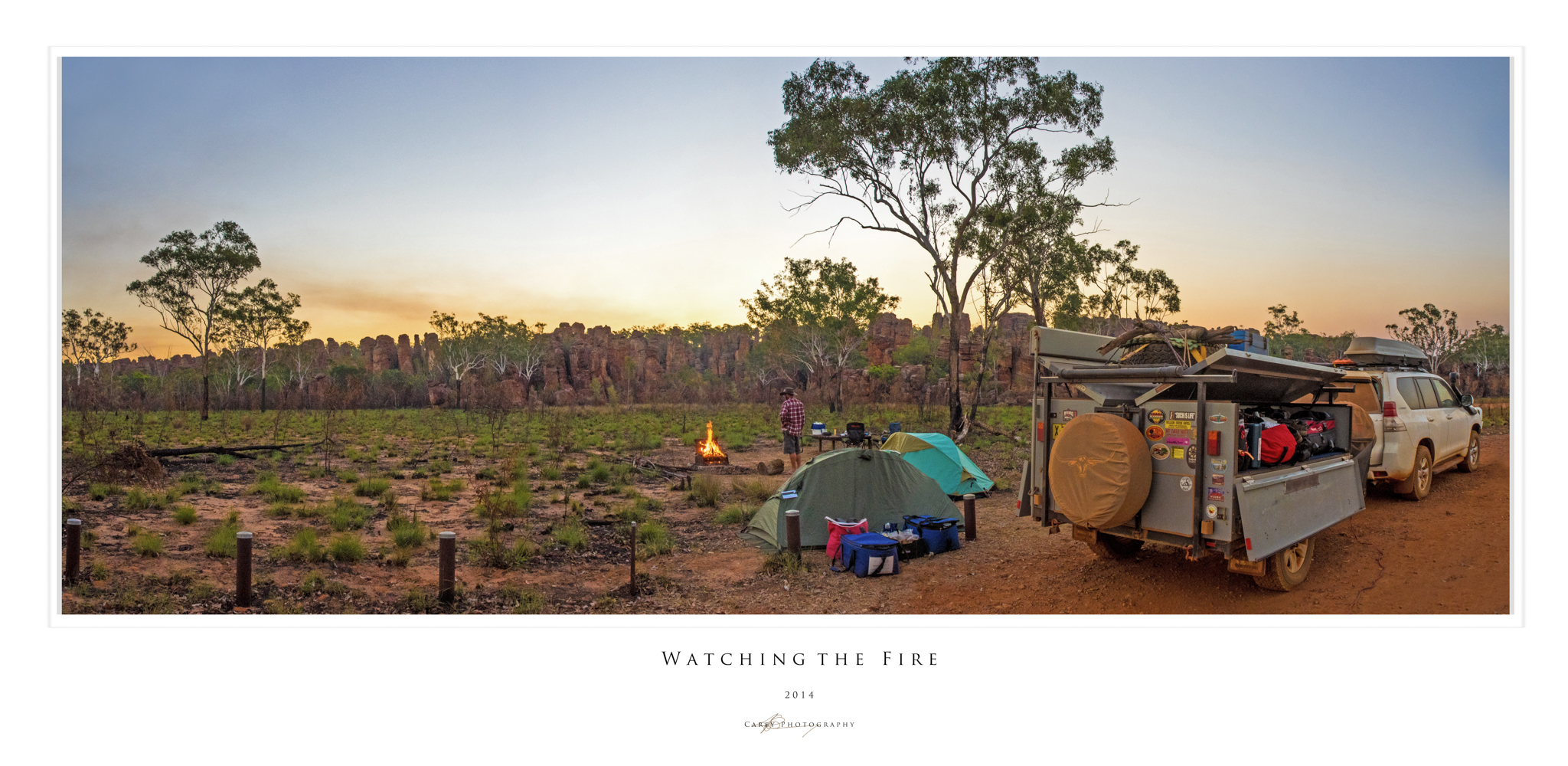
July 2014: to Darwin By Dirt - The Savannah Way
This story was published in the July 2015 Issue of 4WD Touring Australia. This is the fifth part of a 3 month journey from Sydney to Darwin and back. To read a full account of the trip and view photos and videos go to To Darwin By Dirt.
The vast savannah stretched out ahead of us, more than 1.5 million square kilometres clinging to the top of Northern Australia. The mix of tussock grasses and eucalyptus woodland is the result of millenniums of seasonal rains, long dry seasons and regular fires. This landscape will be our shadow as we join the Roper Highway and make our way to Mt Isa, following the aptly named Savannah Way.
In most countries the term ‘highway’ evokes an image of 6 lanes of black tar where the speedometer can get in to triple digits. The Roper Highway however has a thin covering of asphalt little wider than the car. But eventually even the road considers this area too remote as the black top disappears leaving a corrugated dirt road carving through the Savannah.
The dry flat landscape has an intimate familiarity to local Indigenous people. However, to those of us that normally live in the south of the continent the repetitive grasses that pass by the window provides little stimulation to the eyes fixed on the long road ahead. With little for the mind to filter, apart from the muted green vegetation and rust red earth, the repetitiousness of the drive and the hum of the wheels produce a hypnotic slow motion journey.
Eventually this trance is broken as we reach Roper Bar to refuel. Roper Bar also feels as though time has left it behind. With little more than a building surrounded by a wire fence it provides a range of basic goods for locals and travellers alike and is the last spot to refuel before Borroloola, 400km away.


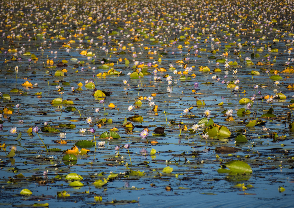
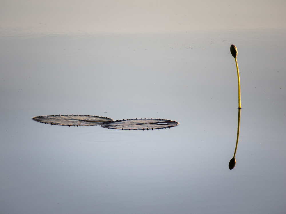
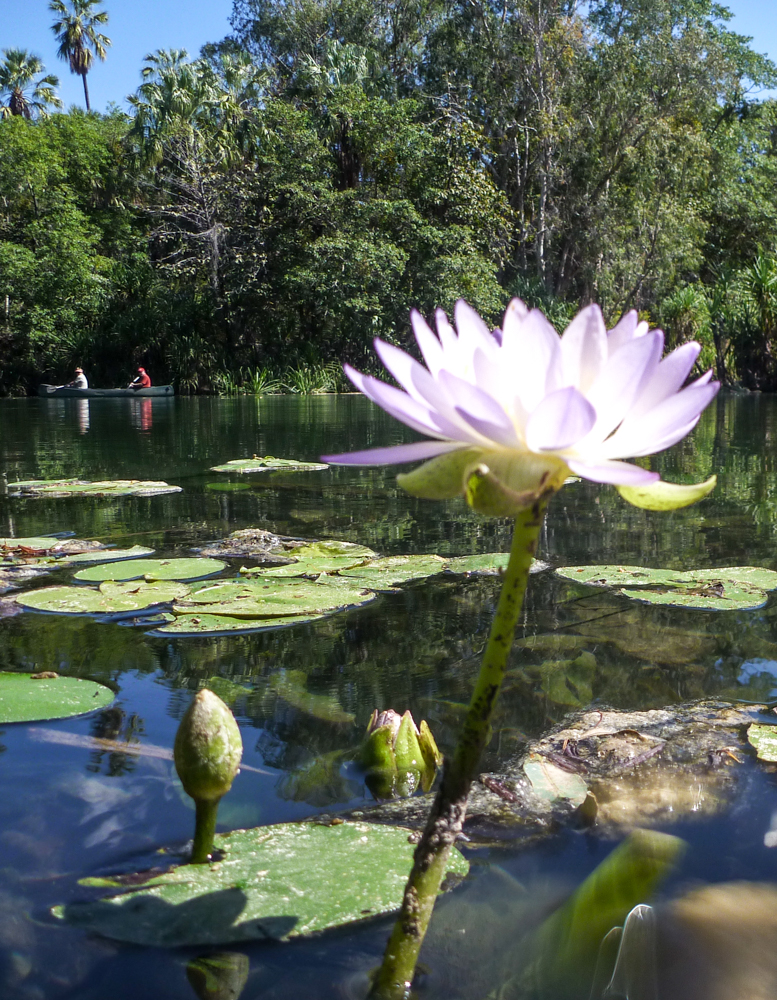
But the setting of the sun means that it is time to push on to Lamarieum Lagoon and our camp for the night. The Lagoon stretches to the horizon with a carpet of pink and mauve water lilies bringing Monet's painting to life. With the watchful eyes of crocodiles it is decided that a tent is not much protection between us and dinner, so we set up just out of jaws reach at the ruins of St Vidgeon Homestead. Sitting by the glow of a camp fire under the chandeliers of a thousand stars we pondered the unimaginable time it has taken for that pin drop of light to reach us. The next morning we wake to the warmth of the golden orb as it rises over the lagoon.

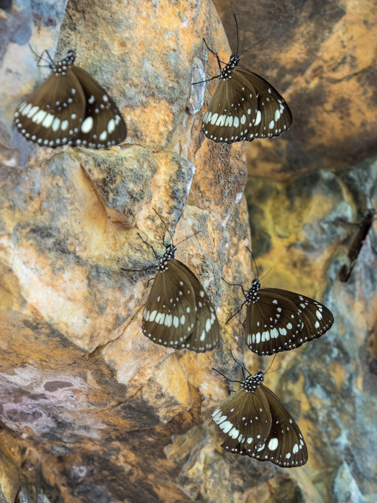
Back on the road Butterfly Springs is our next welcome stop. With a paperback lined billabong wedged between low cliffs, its name becomes obvious as clouds of fluttering delicate wings fill the air in the overhangs.
While many camp here, our campsite is the Southern Lost City further along the Savannah Way. The Lost City rises out of the flat grasslands, the 1500 million year old sandstone pillars the last remains of an ancient sea floor. Taking the 2.5-kilometre walk amongst the ancient columns, the time it has taken to erode these monoliths is difficult to comprehend.


Time has also forgotten to take hold of a privately owned wilderness property further along the ‘Way’. Lorella Springs, covering over 1 million acres, is a welcome place where eccentric travellers and itinerates set up camp.


It is also a place to explore the hundreds of km of 4wd tracks that fan out across the property. One such track leads us to Nannys Retreat. Two wheel ruts wind their way for more than hour through the dry spinifex and across shallow creek crossings. Where the 4wd track finishes, a walking track begins. Eventually we arrive at a majestic boulder strewn range with a spring fed creek that flows into a crystal clear pool. Taking a plunge into one of the most remote waterholes leaves the mind numb.


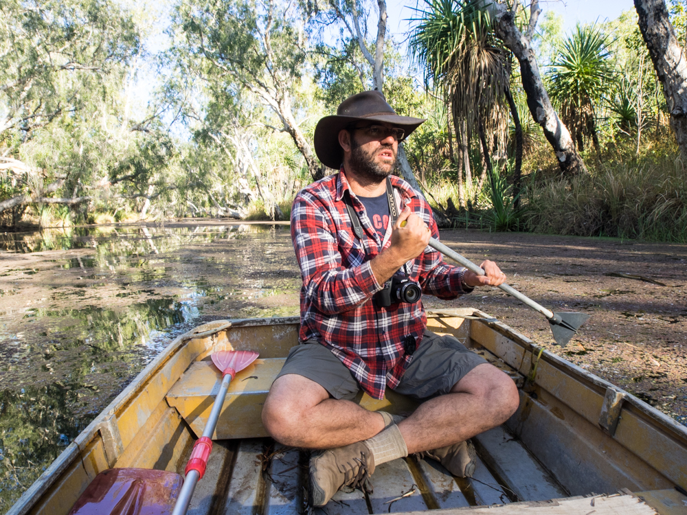
The next morning it is time to head back out again, this time exploring a small waterway called 'crocodile spring' where the owner leaves a small boat for people to use. Getting into the small tinnie, no bigger than a bath tub, the name ‘crocodile spring’ started to take on a more sinister meaning. But this is soon forgotten as we paddle through the motionless water lined with tall paperbarks, their branches reaching out to meet in the middle as though they are trying to hold hands.

Despite its isolation, Lorella Springs has some of the comforts that are often missed when travelling through these inaccessible parts. With hot water from the donkey cleansing the days dust, and a cold beer from the open-air bar cleansing the thirst, it is easy to forget how fortunate we are to experience this place. We spend the evening reflecting that it is days like today where time takes on a different meaning. It is not about rushing to the end or focusing on what you have to do tomorrow. It is about savouring the moment as it is.
Despite not wanting to leave, we continued our journey to another place where nomads and travellers set up camp for days, weeks or forever. After re-joining the Carpentaria Highway, the smell of the salt water leads us to the turn of to King Ash Bay. Perched on the edge of the McArthur River, it is a gathering point for many who have fish in their blood. With another outdoor bar and the promise of barramundi hiding in the river snags I can appreciate why this place is difficult to leave.


With no luck at fishing (I am not sure if the water was too cold or that the best spots were kept a secret), the idea of dipping the toes in the Gulf of Carpentaria was hard to resist. But such a feat turns out to be more difficult than first thought. Much of the coast is mining land including Port Bing Bong. Haulage road trains bring in iron ore where it is stockpiled forming man-made mountain ranges before being transferred into huge floating ships moored off the coast. Unfortunately the area is largely fenced with large signs warning of severe penalty for unauthorised access. It is such a shame that parts of this great country of ours are denied access by large private corporations.


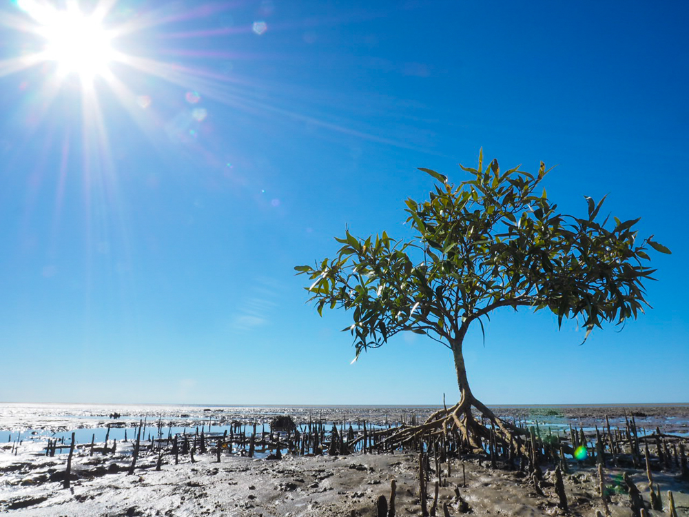
Despite this we find a small nondescript track leading off the road that weaves through the coastal mangrove and salt marsh. Following our nose, we knew that the gulf had to be close. Picking our way through the mud flats we reach the turquoise blue water with the Sir Edward Pellew Islands on the horizon. This is the last of the coast we will see until our return to Sydney.


Leaving King Ash time slowed again as the miles of corrugations took on their familiar rhythmic hum. Eventually we reach a large rocky outcrop, with boulders made from a whipped cream, rising from the plain. I am sure this area once hid the cattle thieves and traditional aborigines who stole from the early cattle drovers who moved herds from Queensland to the Northern Territory. It is for this reason Hells Gate got its unusual name as beyond this point the Queensland Police could not guarantee their safety. Today, it provides the opposite, an essential stop for fuel to the modern day drovers in their 4WD’s.


Not far from Hells Gate we turn off towards Lawn Hill National Park. The sameness of the last few days is replaced with a red snaking track that transitions into ruts full of bull dust. Passing a large billabong, we stop to watch 6 majestic Jabiru and a large number of pelicans before they take flight, climbing on the eddies until they are mere dots against the ocean blue sky.
Travelling through numerous paddocks the eyes of a hundred Brahmin cattle watch us through the low bushes. Cattle have been in the Gulf since the early 1800s. Over time these leases grew to the point that in 1976 Lawn Hill Station was 11,000 sq km, one of the largest in Queensland. At the time this was run by the 'cattle king' Sebastiao Maria, who arrived from Brazil in search of a new life. The good news was that Maria also surrendered part of the station for a National Park now called Boodjamulla (or Lawn Hill).


Time has worked its magic on the ancient rocks which have been gradually sculptured by prehistoric rains leaving behind rugged escarpments and gorges. While there is a well set up camp site at Adels Grove just outside the Park, it is worth booking early and getting one of the small number of sites in the Park to allow you to experience the sun rise over this hidden landscape.


Paddling through the jade green water flanked by tall palms, the suns first glow lights up the sheer red sandstone walls either side of the gorge. The only sound is that of the morning call of the birds and the lapping of water against the canoe. Making our way the 4km up stream we reach Indari Falls created by Boodjamulla, the rainbow serpent.


As time sees the sun begin to set, the afternoon is left to take the steep climb to the Island Stack Walk. The walk meanders through the dark red rocks, lime green spinifex and olive sticky hop bush, all three forming a tapestry of colour.


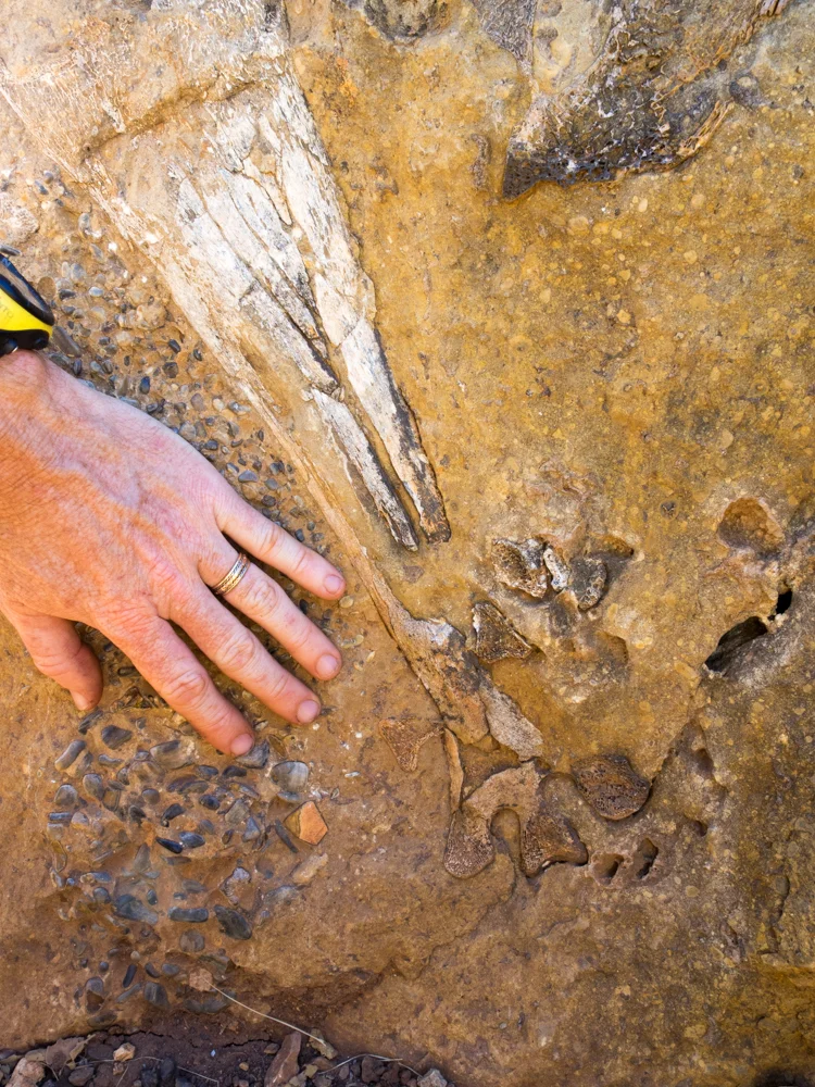
Reluctantly leaving Lawn Hill, a stop at Riversleigh World Heritage Site is a reminder of our infinitesimal time on this planet. Walking past the pale hard limestone rocks with 15 million year old fossils of giant wombat like marsupials with stabbing teeth and the 5 metre Baru crocodile, it is amazing to think that this arid place was once a rainforest.


After more rhythmic corrugations, eventually they come to an end as we join the Barkly Highway. Time begins to quicken as we merge with the line of mining 4WDs heading to Mt Isa, their bright yellow reflective stripes and tall flag protruding from the bulbar visually overloading the senses. With the large smokestack appearing on the horizon, its tip smouldering like a cigarette, we knew this part of the journey was soon over.


Time in seconds and minutes only exists because we have created it. It is a factor of technology not nature. Time simply measures change and beyond that, it is non-existent. Travelling the Savannah Way we are reminded that time is dictated by the rise and setting of the brightest star rather than the watch on your wrist. As time slows you begin to notice the colours of the land. Like a Buddhist meditating, you become more aware of the spirit of the place. And in these moments of clarity you begin to see this landscape as local Indigenous people do - with more intimate familiarity – and only then do you finally understand the magic of the Savannah Way.
JULY 2014: To Darwin By Dirt - Top End Dreaming
This story was published in the June 2015 Issue of 4WD Touring Australia. This is the fourth part of a 3 month journey from Sydney to Darwin and back. To read a full account of the trip and view photos and videos go to To Darwin By Dirt

Our adventure ‘To Darwin by Dirt’ was to see us travelling from Sydney to the Top End exploring as many dirt roads as possible. But with the two main roads through Kakadu being fully sealed, this section of the trip was not going to see many. Little did I know, the most memorable experience of the entire trip would see us sitting ‘in the dirt’ on the edge of Arnhem Land.
The Top End is where the outback meets the tropics, covering more than a million square km between the pearl-farming town of Broome and the subtropical Cape York Peninsula. In its heart is the ecological and cultural backdrop of Kakadu and Litchfield National Park.


Heading north from Alice we made our obligatory stop at the Devils Marbles to amble amongst the geological oddity. From here it is a long haul to our first destination, Nitmaluk National Park. While my preference is an isolated remote camp site, if I was going to be restricted to formalised parks it's would be Nitmaluk. With a tropical pool, bar and the magic Katherine Gorge only 100 metres away, The National Park has facilities that many expensive caravan parks could only wish for. The park is jointly managed with the traditional Jawoyn people who have a philosophy to "share our country". And what a great job they have done.


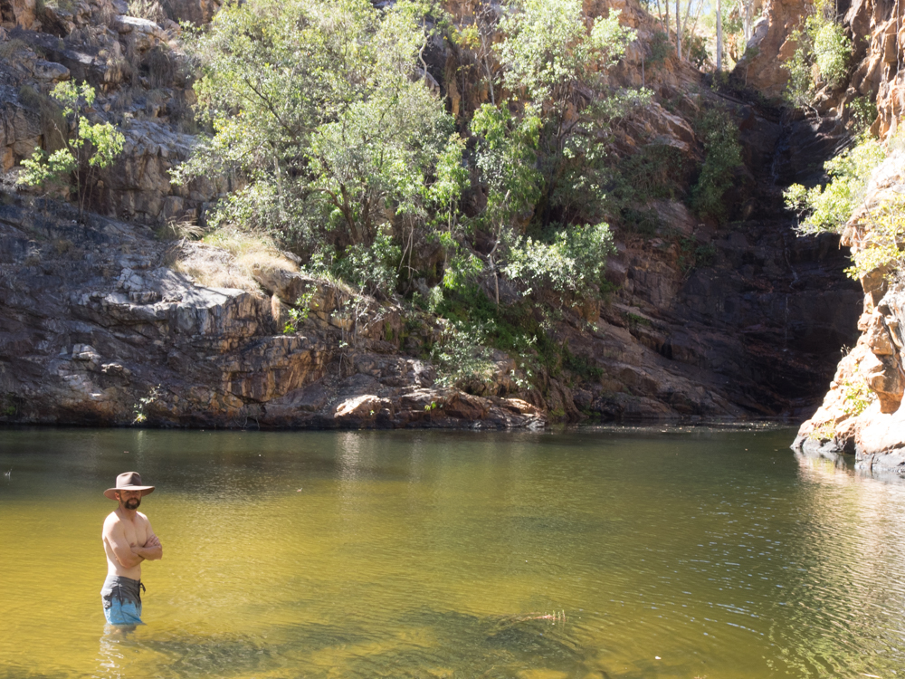
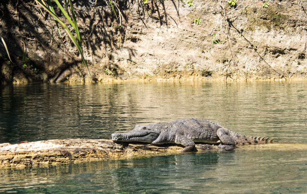
We spent the day cruising up three of the thirteen gorges, created by the Katherine River which has carved a deep chasm through the ancient sandstone. Despite the freshwater crocodiles basking on the edge we took the plunge into the cool waters, one eye on the banks the other on the wonders of what nature has created.
While we could have stayed a week the journey north was calling. Back on the black top it is not long before we reached Pine Creek and the turn off for the Kakadu highway. Here the road meanders through the open woodland plains, which are now parched as the Wurreng (dry season) takes hold. At this time of year it is common to pass through fires slowly consuming the low grasses on either side of the road. These fires are the cornerstone of this unique environment which has adapted to the patchwork burning over millennia. Overhead, flocks of Black Kites circle ready to swoop on any poor animal escaping the flames.
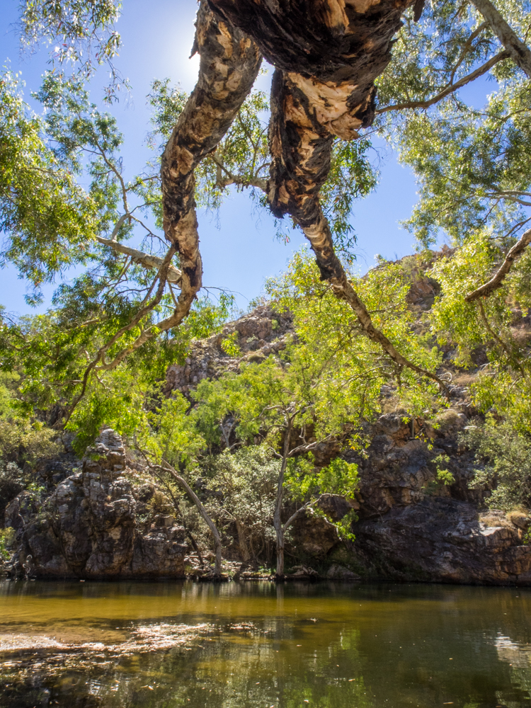
Reaching the Gunlom Falls turnoff, the 37km dirt road can change from a well groomed track to a bone shattering washboard. But what lies at the end is every photographers dream. Not far from the camp site a dark cool plunge pool sits below the towering black cliffs, a permanent rain shower cascading from the escarpment above. Making the 20 min steep climb we reach the series of cascading pools that cling to the edge, water disappearing into the plains below. Here we sat waist deep in the infinity edged pool, a cold ale in one hand, watching the sun slip into the Kakadu horizon – surely one of the best views in Australia.


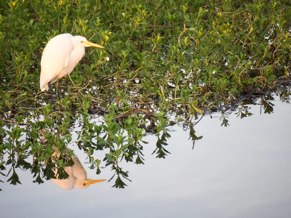
Reluctantly leaving Gunlom, a short drive takes us to a well set up camp at Cooinda. But the real reason we are here is to experience the biological wonder fitting of its UNESCO World Heritage Listing. Getting one of the Yellow Water Billabong cruises, we spent the late afternoon gliding through Kakadu's most impressive wetland that is fed from a tributary of the South Alligator River. It is interesting to note that it is called the Alligator River when we don't have alligators in Australia. Those early explorers will confuse generations of children forever.

Cruising along the mirror like water, with the lilies and swamp grasses slowly rippling in the boat wake, you catch the unmistakeable eyes and tooth ridges protruding from the water. The prehistoric beast. The apex predator. Crocodylus porosus. Or as the locals say - "a salty"! These formidable leathery-skinned, creatures sit motionless waiting for a fish, bird or an unsuspecting tourist to put their arms too far out of the boat. Others are basking in the sun on the banks of the river, mouth agape, revealing large bloody teeth that would be a dentists best friend.


Over the next two hours time slowed as we watched the majestic brolgas, flocks of cockatoos and jabirus, with their piercing yellow eyes and blue plumage, feed amongst the lilies. The afternoon tranquillity is only occasionally broken by the clatter of the whistling ducks and honks from magpie geese. We pass beneath tall paperbark trees where white-breasted sea eagles look into the distance, oblivious to our intrusion. But like the silhouette of the last birds in the setting sun making their their way to roost, we also needed to head back to camp.


While most of Kakadu is easily accessible, the beauty of having a 4WD is the ability to escape the tourist buses and follow some of the great tracks that remind you how inaccessible this area really is. Not far from Cooinda the turn off to Jim Jim Falls sees us back on the dirt. While the first part is an easy drive along corrugated roads, you know it is going to get fun when you reach a sign that says “4WD Required. Engage 4WD gear”. Much of the year the track is closed due to the water levels but for us the next 10 km is a lovely drive following a narrow sandy track, through rocky small creek crossings, with the towering escarpment beyond.
Reaching the car park, the rest of the way is a boulder hopping walk to the base of Jim Jim Falls. It is hard to describe the immensity of the 200m high falls completely dwarfing those brave enough to swim over to the base where the water comes to an explosive end.


Twin Falls is located another 10 km further on but to get there you need to cross Jim Jim Creek. For those without a snorkel this could be a problem with the water as deep as a metre even in the dry season. Arriving at the crossing, having been informed that the base was firm, the water markers give a reassuring sign it is safe to cross. My travelling companion in a hire car on the other hand was less certain. So being the bravest we entered the water and to the kids screams of excitement (or fear) we made it to the other side. But, before I could tell my fellow traveller that it was deeper than I had thought, he had thrown caution to the wind and plummeted into the crocodile infested waters. With a huge amount of 4WD experience under his belt (a 30 second lesson from me before hand) he handled it like a pro creating a perfect bow wave and making it to the other side safely.
Reaching the falls there was just enough time to admire the twin cascades dance in the late afternoon light. Despite the lure of a swim we knew that somewhere under the shadowy water our salty locals were lurking. The good news is we got to do the crossing of Jim Jim all again on the return trip.


The next day we moved on to our next camp at Merl which also appears to be home to the most number of mosquitoes per square inch of land in the world. It is rumoured that if you stand still for more than 4 seconds it is possible for them to drain all of your blood. Bushmans is just a salad dressing as they work in squadrons descending relentlessly until you are forced to retreat. You have been WARNED.
Merl is the ideal spot to access Nourlangie Rock (Burrunggui and Anbanbang) and Ubirr which are part of Kakadu’s 5000 art sites holding more art than the Louve. These soul stirring images of the spirits adorn the rock walls telling the stories of 45,ooo years of aboriginal dreamtime.
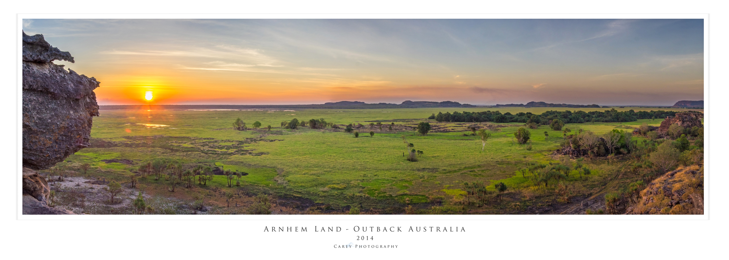
To fully appreciate the spirits of the Top End our next stop was Oenpelli in Arnhem Land. Arnhem Land is one of Australia's special places, 94,000 square kilometres of tropical woodland, gorges, rivers and wetlands. You need a permit from the Northern Land Council to cross in to Arnhem Land but day permits are easy to get.
Passing at Cahills Water Crossing it is as though we left one world behind and entered another. We are immediately struck with not only the beauty of the place but an almost calming spiritual feeling. The road meanders between a rugged rock escarpment and lush green wetland, the faint echo’s of the dreamtime caught in the breeze.


Reaching Oenpelli we explore the Injalak Arts Centre watching the men do their bark paintings of goannas and fish with intricate oca stripes and dots. Outside the women gather under the shade of the tree, sharing stories as they weave baskets from pandanus leaves.


For our three girls this cultural connection was made real as the local aboriginal kids with their jet black skin, beaming white smiles and dust encrusted hair take great pleasure playing together. There is something amazing about the innocence of young children. With no judgement or apprehension, a ball and some rocks become a universal communication tool between the kids.


We spent the rest of the afternoon with the children playing in the dirt, overlooking a mystic wetland with whistling kites rising in the thermals and pelicans slowly descending with wings outstretched, gliding gracefully over the water like a seaplane touching down.

Our last stop before leaving Kakadu was to experience the famous sunset at Ubirr - another contender for the best view in Australia. Despite it popularity, it is still possible to find a lone rock on the escarpment and watch the sky morph from an ocean blue to blazing orange and fire red, above a green natural wonder.


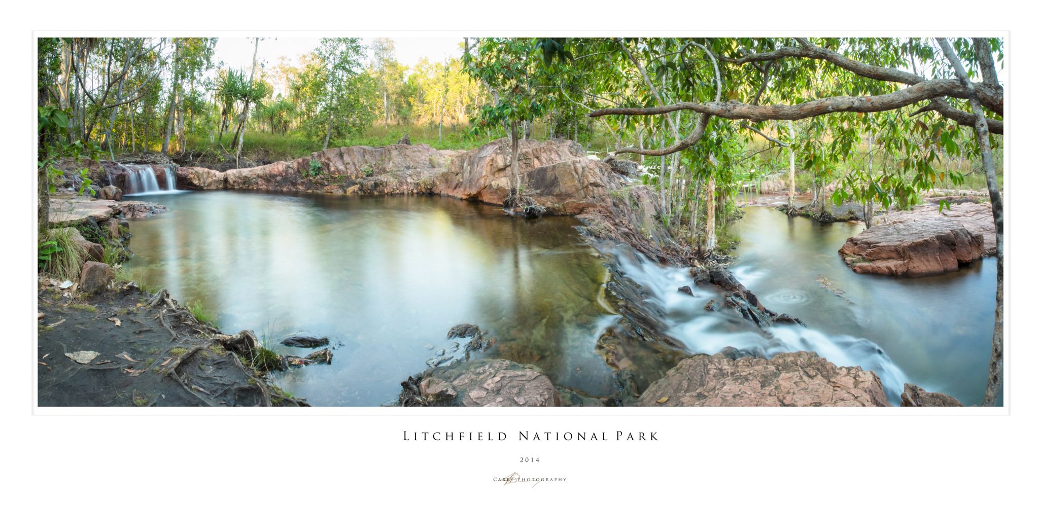
Leaving Kakadu our last stop in the Top End was Litchfield National Park. If you are after a quiet spot to sit and contemplate the mystic wonders of the Dreaming country then Litchfield may not be your place. While there are those that say Litchfield is much better than Kakadu I judge a place by the lack of bollards. Unfortunately, due to the closeness of Litchfiled to Darwin, the camp sites are a forest of bollards. Despite this, a relaxing few days is spent soothing our feet in the cascading wall of white water and crystal clear deep pools of Buley Rock Holes, Florence and Wangi Falls.


Having finally reached the Top End it is finally time to turn the car south and make our way back home. The next part of the trip is to see us return to the dirt as we make our way across the Savannah Way. But our journey to ‘Darwin By Dirt’ could have no better climax than the indelible memory of our children laughing and playing as they sat amongst the Dirt embracing the outback, the traditional custodians and the spirit of Arnhem Land.
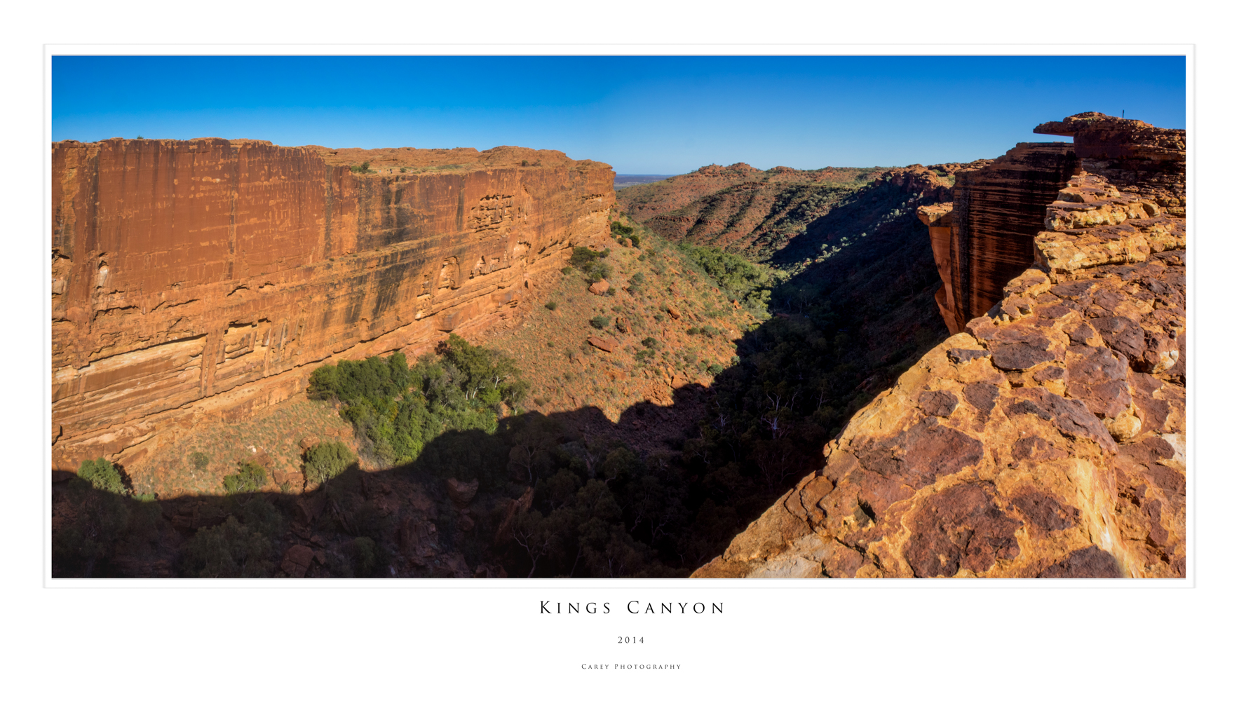
July 2014: To Darwin by Dirt - The Red Centre
This story was published in the September 2015 Issue of 4WD Touring Australia. This is the third part of a 3 month journey from Sydney to Darwin and back. To read a full account of the trip and view photos and videos go to To Darwin By Dirt

“As I walked through that country, I was becoming involved with it in a most intense and yet not fully conscious way. The motions and patterns and connections of things became apparent on a gut level. I didn’t just see the animal tracks, I knew them”.
Robyn Davidson, Tracks
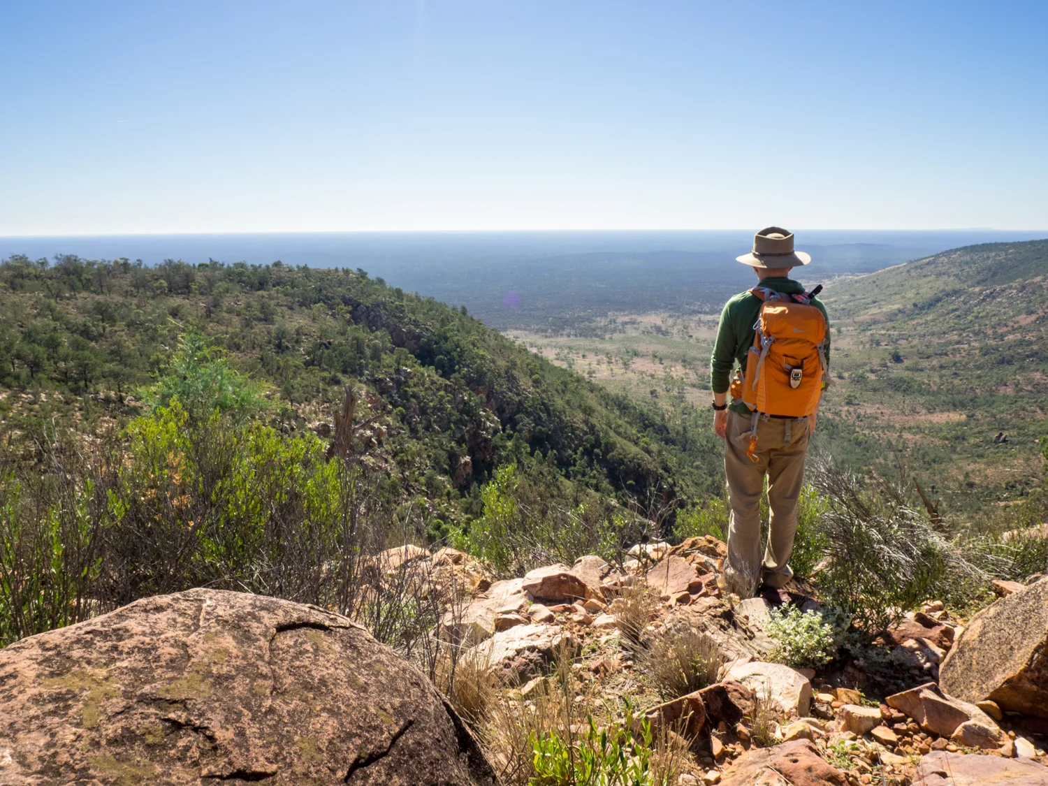
In 1977 Robyn Davidson left Alice Springs and trekked 1,700 miles across the Australian outback with four camels and a dog. Her epic journey was recorded by Rick Smolan for National Geographic and later became a book then film. While our journey leaving Alice Springs was going to be in the comfort of a 4WD we knew that the only way to truly touch the wonders of the West MacDonnell Ranges, Palm Valley, Kings Canyon, Uluru and Kata Tjuta was by foot.
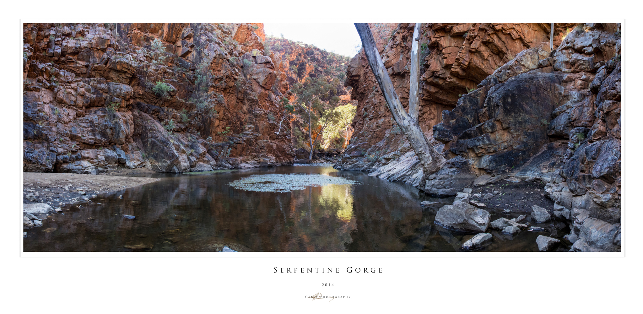
Leaving Alice Springs our first stop is the West MacDonnell Ranges which stretch westward into the desert. This linear Range has been squashed, deformed, lifted, folded and eroded creating layered red peaks. But it is what lies between these peaks that is most extraordinary. It is here where we spend the next 5 days walking in to Gorges and Chasms, an oasis in the outback.
The Ranges are not a place where you will find long remote 4WD tracks, with most sites easily accessible, even by the family commodore. But it only takes a short distance walking in to these yawning crevasses that you feel just as secluded. Hiking, trekking, rambling – what ever term you use - the experience of leaving the confines of the metal box and returning to a simpler form of transport allows you to connect more with the earth.
It does not take long after leaving Alice that we arrive at Simpson Gap. The Gap is said to have been created by a wallaby spinning around and slamming its tail on the ground, creating the split in the rocks. It is hard to imagine what the Black Footed Rock Wallaby makes of the flat footed intruder as he peers down at us from the ledge.

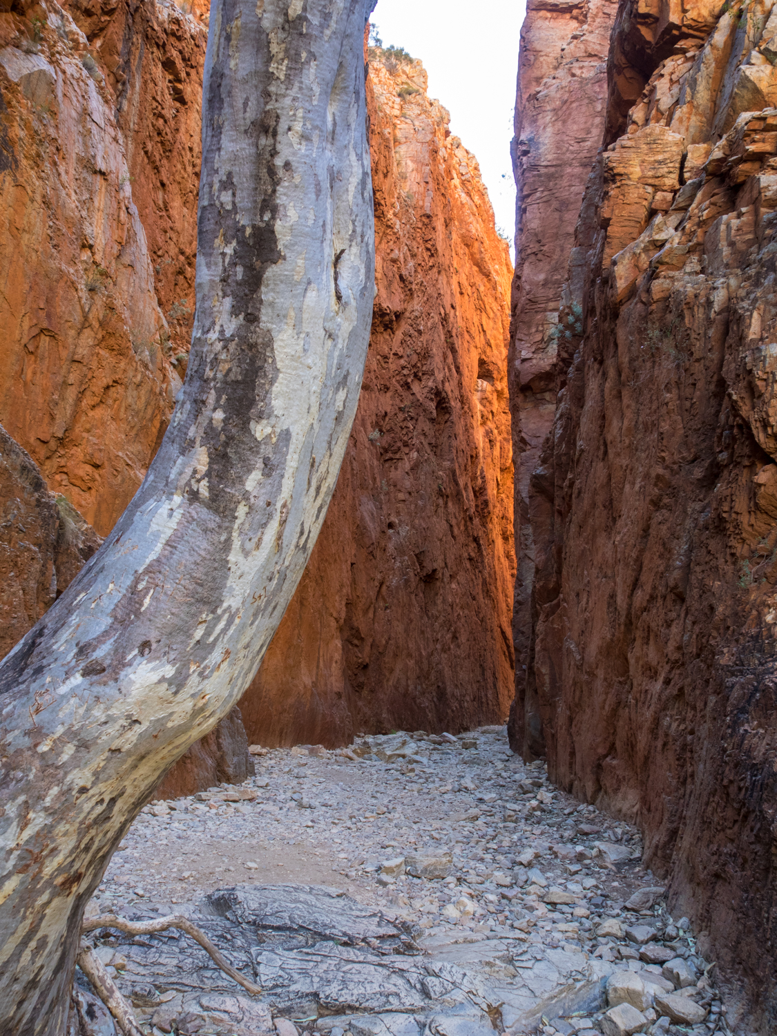
Standley Chasm is one of the most photographed of the gorges. A short walk following the Angkerle Creek bed leads you to sheer walls closing in on both sides no wider than your outstretched hands. The shadows of the floor is only broken by a shaft of light in the middle of the day (along with the 50 camera flashes from tourists).
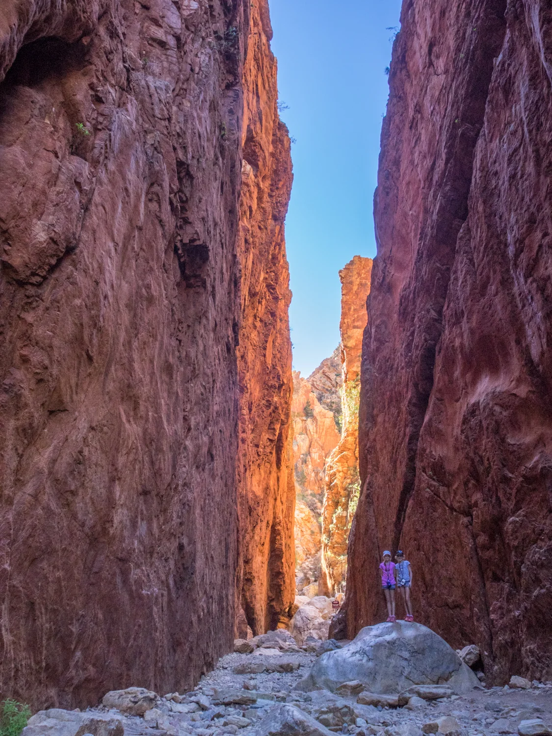
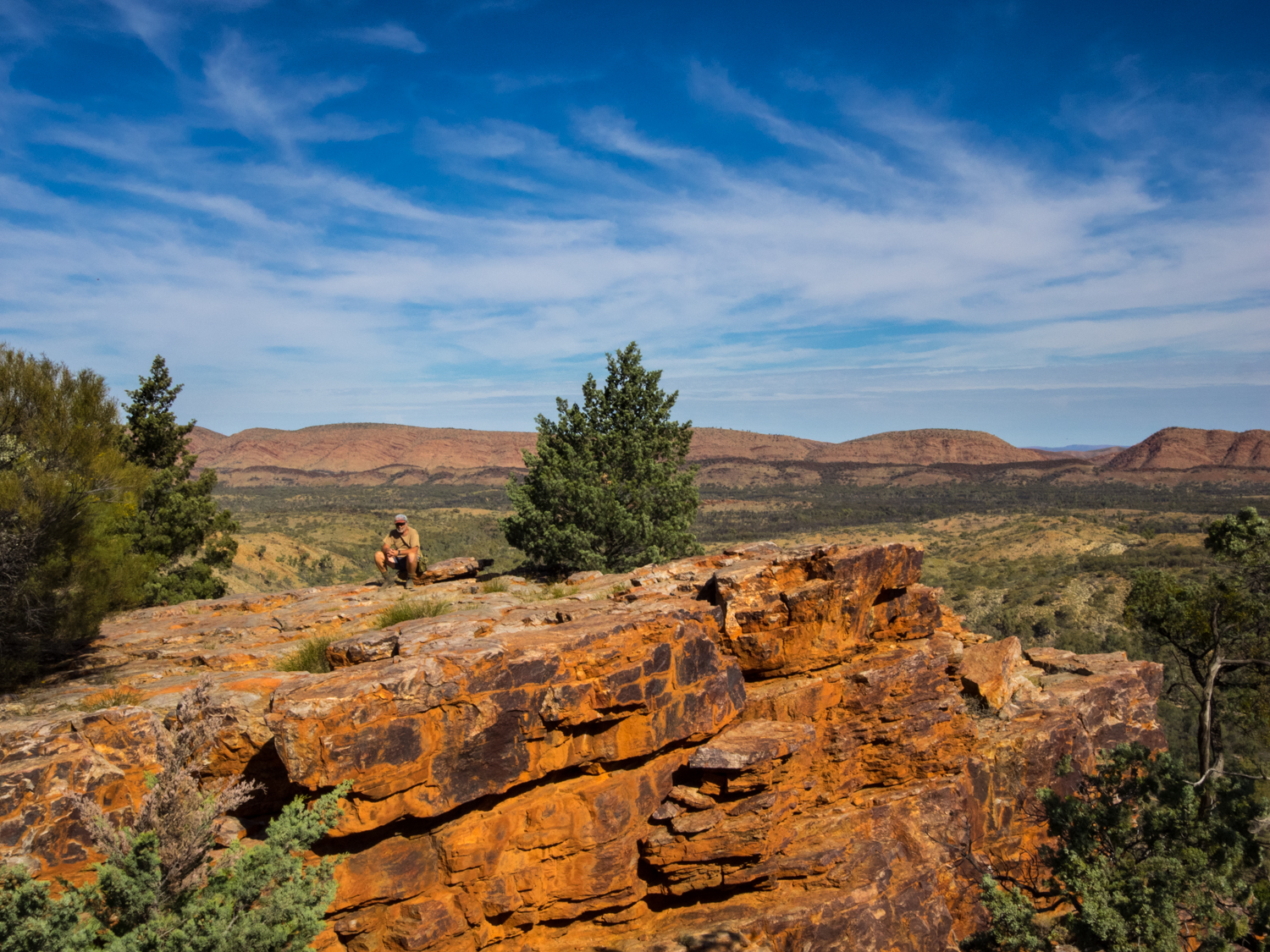
Next along the Range is Ellery Creek. As we approach, the shrill of tourists swimming in the near freezing waterhole echoes off the rock face. While this has its own majestic ambiance, the longing for a quitter place sees us head on to Serpentine Gorge, often overlooked by the passing traveller. We follow the dry river bed winding next to the twisted ghost gums, their white smooth trunks like candy stripes against the red gorge walls. But there is also more to this place than the dark crevices. Taking the Lookout Walk, the steep climb is worth the effort as we look out in to the expanse, the blue sky melding with the ochre red range.


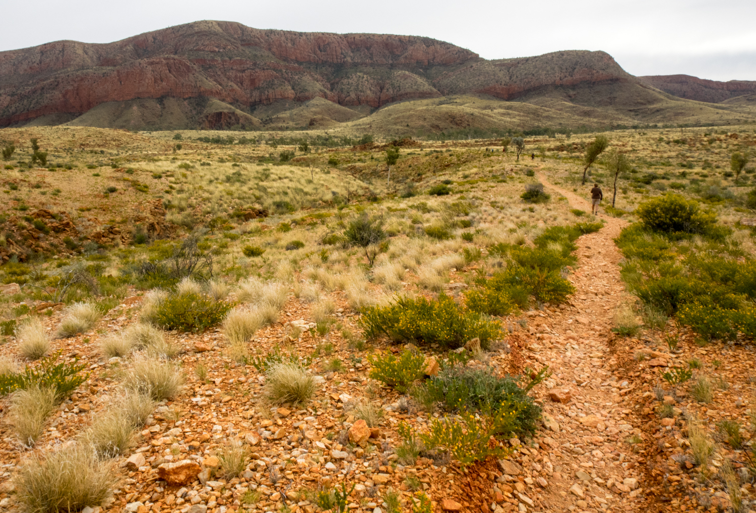
While we could have explored more, camp was calling at Orimston Gorge. While attempting the full 223km Larapinta Trail that follows the backbone of the West MacDonnell Range is on my wish list, todays walk will have to settle on the shorter 10km Pound Walk. Leaving camp early, the first thing we notice is a sign at the beginning warning -“High water level in gorge - possibility of having to swim to complete circuit”. Despite this we follow the well marked path that slowly ascended the ridge, the sounds of camp disappearing in the wind. As we reach the top of the saddle the spectacular pound encompasses the full horizon, the ridgeline circling out before us. It is moments like this that you realise that a 4WD can only take you part of the journey. From here we drop down in to the pound and snake our way through a patchwork of red, green, yellow - rocks, grass, wildflowers. The Range is known to the local Arrernte people as ‘yeperenye’ or caterpillar, and following this winding track the name is apt.


Jumping from rock to rock over the broad creek bed of the Osmington Creek, we began to question the sign we had seen earlier. After a further hour of rock scrambling the trail begins to enter the narrow gorge, the sides changing to towering sheer walls with the water getting progressively deeper. The last 10 minutes of the hike was about to leave an indelible memory. Not because of the magnificent scenery. No. We were about to strip down to our underwear and wade through neck deep water that had been chilled to freezing point having passed through ancient sands.

The next day we head further west. The further west you travel the less crowded it gets, the day tours finally getting out of reach. Reaching Redbank Gorge we are finally able to experience the solitude of the waterhole, as the dragonflies skim across the surface, more knowing than us how cold the water really is.


Leaving the West Mac Ranges the road leads to Tylers Pass where we are greeted with a ring of weathered hills rising 180 metres above the desert. Science and dreamtime stories come together with both telling the story of the creation of the circular rock walls due to an object falling from the sky. Reaching Gosse Bluff, we don the walking shoes again and explore the base of the crater.
Departing the Bluff, the road finally reverts to the red dust we are used to as we make our way to Finke Gorge National Park. Not far from the turn off, Hermannsburg appears as a juxtaposition to the remote landscape. The site, established by German missionaries, is much like it was in the 1800’s with the white washed stone buildings sheltering from the heat under the date palms. Just out of Hermannsburg we stop at an unimposing cottage where the famous artist Albert Namatjira lived. Despite my best efforts to capture a photo of the MacDonnall Ranges, they do not compare to his richly detailed paintings of majestic ghost gums brought to life on canvas.


Taking the turn off to Palm Valley we are greeted with a sign “Severe 4WD Route – Allow 3 Hours”. While the track in is not as bad as the sign makes out (I assume it is to keep the backpackers out with their hire cars) it is still an interesting drive through sand drifts and rocky river beds. Setting up camp is a welcome change to the more bustling sites of the Mac Ranges.
The next morning we take the short drive to Palm Valley. Leaving the car, it is time to again ‘go walk about’ in this ancient land. While a ‘Walkabout’ is a young boys right of passage to honour their ancestors and reflect on life, we have our own chance to reflect on the majesty of this ancient landscape. Walking through the rare red cabbage palms, relics of the ancient rainforest that once occupied this land, this unique species has become a time capsule of a forgotten place.


Leaving camp we join the Mereenie Loop that links to Kings Canyon and Uluru. This wide red corrugated road is like many outback tracks with the level of difficulty determined by the last time it was graded and how much rain they have had. Occasionally there is the reminder of how popular this area is, with a road sign saying ‘Acthung. Slow down. Drive on the left’. It will be a sad day when this road is fully sealed.
While the home comforts of Kings Canyon Resort may appeal to some, further on is Kings Creek Station. This working cattle and camel property has excellent campsites amongst the shade of desert oaks. While there is enough to keep you occupied here for days from quad bikes to camel rides, the real reason to visit is Watarrka National Park, also known as Kings Canyon.


Again the only way to experience this natural phenomenon is to walk. The 6km Rim Walk is the most spectacular and it is not only the 5oo stairs at the begging that leave you breathless. The sandstone chasm disappears 270 metres to the canyon floor the walls appearing to have been sliced by a knife.


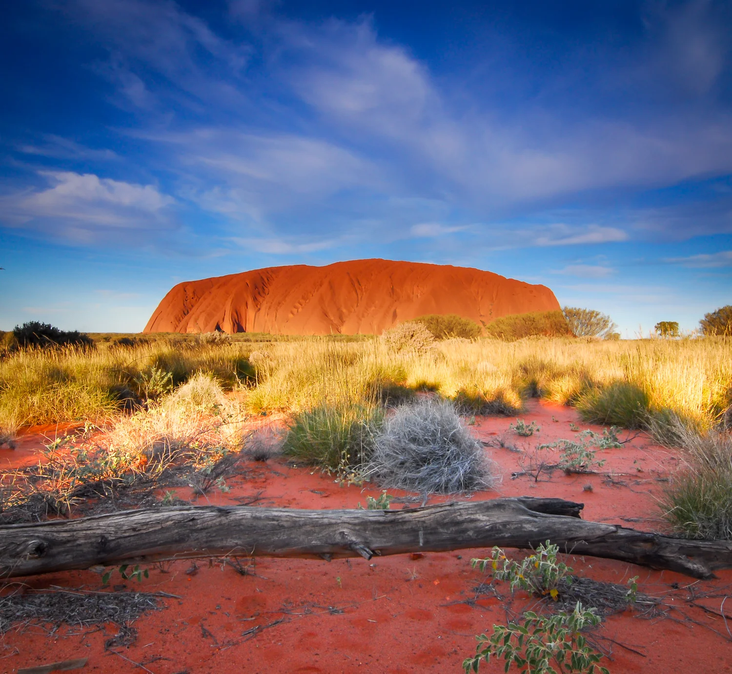
There is one more stop that pulls all visitors to its centre like a vortex. It does not matter if you are an overseas tourist, a local or a traditional owner of this land, Uluru has the power to change you well beyond just its physical presence. Standing looking at this huge monolith, you are looking at the soul of Australia.


There is no doubt that travelling to Uluru could be seen like visiting a theme park with its controlled opening times and restricted areas. As we follow the other 500,000 people a year that have watched the sun set, the initial popularity is soon forgotten. As the sun sets the symphony of colour on the rock begins to change, Mother Nature becoming an artist as though dipping the brush in a rainbow.


Our final walk on this part of the journey involves a decision. “Should I climb or shouldn’t I?” Many who come here feel that it is their right to climb. Others respect the traditional owners who ask us to refrain. My decision was more driven by a desire to come see the different faces of the rock.
From a distance Uluru appears like a vertical wall erupting from the flat expanse. But taking the 9.4km walk around the base you can fully appreciate the millennium of erosion causing ridges and valleys stained black from the rare rain events, the flaking stone like layers of an onion, the mystical caves, the hidden water holes, and the ancient paintings.


Part-way around you come to an area with signs saying ‘photographs not permitted’. I can understand why this part of the rock is considered to be so special with its large overhangs radiating a power and presence. While I slip the camera in to its bag, as a landscape photographer I feel I want to have the same connection to this place and to capture and share it, like Albert Namajera in his paintings or the aboriginal stories that are passed on to future generations.
Edvard Munch, the expressionist painter said “Nature is not only all that is visible to the eye.. it also includes the inner pictures of the soul.”. Photographing the wonders of Kata Tjuta or the changing light of Uluru is about communicating the inner soul of Australia. It is about communicating our connection with this land. And there is no better way to do this than spending time in the outback .…. Walking.


JUNE 2014: To Darwin By Dirt - The Oodnadatta and Old Ghan
This story was published in the May 2015 Issue of 4WD Touring Australia. This is the second part of a 3 month journey from Sydney to Darwin and back. To read a full account of the trip and view photos and videos go to To Darwin By Dirt.

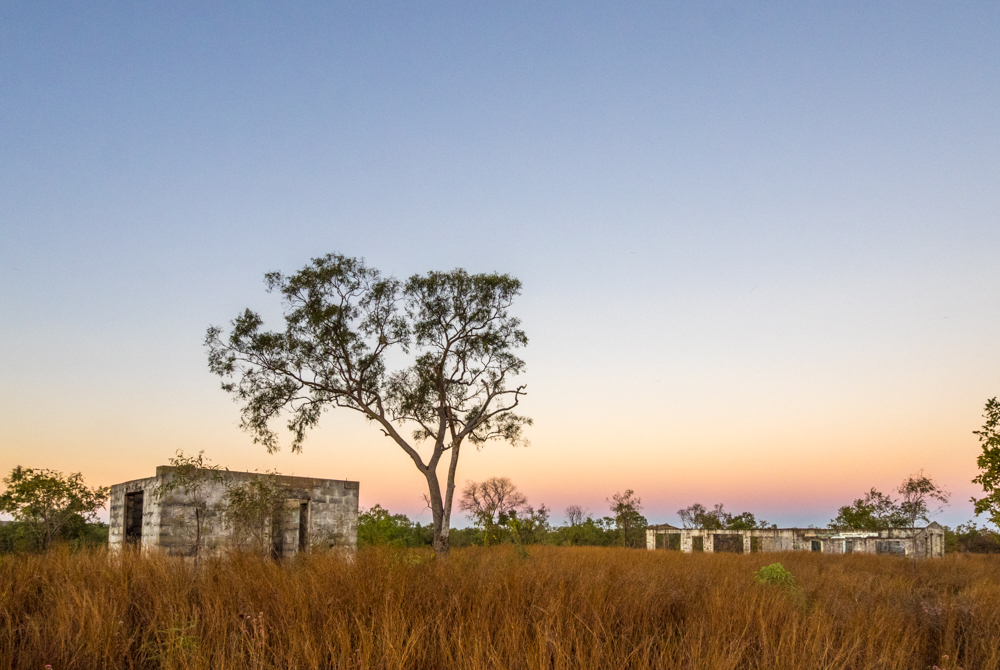
The crumbling limestone walls are slowly eroding back to the earth from which they were extracted. Their long shadow the only reminder of the building that was once a barrier to the extreme heat and cold protecting Edward Meade Bagot and his family. An iron rusted tool part buried in the ground is the only sign of the time sheep, cattle and goats were raised on the thin covering of salt bush. Standing looking at the Dalhousie Ruins, on the road between Oodnadatta and Mt Dare, it was unsettling to read Captain Whites description of the homestead in 1914 – “The solitude and depressing aspect of the place have sent former managers to sit and cry like children”.
My trip from Sydney to Darwin and back was to take me on a stretch from Yunta, in South Australia, to Alice Springs following the Oodnadatta Track and Old Ghan line. One of the features of this iconic outback track are the numerous buildings and rail ruins that litter the landscape, each one a distinctive relic telling a story of our early pioneers battle to survive.
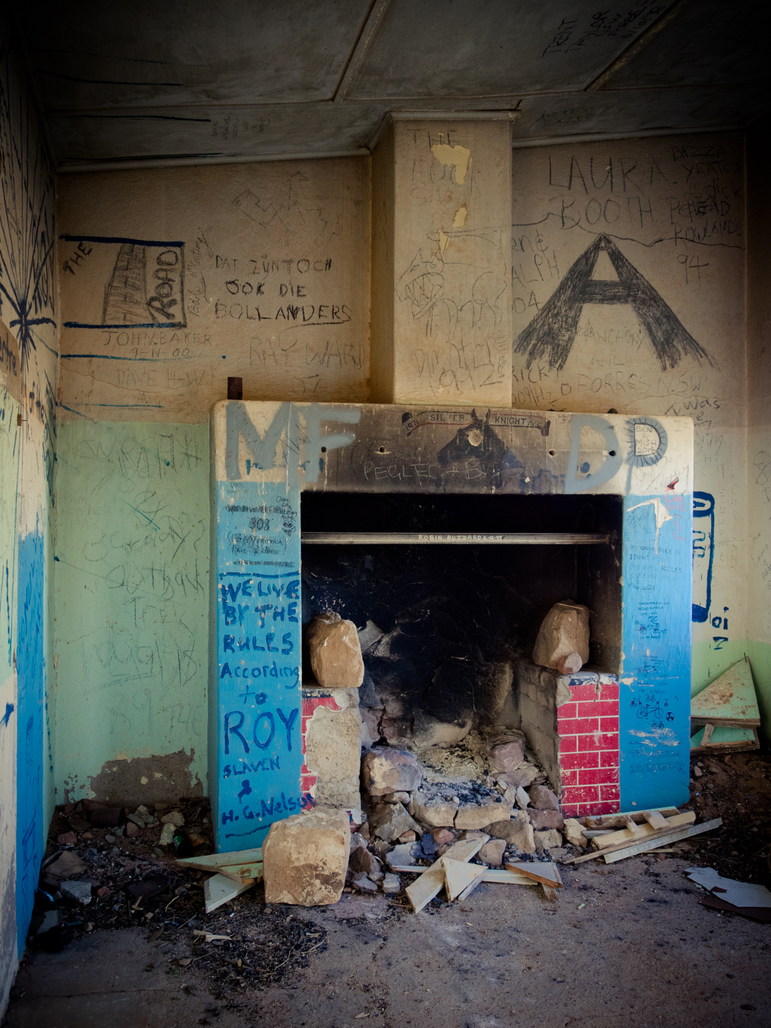
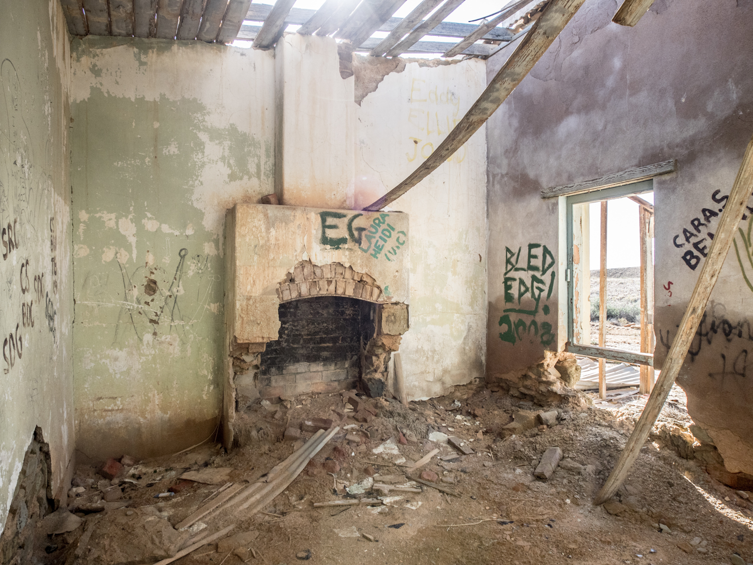
Having met up with relatives (it always pays to travel with another vehicle in these remote parts of the centre) our first camp was at a pub called Waukaringa not far from Yunta. Unfortunately it was not possible to get a beer as they stopped selling it in 1855. The township once boasted a population of over 400. Now all that remains are the carcass of the Pub and the numerous mines shafts, large chimney and other mining remnants that puncture the rocky earth.


From here, the Frome Downs Track through to the Gammon Ranges National Park is well maintained due to the gas trucks that travel to the Moomba and Gidgealpa gas fields. So wanting to test the suspension, we took a detour north of Curnamona to the Erudina woolshed. While not yet a ruin, the shed and shearers quarters have changed little since the early ringer sweated in these wrought iron saunas. Heading east from the woolshed we meandered through open country, two small wheel tracks lined with Sturts Desert Pea, their black and red stooping petals on a dark green rambling carpet a stark contrast to the sands.


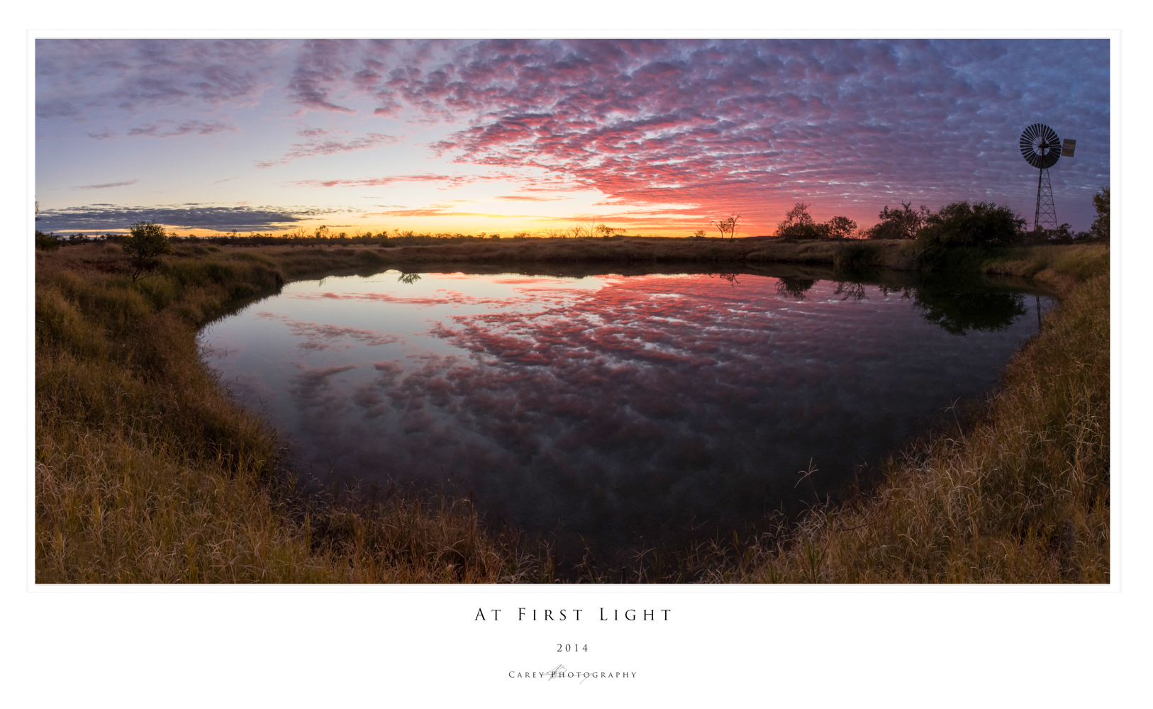
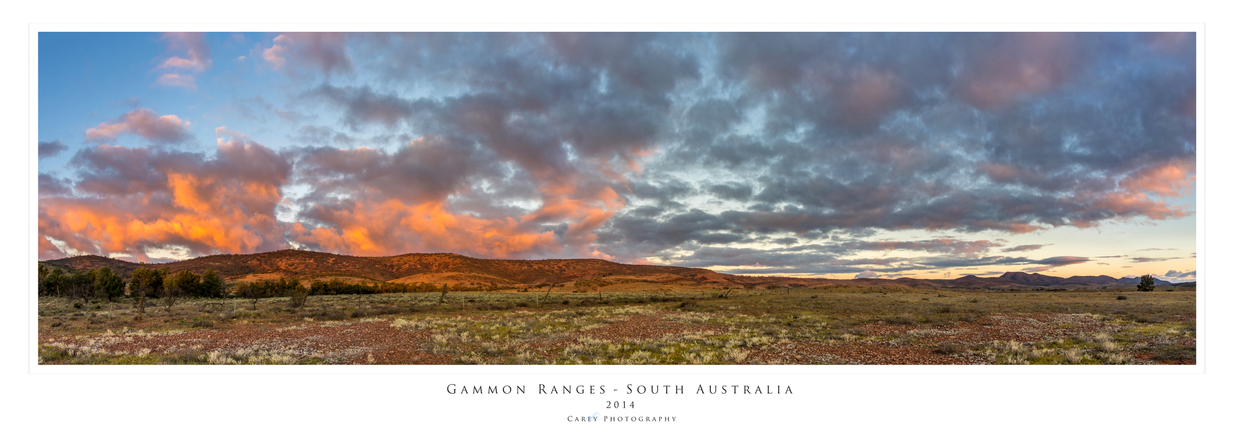
Back on to the Frome Downs Track we passed the vast salt lake of Lake Frome finally reaching the rugged Gammon Ranges, their deep gorges part hidden by the imposing range. While many head further north to Arkaroola, our journey was to take us along part of the Wortupa Loop Track through the Weetootla Gorge and Manyi Range. The track descends in to valleys and across stony dry river beds then cresting peaks revealing all the glory of twisted and buckled rock formations that have been thrust upwards over millions of years.
Coming across the abandoned homesteads of Yadnina and Yankaninna, we were again reminded of this unforgiving land. We spent the night discussing what may have caused their demise as there were many unknown stories hidden in the crumbling walls and dilapidated furniture which we will never know. Leaving the Gammon Ranges, we made our way to Leigh Creek for a quick refuel before tackling the next leg – the famous Oodnadatta Track.


Early explorers looking for the inland sea were disappointed in finding endless salt pans. But they did discover natural springs originating from the sea of fresh water under their feet called the Great Artesian Basin. Much like the aborigines of the past, the early settlers followed this life line in to the interior. Our first stop was Blanche Cup Springs, part of Wabma Kadarbu Mound Springs Conservation Park. Here a circular pool sits atop a mound that has grown over the eons as a result of mineral deposits being brought to the surface. From here it was only a quick drive on to Coward Springs and a dip in the hot tub to wash of the dust. While this has a great paid camp site, there are numerous free spots to stop along the track with creeks lined with coolibahs and gidgee trees providing welcome shade.
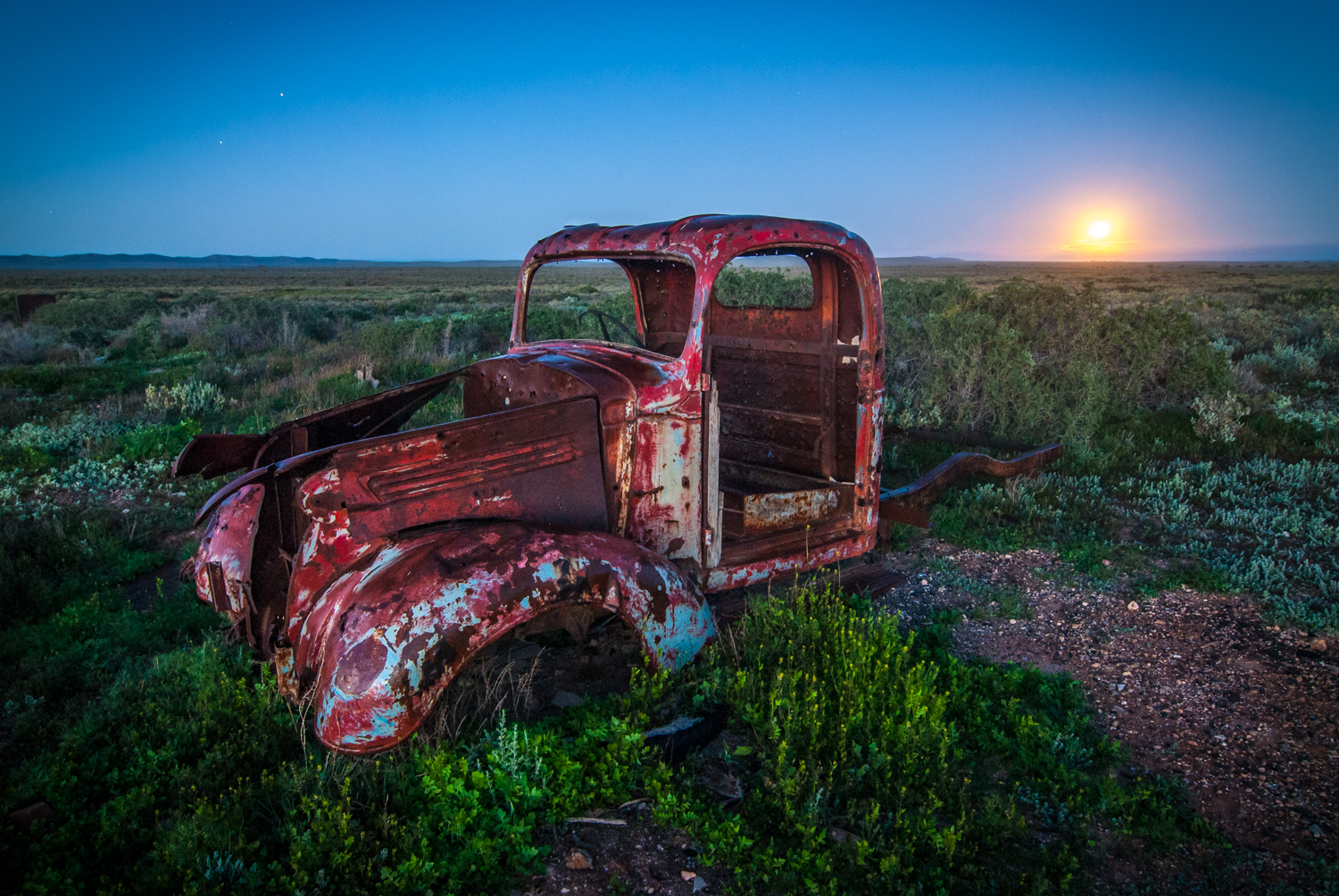
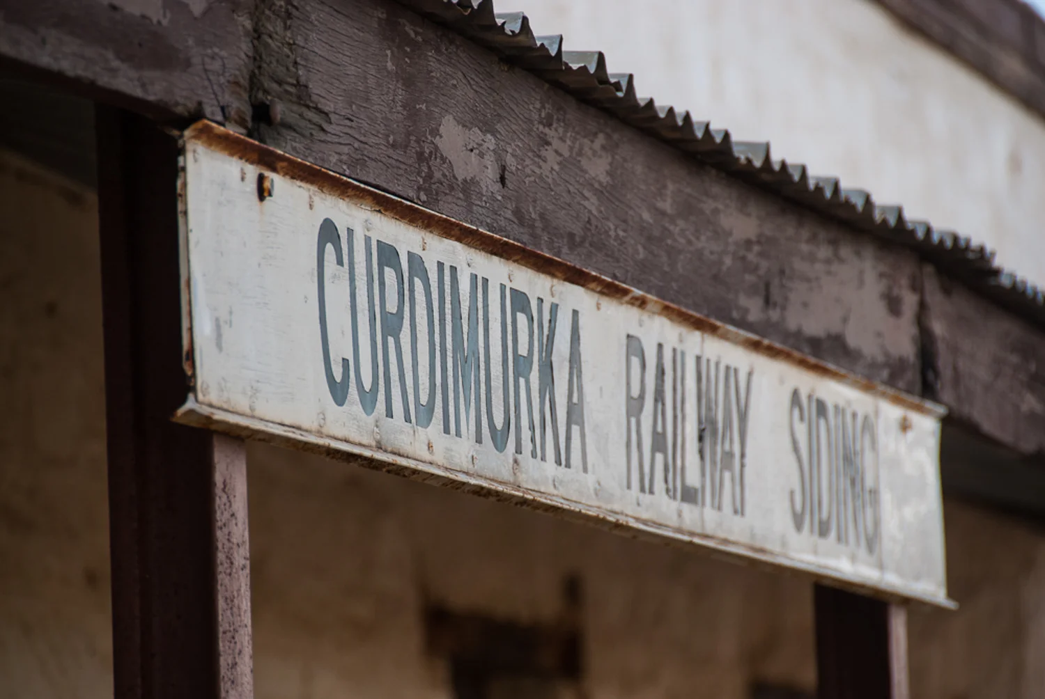
These natural springs are also the reason the Ghan was able to venture this far in to the interior provided the water essential for the early steam trains. The relics of the old Ghan edge the Oodnadatta track, such as the stone sidings and rusty red water towers at Wangianna, Curdimurka, Warrina, Callalanna, Alberrie, Margaret Siding and Beresford. Each one in different states of atrophy with buckled timber verandas and corroding iron roofs.
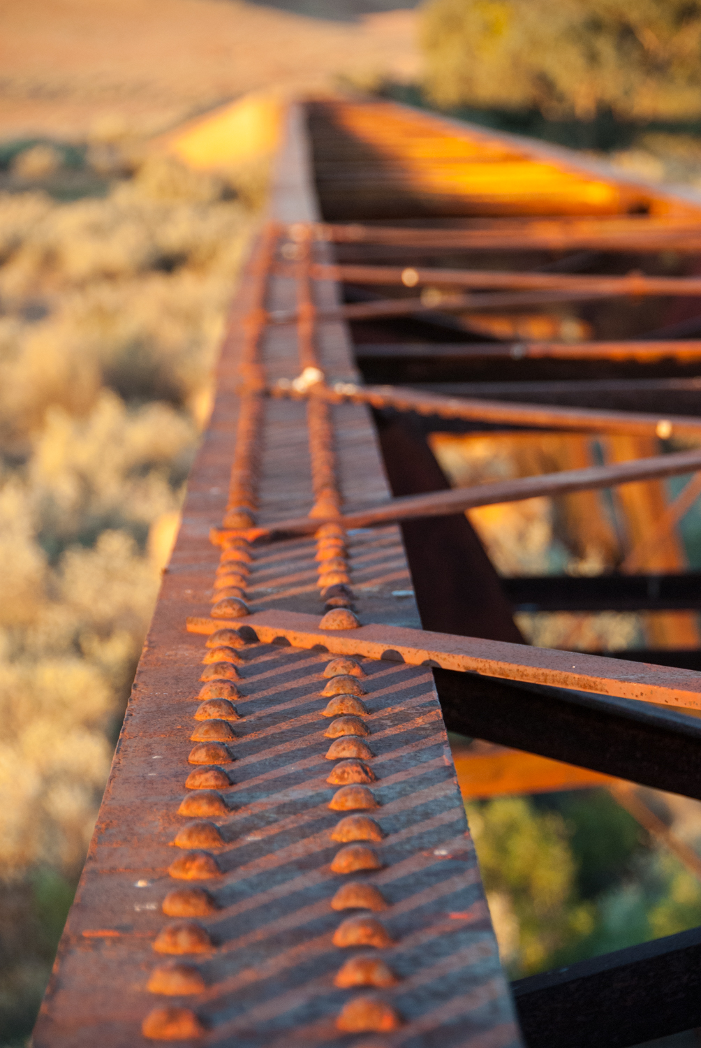
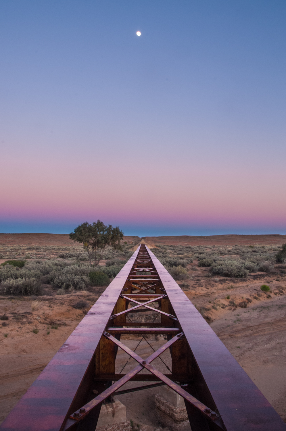
Heading north from William Creek, Algebuckima is probably the most dramatic of these structures being the longest bridge in South Australia (approx 600m). Its other claim to fame is the car at the base of the bridge. The story goes that someone decided to take a shortcut and drive over the bridge only to be met by the train coming the other way. The driver bailed into the river just as the train hit, dragging the crumpled wreck to the end where it still remains. While this is also a popular camp site, we made camp next to one of the smaller relics of the old Ghan line and watched the sun light fade over the red rusty stanchions.


While much of the journey is through vast plains and mesas (flat topped hills) there is the occasional edifice that breaks the horizon. Somewhere between hump number 125 and dry river crossing 23 you come across 2 metal planes side by side and nose pointing skyward like they are holding hands. This is one of about 20 sculptures that appear near Alberrie. Something else impossible to miss is Oodnadatta, what was South Australia’s most northerly railway town, now more famous due to its brightly painted flamingo pink road house welcoming you to the town.


Just north of Oodnadatta we turned right to continue our trip following the ruins of the Ghan. After travelling for approx 15 km over rolling sand dunes that felt like you were on a never ending roller coaster, the topography changed dramatically to open flat expanse of nothing. Well nothing except rocks. Now these are no ordinary rocks. These are the gibber plains which means miles of fist sized smooth rocks that not only cover the landscape but also the whole road.
A track out west has the ability to take on different forms. There is the smooth wide dirt ones that makes you think you are on a highway. There is the track composing of 2 wheel ruts, generally something that kangaroos and goats have left. There is the most common one – the track with minute humps that in isolation would go unnoticed, but when they come together they form the most bone shaking, teeth rattling, car destroying experience. But the worst is the track covered by gibbers. The jolting and shaking was enough for me to sympathise with Captain White that this would make any 'traveller sit and cry like children'.
Finally reaching Pederka ruins, approximately 58kms from Dalhousie, it was time to inspect if anything had rattled loose on the car and trailer and also check that my teeth were all still present. With the campfire providing an orange glow on the decaying walls of the cement block cottages you could almost hear the rattling of the steam engine in the wind.


Leaving Pederka, we made our way in to Witjirga National Park with a mix of red dunes and yellow hills reminiscent of an old American western movie set. The Park is the gateway to the Simpson Desert but unfortunately that will have to wait for another trip. Instead we explored Dalhouise Ruins built somewhere between 1872 and 1875 and finally abandoned in 1925. Unlike many of the other relics we have come across, the gradual erosion has only been halted due to more recent stabilisation in 1994 by Heritage SA.
Continuing on the track you can hear Oposum Waterhole before you see it. The clatter and squarks of the Galahs fill the air as they travel from waterhole to waterhole. But the watering hole we were interested in was Mt Dare Hotel, another eclectic outback pub with hundreds of beer coolers hanging on the roof like a string of fairy lights.


After the compulsory ‘cleansing ale’ we left the Hotel to make our way to the 'Centre of Australia'. Officially known as Lamberts Centre, the track weaves through fields of little yellow, purple and pink native windflowers carpeting the edges. Reaching the loneliest flagpole in Australia I can finally say I have been to the true ‘Red Centre’.

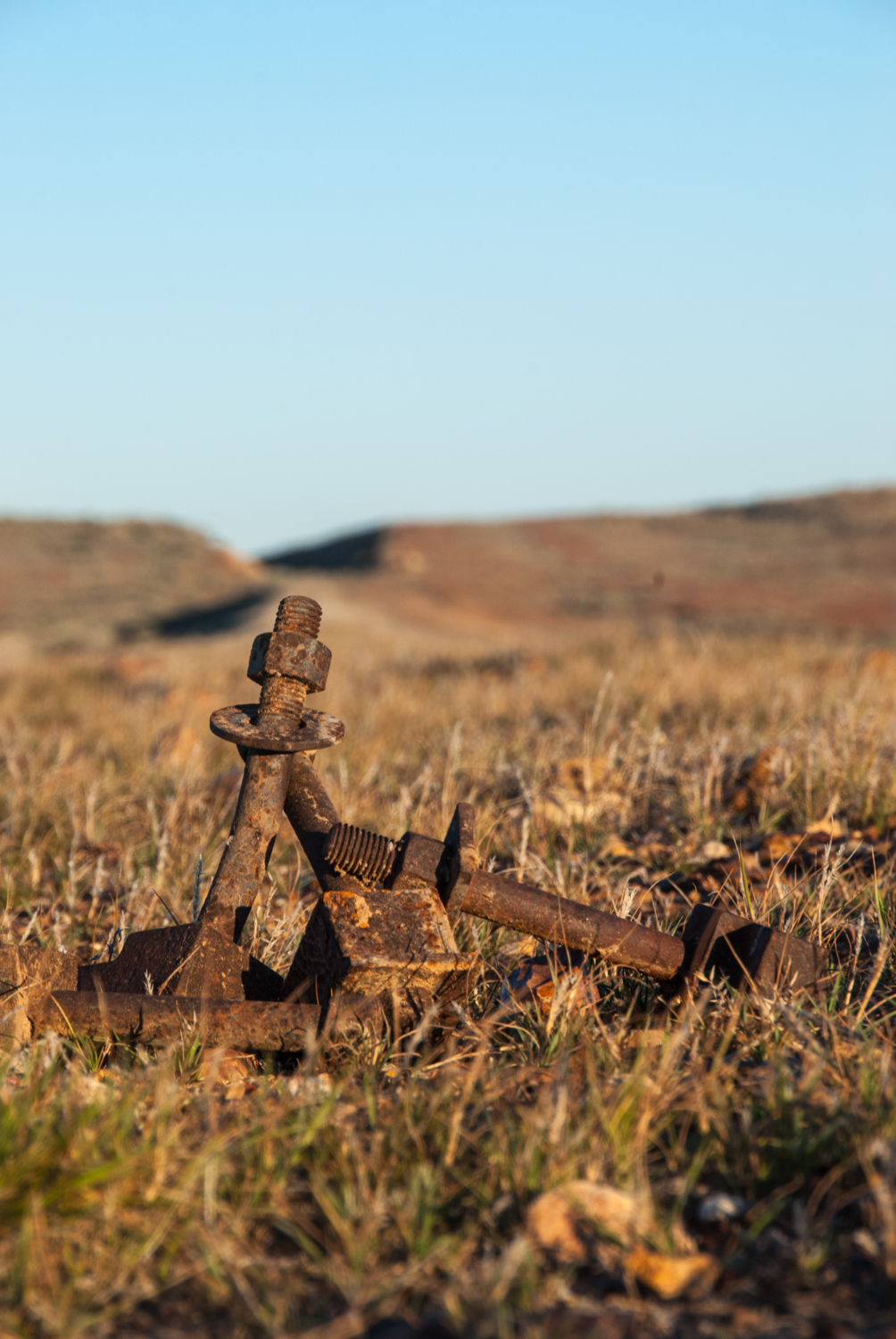
Having retraced our steps back and re-joined the path of the old Ghan line our last run was from Finke to Alice Springs. Finke is well known as the site for the Finke to Alice desert race where lunatics on bikes and 4wd hurtle 220km along an unmaintained track that runs parallel to the main track. But the final run north left my previous definitions of ‘tracks’ beyond words with corrugations the size of Mt Everest and large metal spikes ever couple of hundred metres ready to leap out and skewer your tyre. These are the dog spikes used to hold the rail to the timber sleepers. With the concept of another 100km of earth trembling corrugations ahead I decided that the 'unmaintained track' they race on couldn't be any worse so we gave this a go. While not as corrugated the moguls would make any Olympic skier quake in their boots. Deciding at this speed we would not be making our next camp for a week it was with much pain we endured the next few hours.


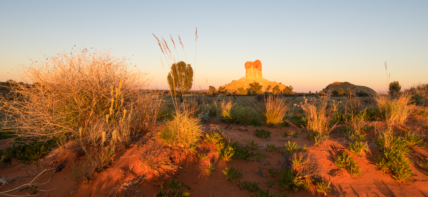
Before getting to Alice there was one last diversion to Chambers Pillar. This amazing ancient stone monolith rises like a volcano from the flat planes, carved as a result of eons of wind erosion. With just enough time to catch the last glimpse of the sun on the pillar before it slipped into another time zone we set up camp to finally reflect on the journey from Yunta and the trip ahead. The next leg would take us back in to civilisation and follow the much more trodden path through the McDonald Ranges and Uluru.


The trip so far has highlighted the desolateness of the outback and the amazing persistence of the early settlers. There is also a sense that the ruins have only just survived the past yet lived on too long. But as time and the outback reclaim the sidings, bridges, homesteads and stone buildings, eventually the only relic remaining will be the shadows from the clouds, the fine red dust and scattered grasses and the sheep footprints left in the sand much like it was before Edward Meade Bagot arrived at Dalhousie back in 1873 .


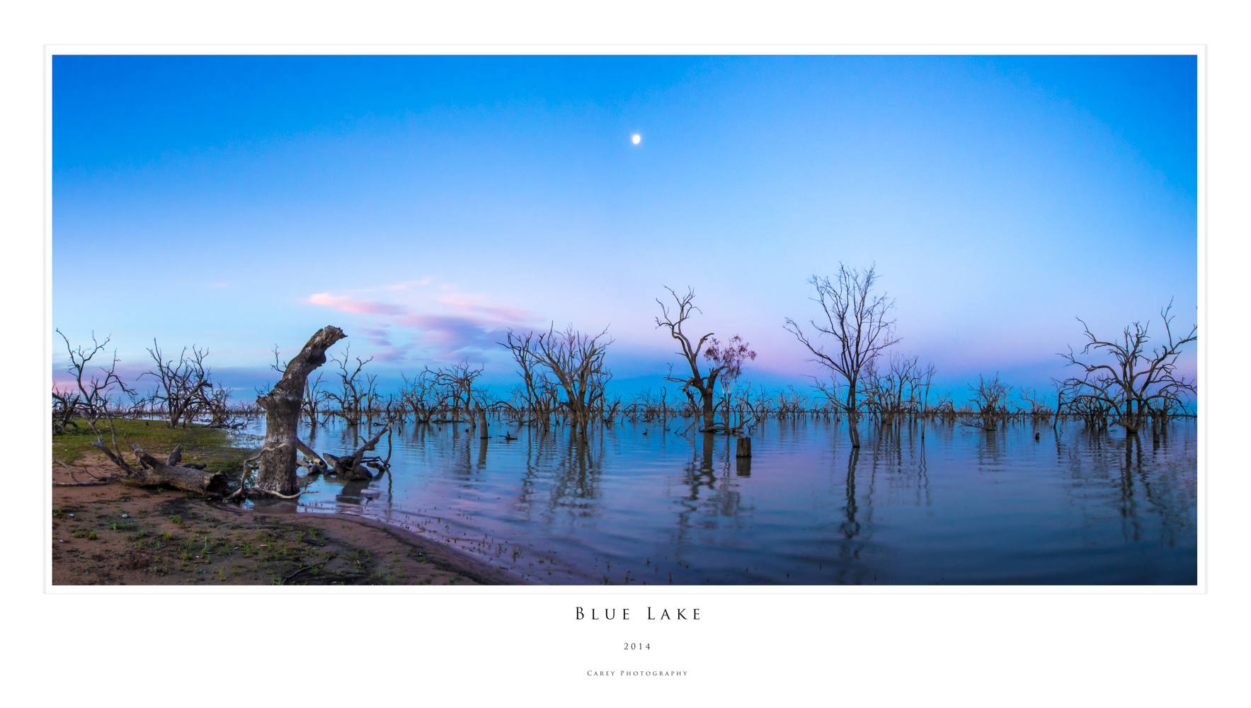
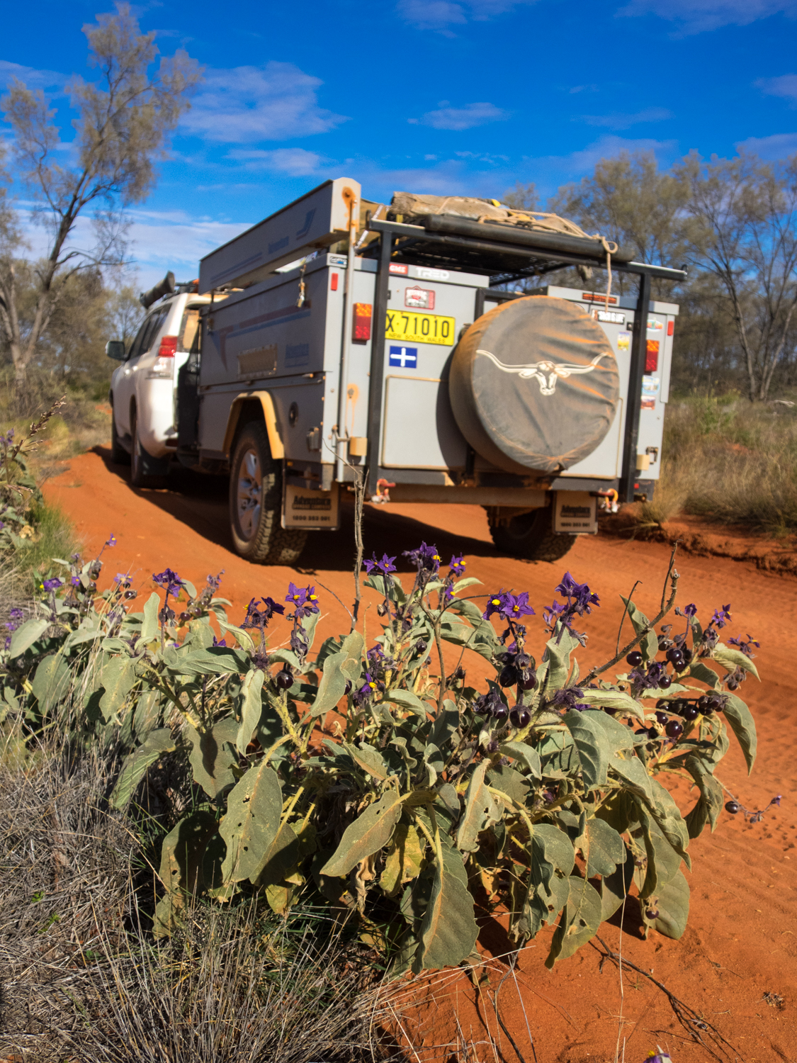
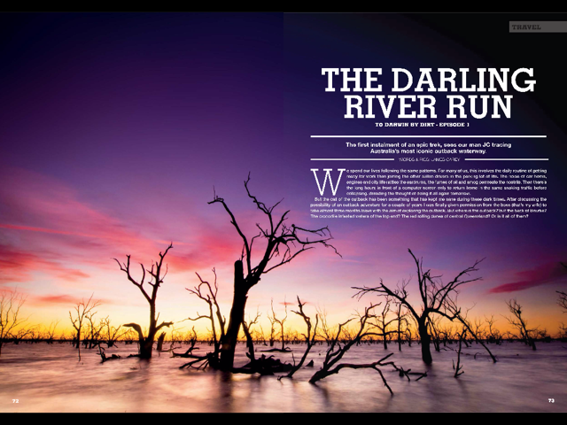
June 2014: To Darwin By Dirt - Darling River Run
This story was published in the April 2015 Issue of 4WD Touring Australia. This is the first part of a 3 month journey from Sydney to Darwin and back. To read a full account of the trip and view photos and videos go to To Darwin By Dirt.
We spend our lives following the same patterns. For some of us it involves the daily routine of getting ready for work then joining the other sullen drivers in the parking lot of life. The noise of car horns, engines and city life rattling the ear drums, the fumes of oil and smog permeating the nostrils. Then the long hours in front of a computer screen only to return home in the same snaking traffic before collapsing, dreading the thought of doing it all again tomorrow.
But the call of the outback has been something that has kept me sane during these dark times. After discussing the possibility of an outback adventure for a couple of years I was finally given permission from the boss (that’s my wife) to take almost three months leave with the aim of exploring the outback. But where is the outback? Is it the back of Burke? The crocodile infested waters of the top end? The red rolling dunes of central Queensland? Or was it all of them?
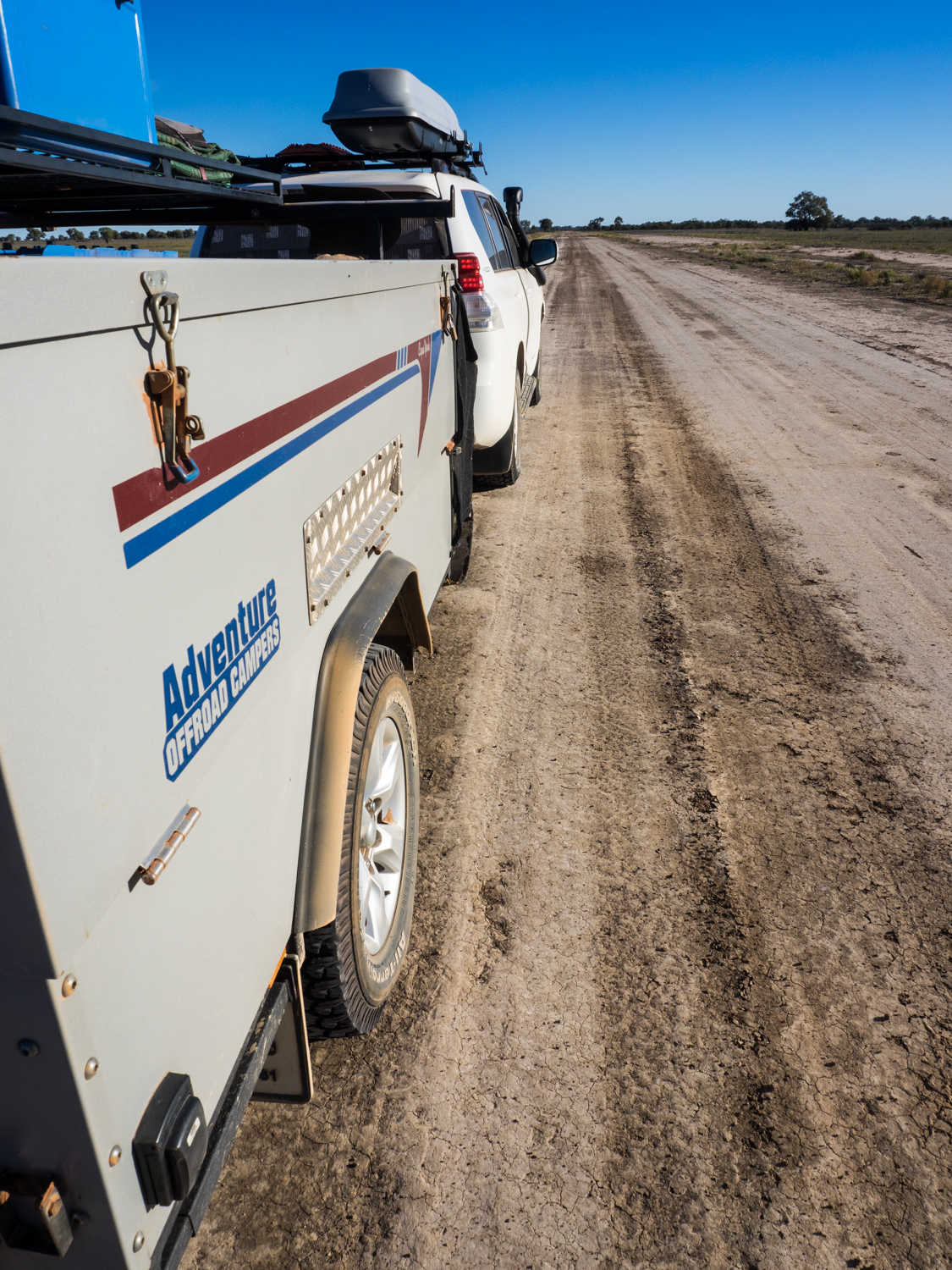
Pulling out a map, a line was sketched out taking me from Sydney out to Bourke and then the Darling River Run to Menindee. From here it was to track north from Yunta through to the Gammon Ranges and then on to the Oodnadatta and the Old Ghan. Taking a closer look at the map, West McDonald ranges and Uluru were added before continuing north to Kakadu and Litchfiled NP. Unfortunately time dictated that I could not join the fortunate few that have decided to circumnavigate this expansive red continent so a course southwards was needed. So a path across the Savannah Way to Lawn Hill NP then down to Birdsville and Innaminka before making the journey home was finally settled on. In total over 13,000km and 2 million corrugations was mapped out.
The outback gods must have been on my side as the first part of the trip following the Darling River was to be a solo adventure before meeting up with family and friends on later parts of the journey. Rollling along the long straight 300km stretch of road from Naromine to Burke the steering wheel only moved twice giving me time to contemplate the adventure ahead.
What I knew is that the Outback is a place of opposites. It is both a place of vast flat nothingness to rugged terecotta red gorges and mountain ranges. It is the single Sturt's Desert Pea that clings to life against the drought and the sea of wild flowers after the rains. It is a place where the flies descend by the thousands or the lone wedge tail eagle soars skyward. It is where the gibber stones shimmer in the 45 deg heat and the morning frost clings to the Mitchell grass following a freezing night. It is the dry Todd river bed flanked by river red gums and the rushing Darling river engorged by flood waters. It is the raucus galahs and corellas drinking in the waterholes and the endless quiet of the desert.
But as beautiful as this can be, the outback can also be extremely unforgiving. There are numerous stories of people venturing in to the outback unprepared such as the 36-year-old German Kim Hardt who became bogged at Lake Disappointment with ten litres of beer and a packet of bikkies to survive. Having spent two years planning for the trip I hoped my own fate would not be as dramatic.
My thoughts were brought back to present as Mount Gunderbooka began to rise out of the expansive floodplain forming a magnificent escarpment that is of great significance to the local Ngemba Aboriginal people. Leaving the Kidman Highway, Gundabooka National Park is a great spot to stop and experience the feeling of isolation that only an outback travel can provide. Having set up camp at Dry Tank campground it is a short drive to Bennett’s Gorge and the beginning of the "Valley of the Eagle" walk. The first 1km is an easy stroll along a well maintained path to the base of Mount Gunderbooka. From here it is a more strenuous 2 hour climb to the 500m summit as the track weaves its way higher climbing over rocky red boulders and rock scree, past mulga thickets and through the white cypress pine and western bloodwoods. From the top I looked out over the parched plains and watched the eagles as they glided on the rising eddies looking for lunch. The last sign of another traveller was a hundred km away making the climb both rewarding and a reminder of how remote this land is.
While a side trip to go on the paddle steamer PV Jandra from Bourke is a possibility, the desire to find a dirt track was calling. Affectionately known as the Darling River Run the track follows a section of the 2,740km long Darling River. Just as the river slowly meanders through the heart of NSW, my journey was to meander from Bourke, Louthe, Tilpa, Wilcannia, and Menindee before leaving the river to continue on its journey as I made my way west to Broken hill.
The road from Bourke to Louthe is an easy drive suitable for 2WD when its dry. But like the other opposites of the outback, it only takes a sprinkling of rain to turn these tracks in to a rutted slippery, impassable barrier. Luckily for me the rains of last week that brought life to this parched land had subsided enough to get through.
The other liquid that parches the thirst in the outback is that found in the many unique pubs that provide both a watering hole and gathering place to the locals and weary travellers. ‘A place that loved a drink, a party and a punt…’ so wrote Henry Lawson about Louth, a small town with a population of 30ish (you never can be precise in these small places). And the place they now come to drink is Shindy’s Inn, a pub with eclectic memorabilia adorning its walls telling stories of past explorers who paved the way for European settlement along the Barwon-Darling River.
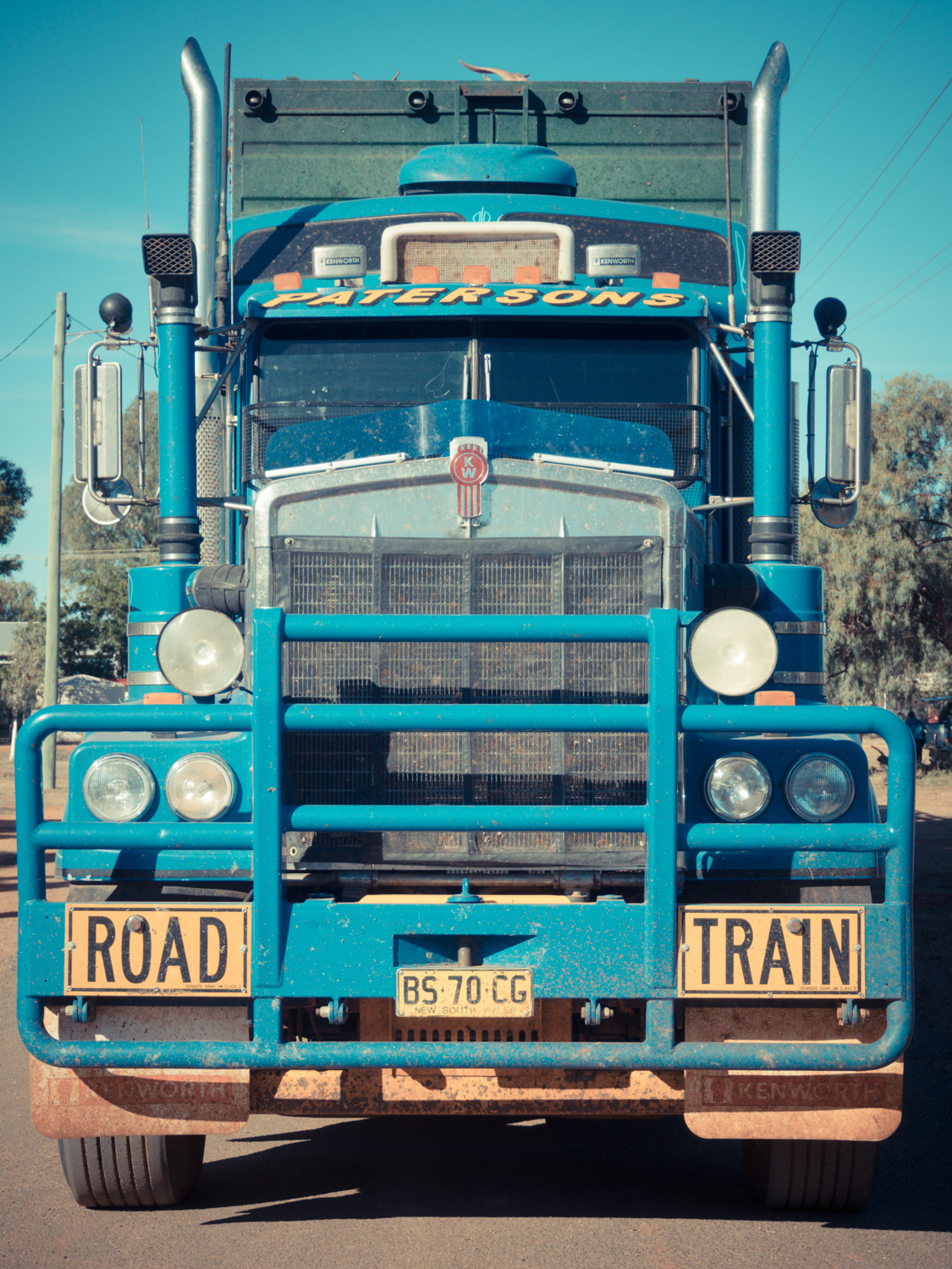
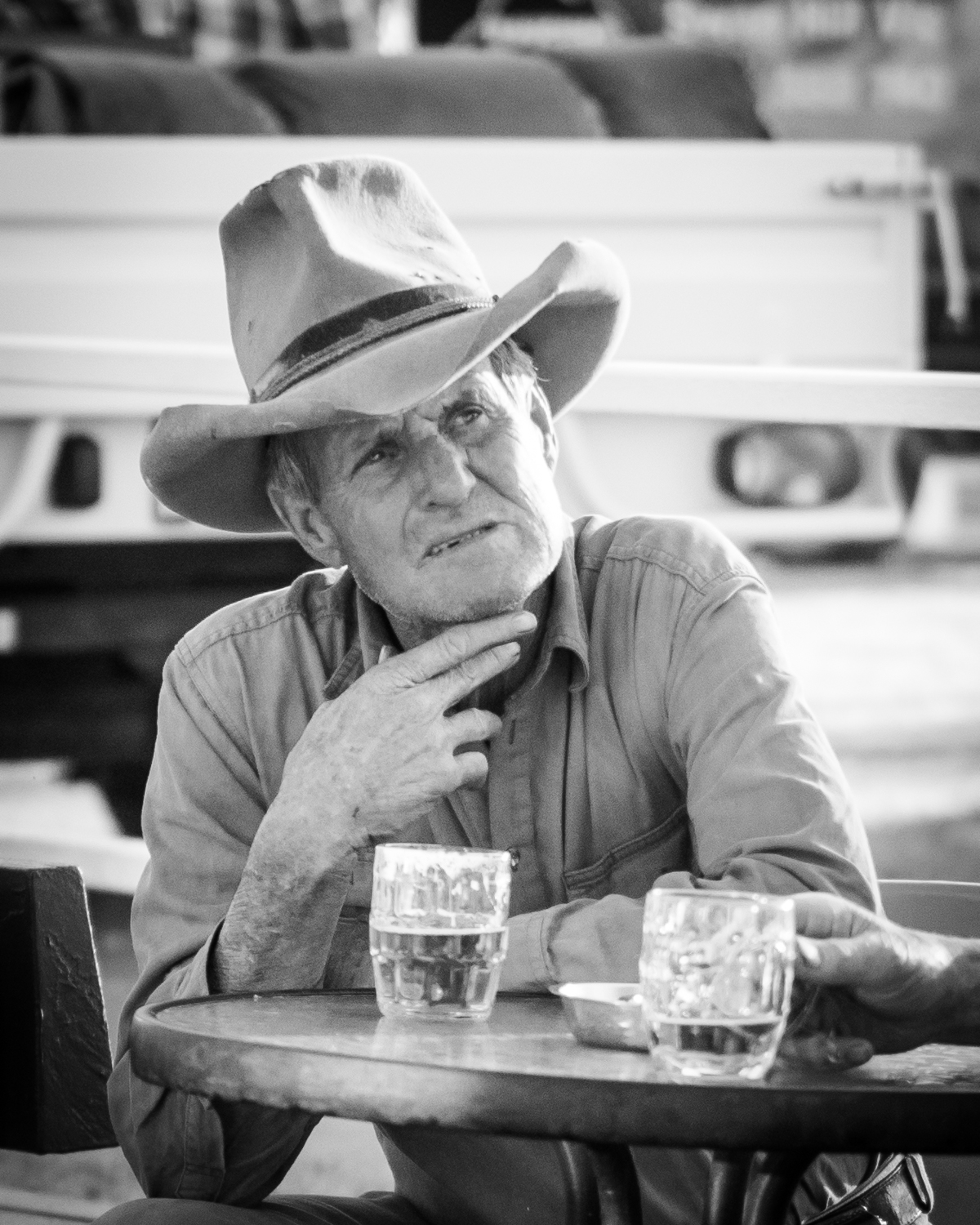
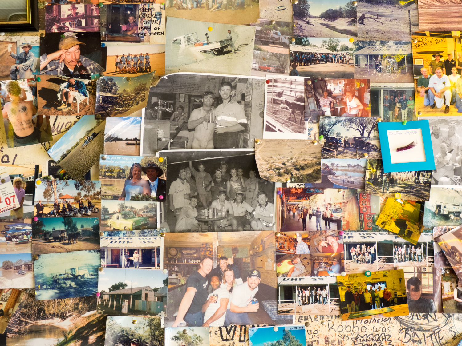
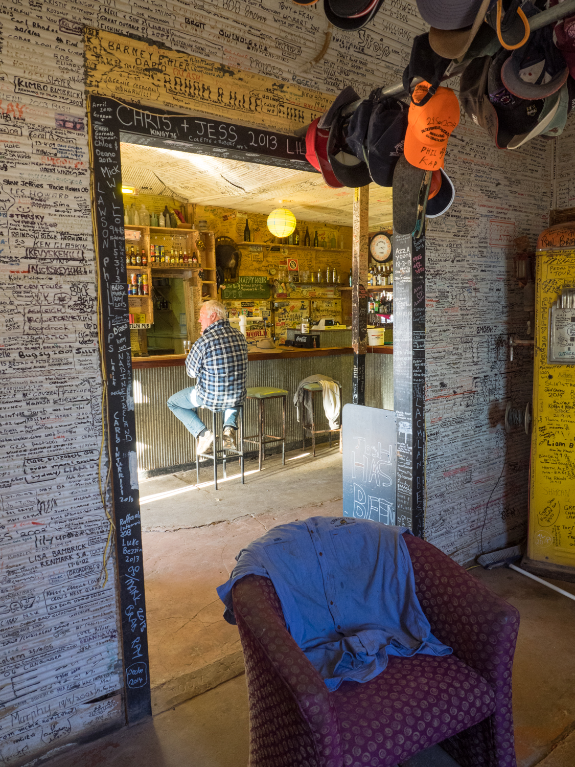
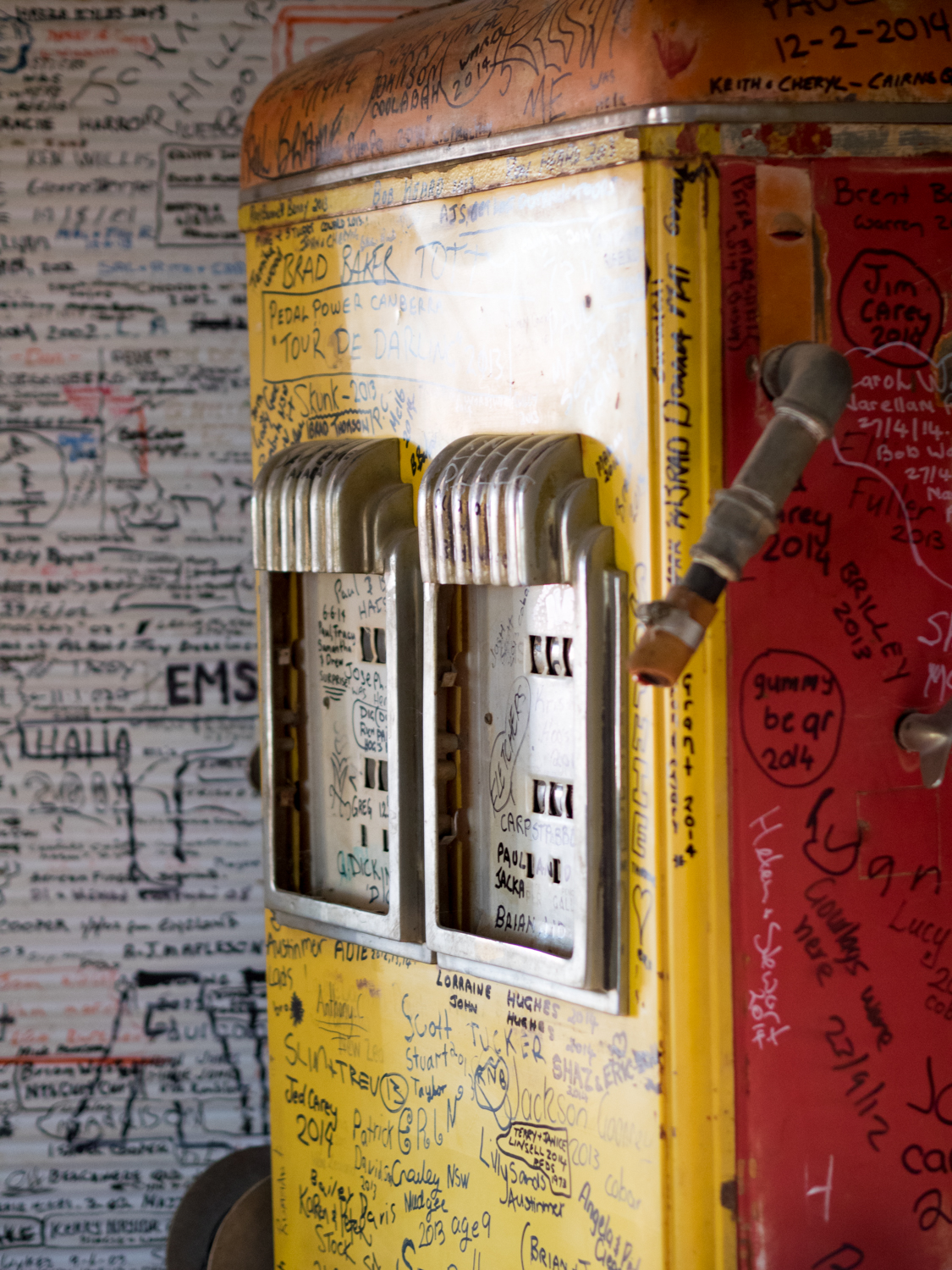
Following the flow of the Darling a further 80ish km (you never can be precise travelling the outback) you come to Tilpa, one of those iconic locations that appears as an oasis to the travelling shearer (or me). Consisting of a pub, 3 shacks and 2 sheep, there is little more to this place but its character typifies everything to me about the outback. The 100 year old Tilpa Hotel with “UHF 35” painted on its corrugated iron roof, signals the passing traveller to call in. Out the front two elderly bushies chat, their faces shaded by bush hats that had enough history to tell 100 stories. Under the porch a wiry cattle dog sat waiting for its owner who was in side having one last cold beer before returning to the station. Like Shindy’s Inn, the walls of the pub are decorated with memorabilia, but more impressive are the thousands of names and other graffiti written on every surface from locals, travellers and misfits who have ventured past its doors. I am sure if the wiry cattle dog did not move it would have someone's name scrawled on it in no time.
While the clutches of the pub tried to keep me there for one more beer, the sun was setting and I needed to find somewhere to camp before I had to play lotto with the numerous cows, goats or wild pigs on the road.
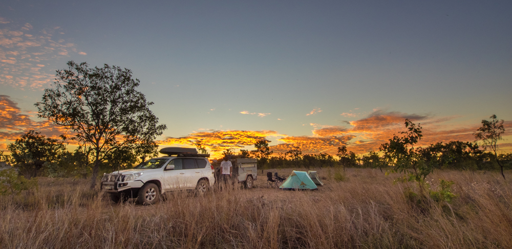
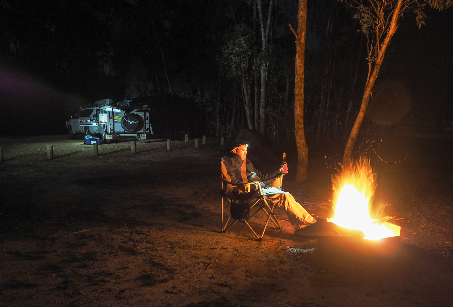
While the track generally follows the Darling river you generally only get a few glimpses of the milky brown water as much of it passes through private stations. Some of these have opened their gates to travellers such as Trilby Station. But if you look hard enought there are two small wheel tracks just west of Tilpa that end up in a magnificent open camp site on the bend of the river. As the blue sky gave way to ink black it was time to light a fire and ponder tomorrow's journey.
Leaving camp, the track to Wilcannia changes through a candystripe of deep red and white soils marking out where the floodplain and higher land occurs. The section of road from Wilcannia to Menindee is less eventful with a monotonous mallee and Belah woodlands encroaching on the edge in an attempt to reclaim the track back. This was only punctuated by the occasional wandering cows that considered the track to be their own.
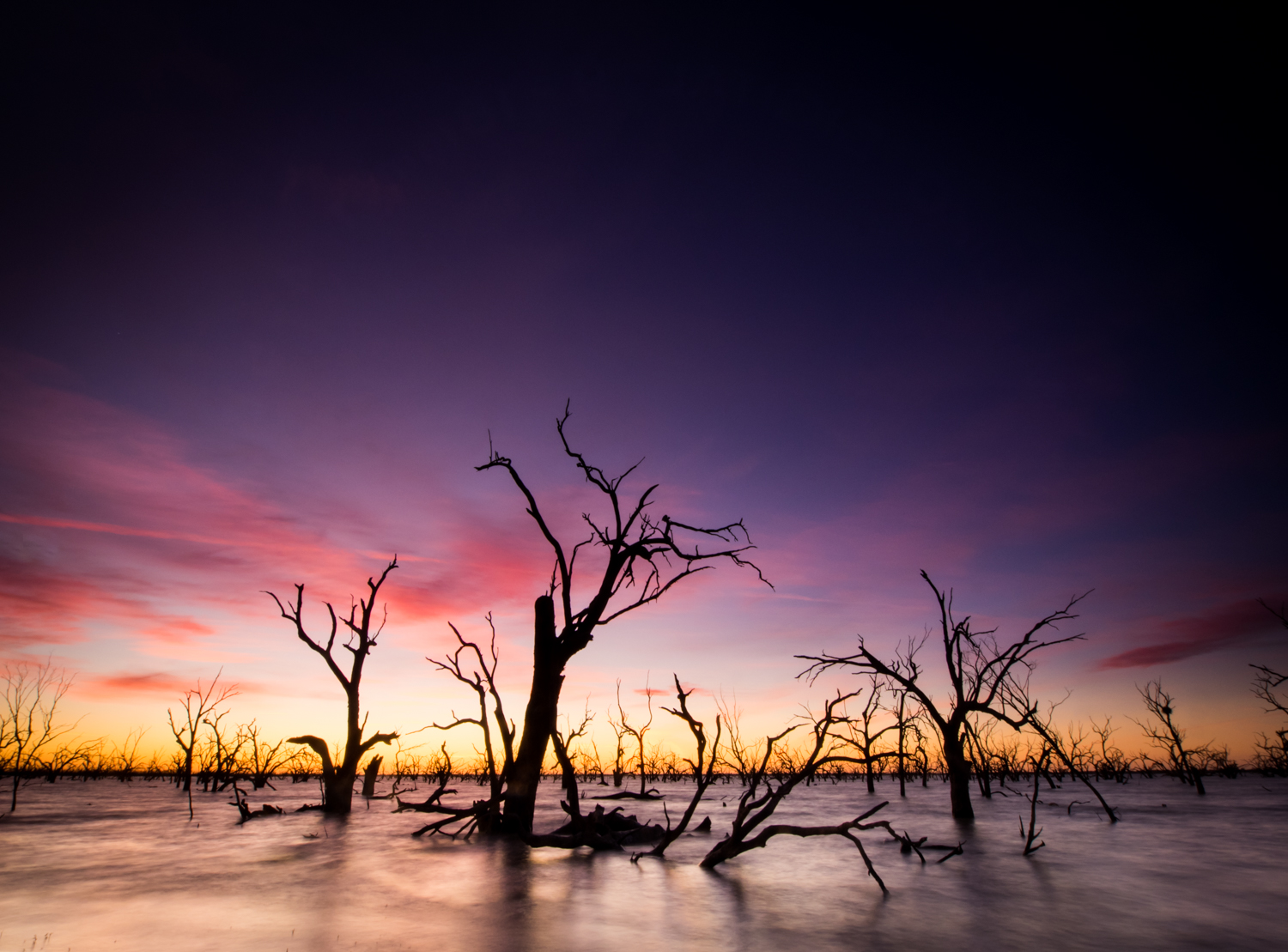
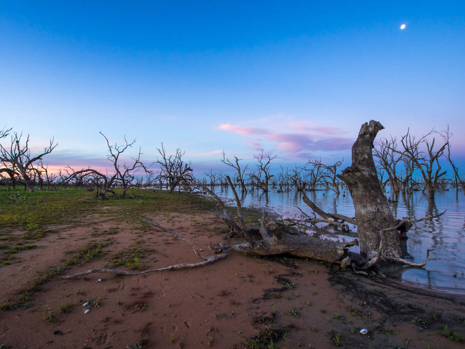
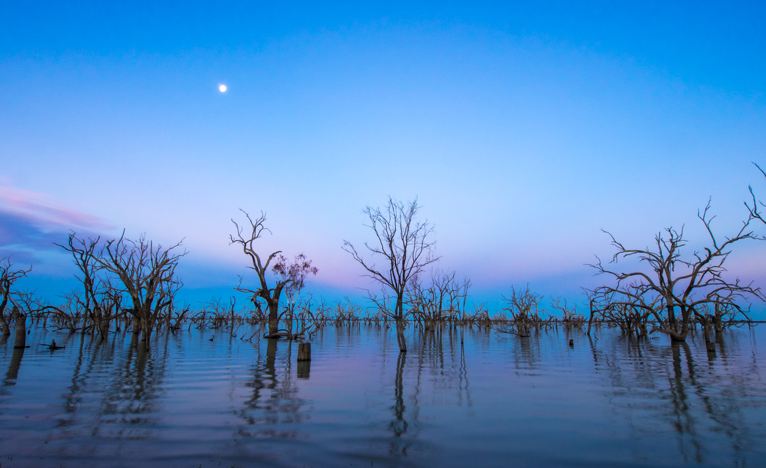
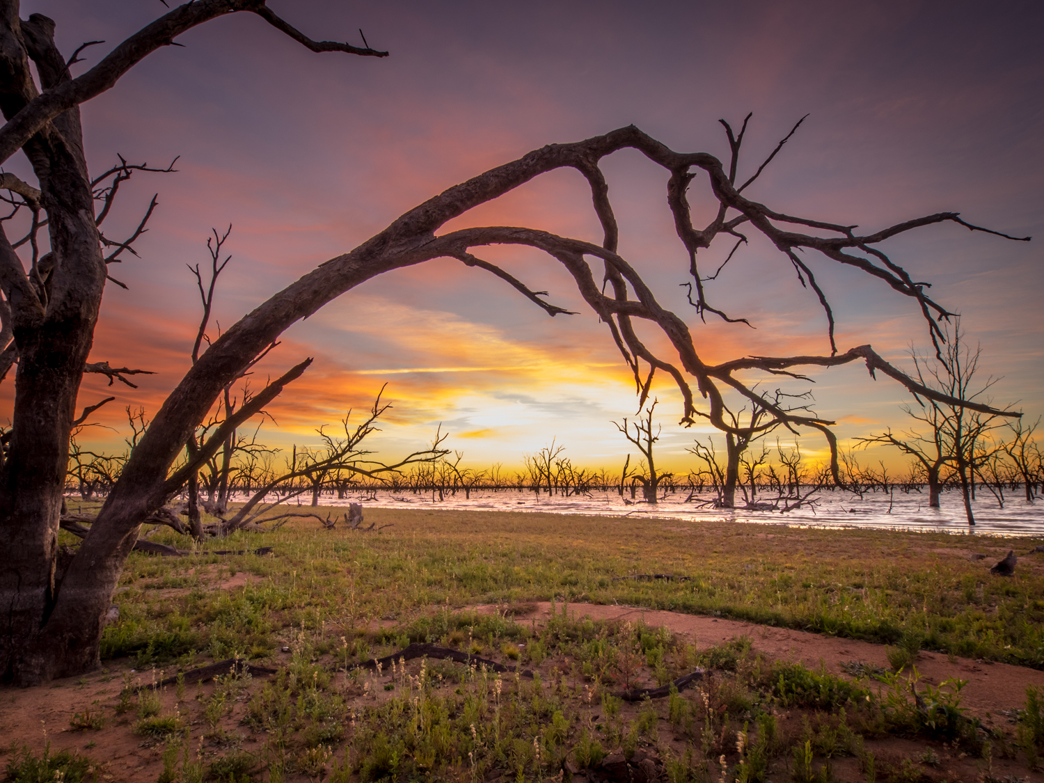
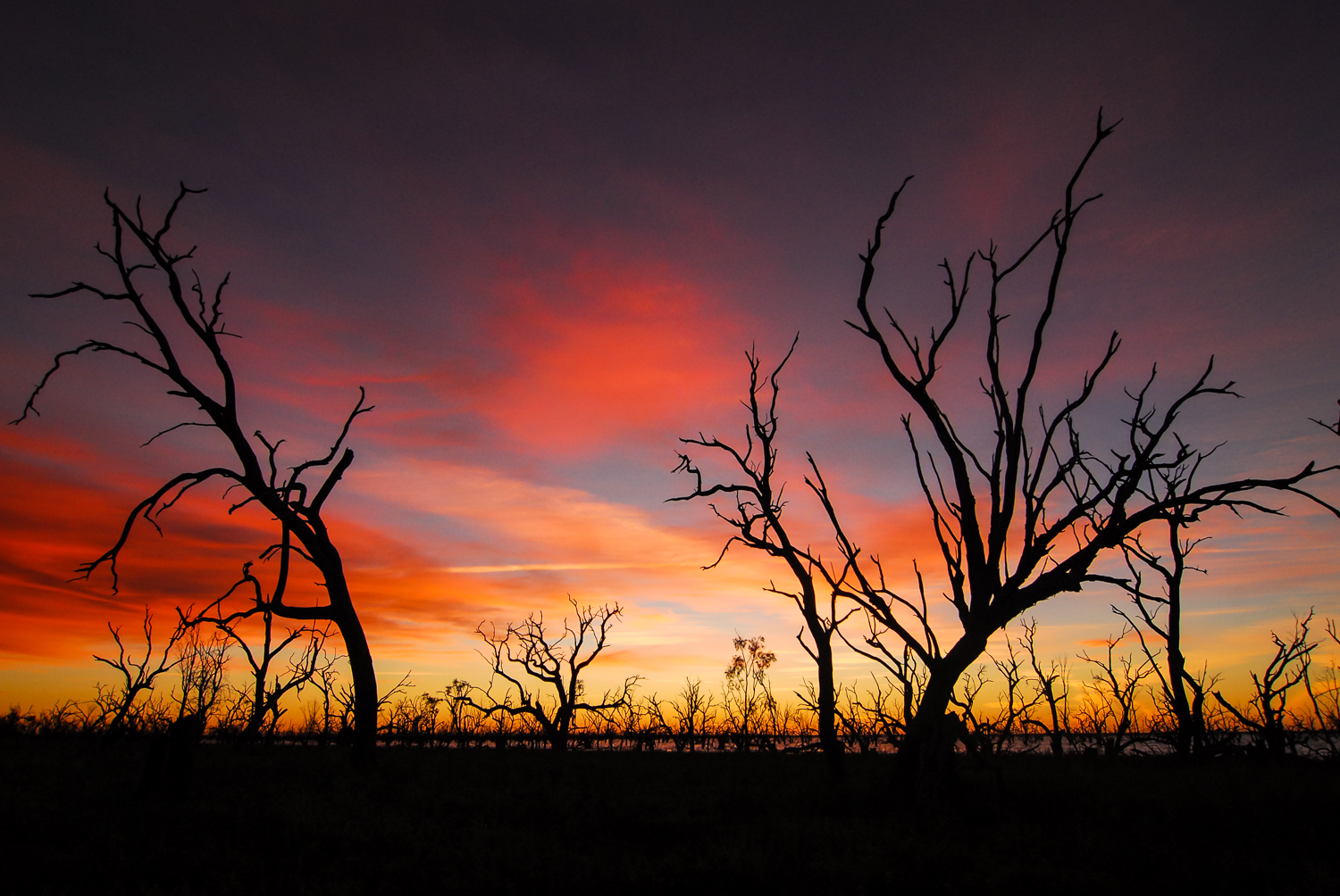
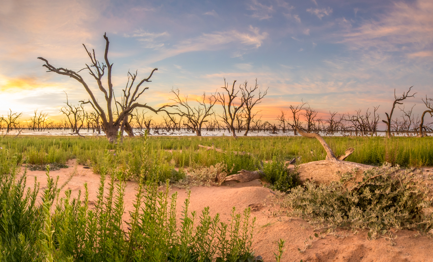
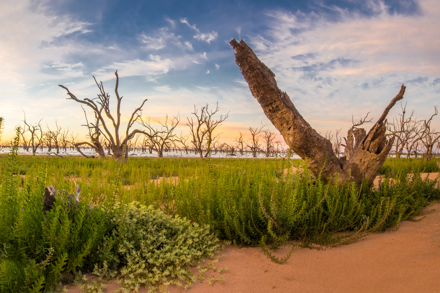
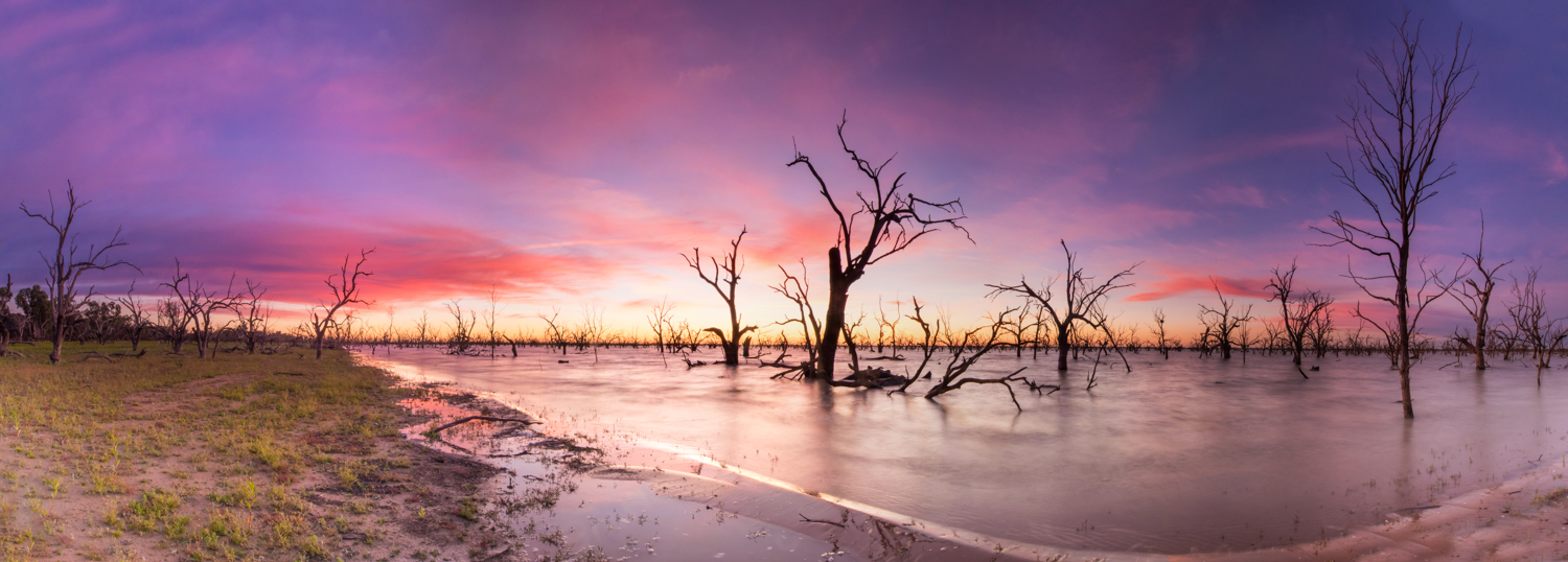
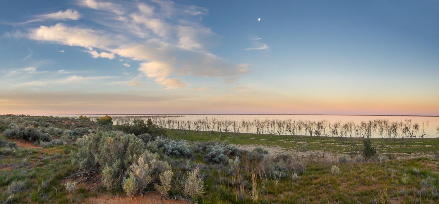
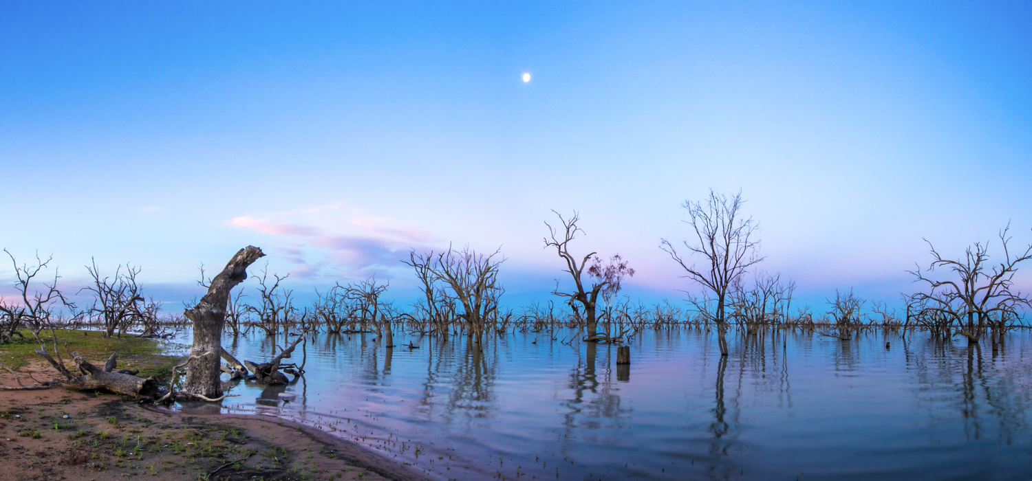
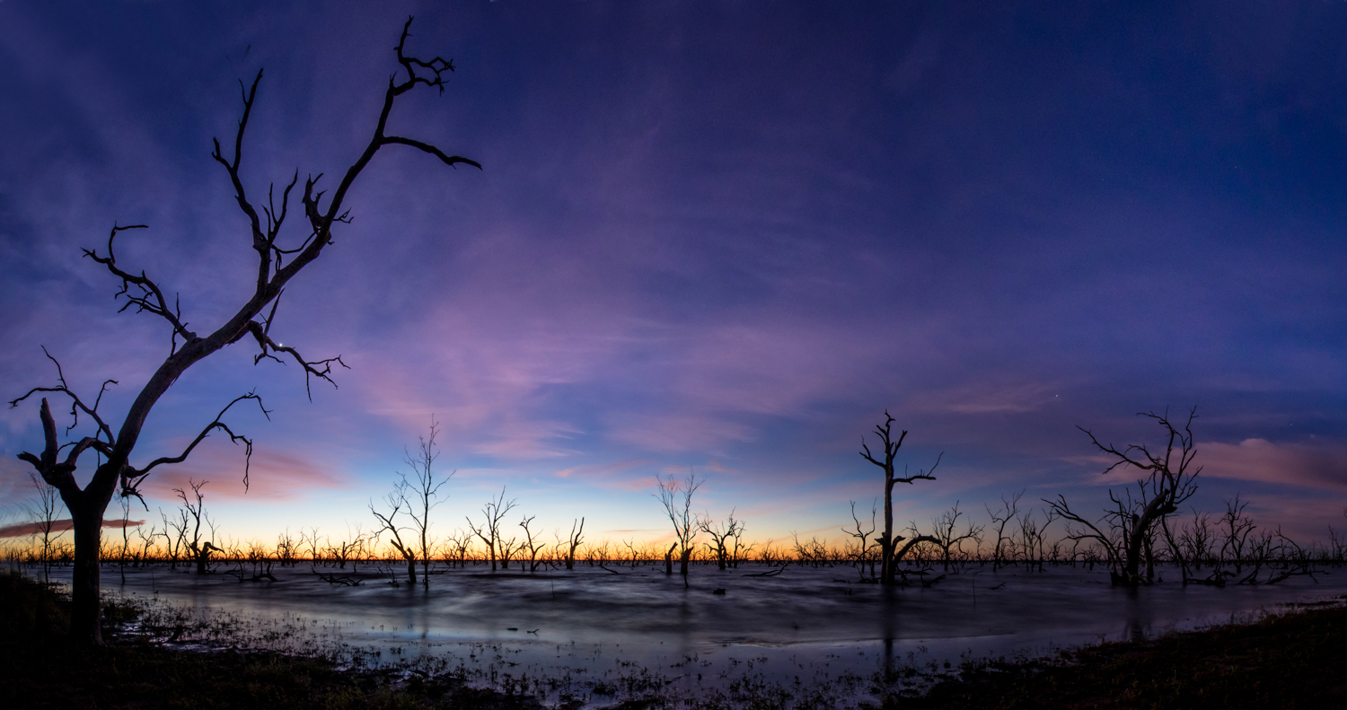
Reaching Menindee there are several choices on where to stay from the more civilised caravan park at Menindee to the adjacent Kinchega National Park. But again looking for a free camp, the aim was to find a track that would lead me to a secluded spot on the banks of Lake Pamamaroo. Following a random track however can be a bit of pot luck. Some lead in multiple directions then return you to where you started. Sometimes they will disappear out into nothing requiring backtracking. But if you are lucky it may lead to something interesting such as the spot I found overlooking this ancient lake with its part submerged black box trees looking like ghostly soldiers standing on the front line ready for battle. Waking early was well worth it with the silhouette of these twisted ghosts against the sky as it put on a magic light show transitioning from deep guinness black through to a wine burgundy, pink rose then yellow chardonnay.

Leaving the lake it was time to return to the black top, letting the Darling river continue on its journey as I made my way to Broken Hill to resupply. The next part of the trip will replace following the meander of a river with that of a rail line. It is to take us from a small dot on the map called Yunta in to the Gammon Ranges of South Australia then on to the Oodnadatta Track and the old Ghan line.
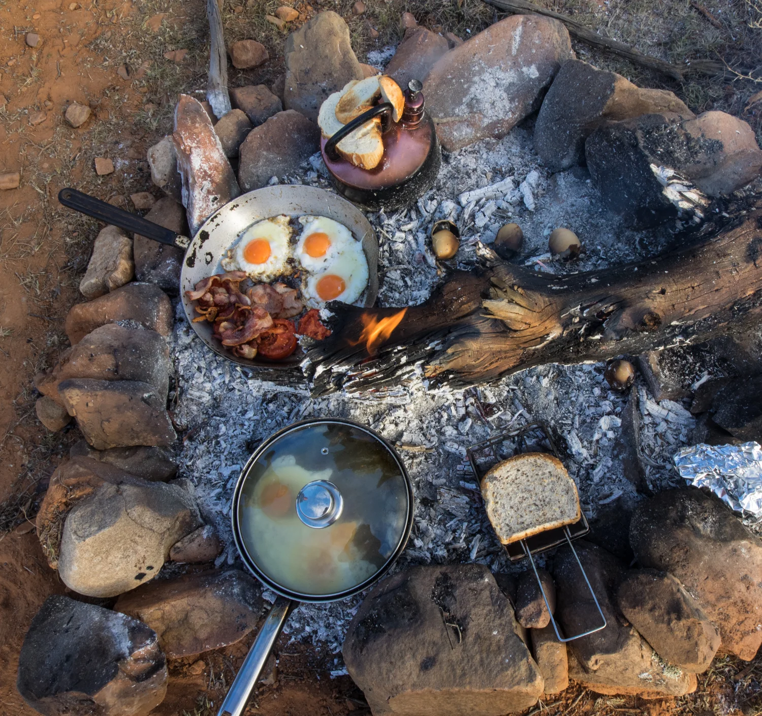
But what was this folly all about? What was I in search of? For me, it was to experience a new pattern. A new daily routing that was to involve time driven by the sun, roads where few cars have travelled, noises of silence broken by the wind or call of a finch. The smell of dust. The long hours exploring the expanses of the outback. Setting up camp in a new home each day and collapsing dreaming of the thought of doing it all again tomorrow.
Luckily I have more of this folly to come.
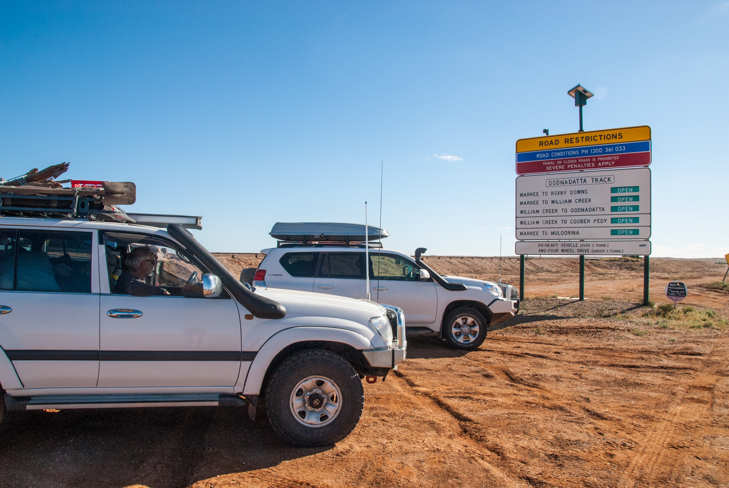
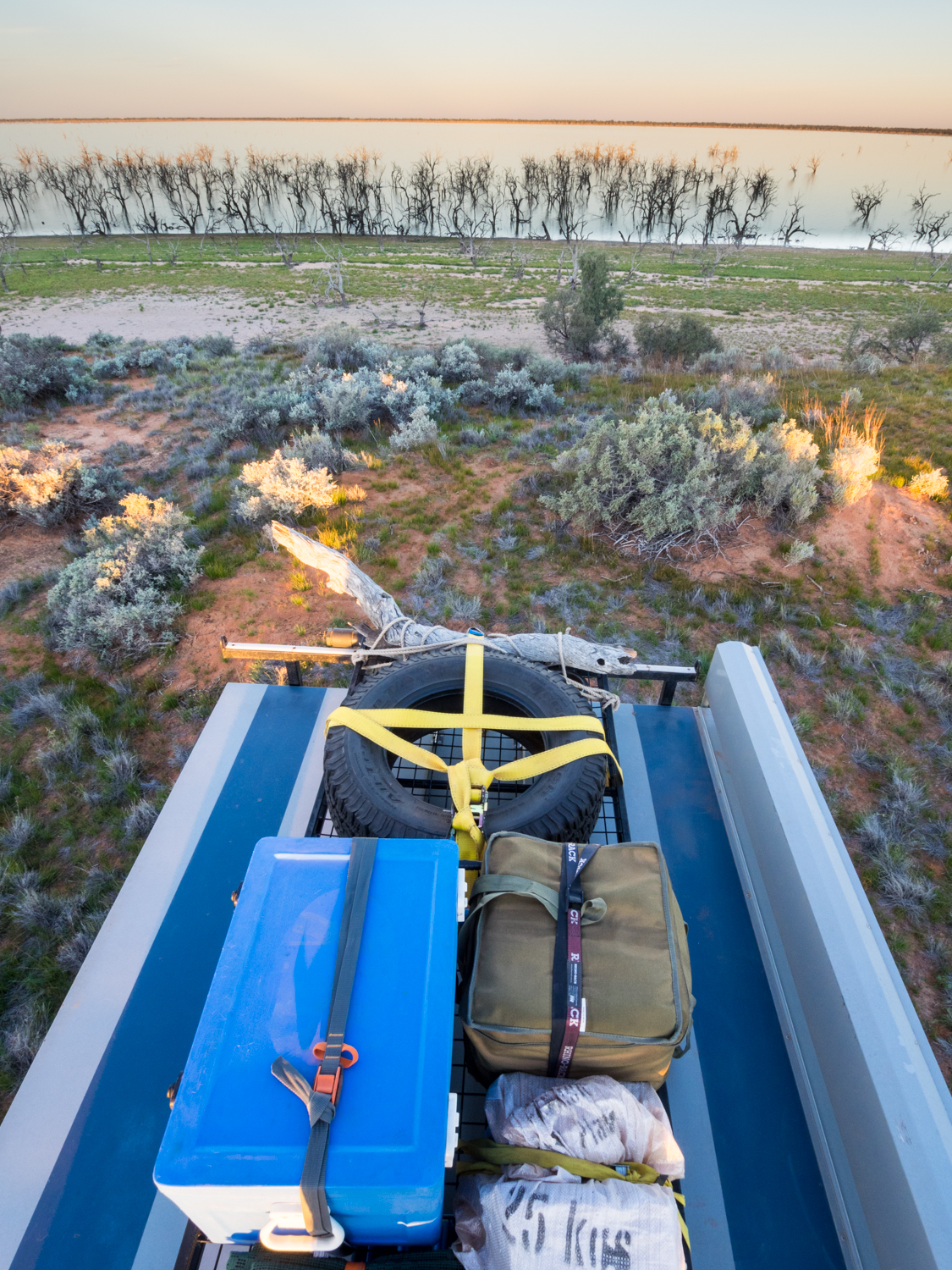
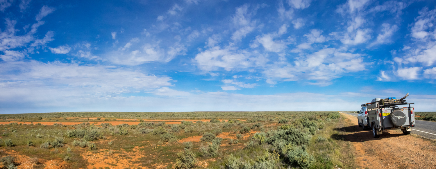
For an idea on what the roads were like have a look below
MAY 2014: Willowglen, NSW

What if I break my leg and cant drive? What if I am bitten by a snake? What if I have problems with my eyes and I cant see? What if I need someone else to drive to the nearest town for more beer?
These are not normally the kinds of questions I have with my wife but they were important seeing we are about to head off on our trip to the outback.
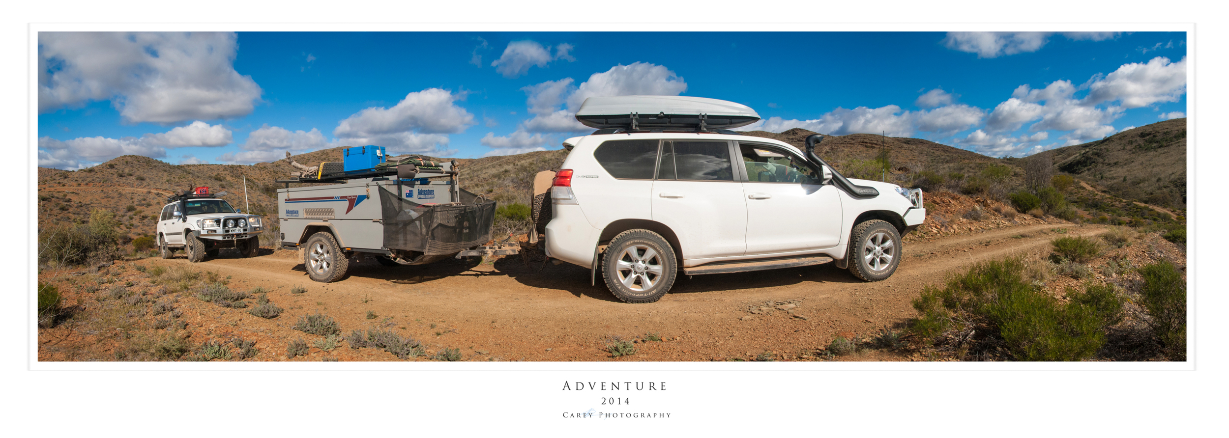
While Kathy is a very capable driver (I had to say this as she is probably reading this post) and drives the 4WD every day to and from work, I realised that the speed humps in the local shopping centre were probably not a good enough test of what we may experience over the coming months. So with this in mind we went and did the 4WD training course which is run by the Toyota Landcruiser Club which we are a member.

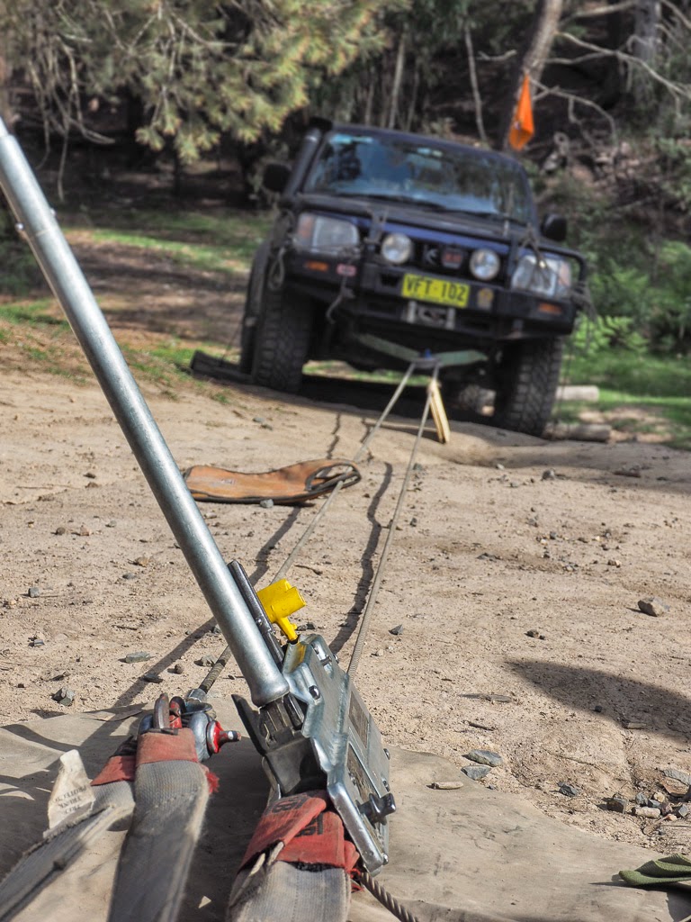


This involved 2 days of learning:
- The difference between winches to snatches (I though this related to previous people I knew);
- dead man anchors (lets hope I never need to do that);
- why high lift jack are designed for macho men to stick on their car roof and serve no other real purpose;
- how to repair a tyre with a piece of chewing gum, string and kitchen fork (well something like that);
- successful water crossings without being eaten by crocodiles (it turns out children are the perfect size for walking the rivers to see how deep they are);
- how to climb steep hills and then come down them again without rolling over;
- how to avoid large rocks jumping out and damaging the car (oops – I don’t think I leant that this weekend)
It was a great chance to really experience where the car is capable of going. It also turned out that the women drivers mastered the course better than many of the men on the course…..except me obviously.
A special thanks to the volunteer teachers from the Toyota Landcruiser Club who did a great job. I can highly recommend it

APRIL 2014: Megalong Valley, NSW
The Easter Weekend is synonymous for rain so camping is usually an unpleasant thought but this year the sun gods were good to us with 3 beautiful autumn days. So with the trailer packed we headed to a lovely campsite in the Megalong Valley called Dunphys Campiste.


I didn’t know until after doing a bit of research that both Milo and Myles Dunphy were avid bushwalkers and were instrumental in pushing the case for national park reservation in NSW. These included the Snowy mountains, Colong, Myall Lakes, Kanangra-Boyd, the Border Ranges and the Blue Mountains.
Despite it being the Easter long weekend and so close to Sydney the campsite was surprisingly empty. I assume it is because it is not well promoted (not even appearing on the National Parks Web site) and you need to follow Megalong Valley Rd passing through private gates before you re-enter the National Park. The site’s openness catches the warming rays of the sun and you get spectacular escarpment views from your tent. It even has the luxury of a clean pit toilet and timber tables and seats.
The nights was spent around the obligatory fire eating marshmallows and damper washed down with a few glasses of 15 year old red to warm the toes (best to bring your fire wood with you or collect before you enter the private property)rather than collect in the NP).


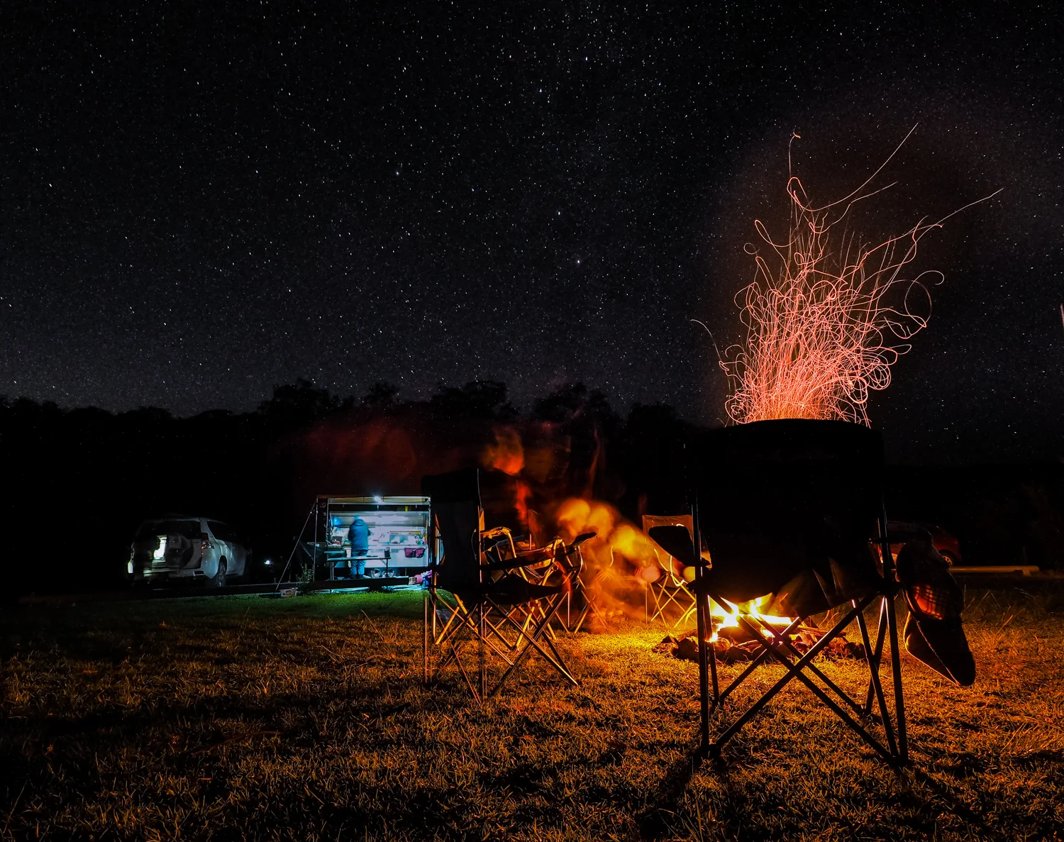


Dunphys is obviously a popular spot for walkers doing the 7 foot track or some of the other popular over night walks down to the Cox’s River. We had to settle for day walks including a trip back up the valley to the Grand Canyon Walk leaving from Evans Lookout. (http://bushwalkingnsw.com/walk.php?nid=787). While normally a loop track it was closed at the bottom. Despite this it was still a fantastic walk as you descend into the canyon through lush rainforest gully. The 1178 steps back out (yes Kathy counted them) was hard work but I will definitely be back to do the full loop when it reopens.


MARCH 2014: Lord Howe Island
Lorde Howe Island is one of the most magnificent places in Australia. With turquoise blue water, tropical reefs, vivid green forests and mist covered mountains it is a photographers paradise. It is also not a bad place to spend your 20th Wedding anniversary.


MARCH 2014: East Beach, NSW
We had a lovely weekend away with Friends at East Beach.....AND IT DIDN'T RAIN!!!
We managed to get a lovely walk in along the coast, a few dips in the water and an early morning photos shoot


January 2014: Narrabeen, NSW
What a great way to spend the Australia Day Long weekend


Despite the story skies I also managed to experience one of the best sunrises i have ever had


