kimberley Calling Part 4: The Dampier Peninsula

Day 34: Boabs and Broome

My large bulbous trunk has the shape of a fat Buddha’s belly, slightly dimpled and weathered after exposure to the Kimberley sun. Some of my fellow trees are known to have a belly 20 metres round and are over 1000 years old.  Although with no tree rings, I like to keep my age to myself.

I have now dropped my leaves to conserve water until the next wet season, leaving a twisted tangled contortion of limbs reaching in no particular direction. It is as though someone has ripped me out of the soil and stuck me upside down leaving my roots in the air.

Yes I am talking about the Boab tree (Adansonia Gregorio for the botanists amongst us).  These enduring trees are a feature of the Kimberley between Derby and Victoria River and have been a constant companion on our trip on the Gibb.

As we leave Derby we drop into one Boab known as ‘The Prison Tree’. In the late 1800’s settlers would round up Aboriginal people, kidnapping them to use as free labour on the coast.  On the way, they would use old Boabs with hollows in their trunks as a temporary jail, a demonstration of how large they can get. The local Nyikina people of Derby call the Boab Larrkardiy, and have multiple uses including a water source, food and medicine, which is a much more fitting use than what the settlers did.

Leaving Derby and the Boabs behind us, it’s not long before we reach Broome.  It feels a bit like being transported from the depths of the outback to Byron Bay without the rich people.  The Main Street has the mix of tourist shops and cafes, something we have not seen for 5 weeks travelling.

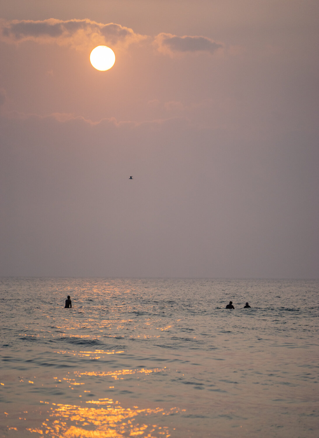
Already feeling overwhelmed we head strait to Cable Beach.  Here we spend the rest of the afternoon having drinks (including a Mango Beer) while we watch the sun set over the water. As the yellow orb slowly sinks below the horizon and the sky becomes an orange blaze, the alcohol begins to relax the mind and muscles.   Time in the Kimberley is like a slow moving clock and I finally feel like I have got within its rhythm.  Let’s just hope with all this eating I don’t get the same Buddha belly as the Boab.

Day 35: Dinosaurs and Camels

There is a quote I recall which says “We all leave our own footprints as we journey through life”.  These footprints can be the things we do, the children we love and the legacy we leave.  So I wonder what the Theropod that was walking through the swamp 135 million years ago was thinking when he (or she) left multiple footprints in the rocks along the Broome coast?

While it is not really possible to know exactly what it was like then, we at least got to see how big their footprints were when we visited Kabbarli and Minyirr or Hantgeaume Point. Heading out on a Dinosaur hunt I would love to say it was my unique palaeontology skills that allowed me to actually find the prints.  The reality is I watched a tour group wonder over the rocks and reach a point where lots of cameras came out.  Following in their footprints when they left, we found several imprints.  With a little bit of interpretation, like a psychologist ink blots, you could make out the three clawed foot now permanently set in rock.

Deciding we wanted to make footprints of our own, we joined the procession of 4wd’s to line along Cable beach for as far as the eye can see to watch the sun set over the Indian Ocean. The other footprints left on the sand was from the camel trains that trundled up and down the beach, tourists bobbing up and down uncomfortable on their humps.  While this is an iconic image of Broome, we decided to enjoy the sights from the ground adhering to the other well known quote “Take only memories and leave only footprints”.  Well for me it’s probably more appropriate - “take only photos and leave only footprints”.

Day 36: Kimberley Time

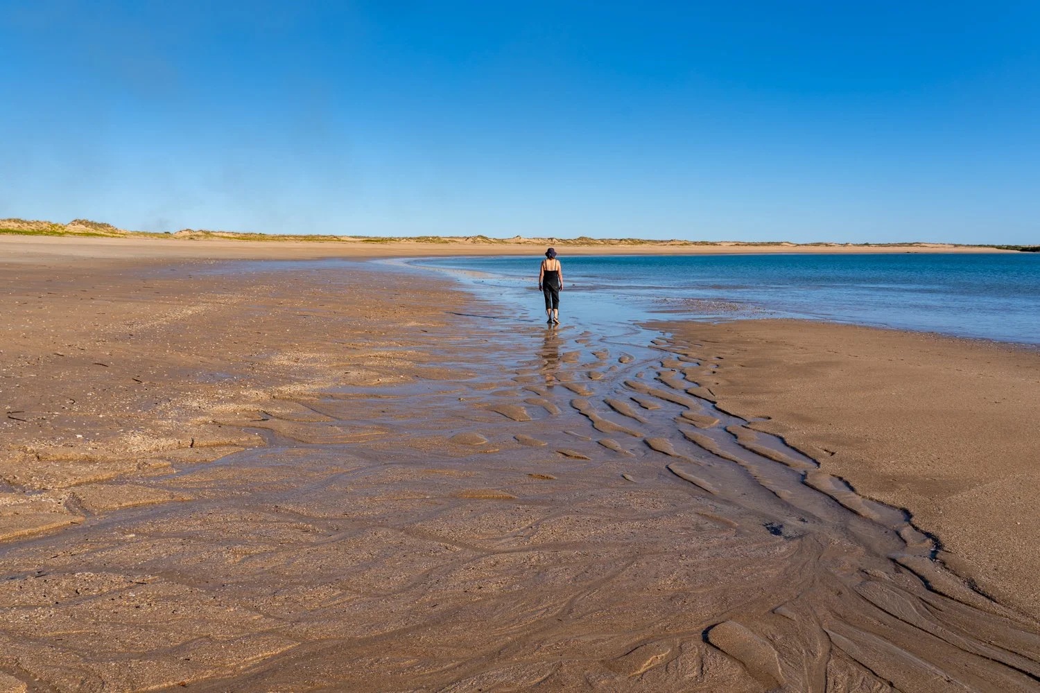
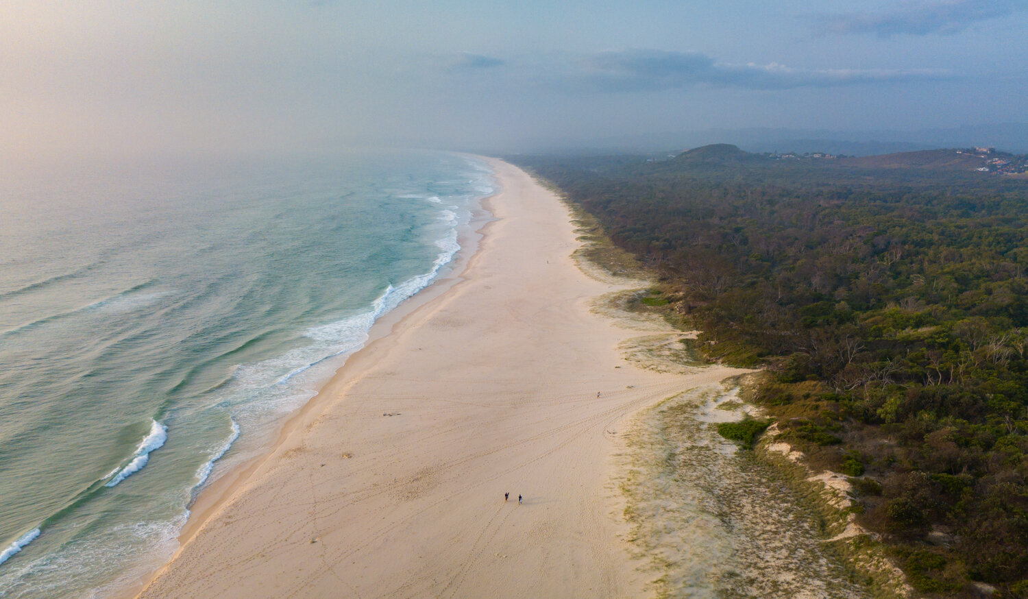
The four of us have set up our camp chairs in the sand. A small table in front of us with the requisite nibblies and a beer in hand. We have just taken front row seats to one of nature’s best movies. However the picture screen is replaced with a curved bay with its white sand taking a long arc in either direction. Beyond the sand the deep blue water is calm, almost appearing to merge with the blue sky, removing any sense of horizon. Where the sand meets the water there is the slightest of waves no bigger than your toes. The rhythmic sound of the lapping water acts like a metronome distorting all sense of time. The only sign that time is still moving is the setting sun slowly converting the picture screen from vivid blues to oranges and reds. This is what is known as ‘Kimberley Time’.

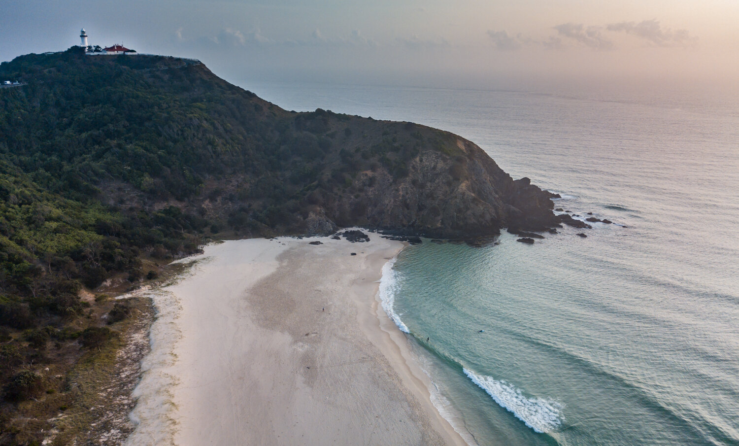
We are currently at Middle Lagoon, a remote coastal campsite north of Broome on the Dampier Peninsular. Where Broome is the equivalent of Byron Bay, Middle Lagoon is what Byron Bay could have been like 100 years ago but more remote. While the road north was good, the sandy track into this coastal oasis was no wider than the car with more humps than the numerous camels we saw on Cable Beach.

Humps are never fun, but today we also experienced one hump that I have been dreading. That is hump day for our trip away. While we have officially reached the half way point on our travels, I can only hope that ‘Kimberley time’ continues to slow us down. May be it will eventually stop and the trip will never end?

Day 37: A pearler of a day

We are all standing around a small table in anticipation of what might happen next. Sitting on top of the table in a metal clamp is an inconspicuous shell that may be worth over $1000. It’s is not the shell itself that is so valuable but what is in it. Hannah inserts her knife into the edge of the Pinctada maxima oyster prizing it apart. We all look on guessing if this will be a perfect pearl sphere that is so sought after, or one with a few more imperfections bringing the price to a more realistic level.

Pulling the little jewel out of its natural home and placing it in Kathryn’s hand, I am trying to sense if she is all of a sudden finding an attraction to this small but very expensive wonder of nature.

Hannah has been taking us on a history and physical tour of the Cygnet Bay Pearl Farm located almost on the tip of the Dampier Peninsular. This region is made famous for the fortunes and losses experienced by those in the pearling business.

Originally the shell of the oysters with their shinny mother of pearl inner layer was used by the local aborigines for ceremony and trade dating back 22,000 years. The Europeans, prizing this smooth white material, used it for buttons, and cutlery handles which I can still remember seeing in Grandmas kitchen drawer. Plastics eventually put and end to this, replacing a renewable item made from the ocean with non-renewable oil consuming, ocean killing material.

While mother of pearl was no longer sought after, Cygnet Bay came to life in the 1960s after Dean Brown decided to see if he could beat the Japanese who held the secret art of pearl cultivating. Inviting his son Lyndon to come and live in one of the most remote parts of Australia, they toiled away for several years until they managed to break the code. Working with local Bardi and Jawi men to seed the oysters, they would strap a tonne of metal on their heads, heavier than a ships anchor, and descend 30 metres to the ocean floor to collect the oysters.

At the end of the visit we get to see several pearls that have been made in to jewellery. As Kathryn grasps a $300,000 necklace I am starting to get even more nervous, but thankfully the shinny lustre has not mesmerised her with its magic, as she comment, “I prefer diamonds instead”. Instead we settle for a mother of pearl shell, a reminder of both the trip and grandmas kitchen.

Returning to camp we jump in the water for a snorkel amongst a myriad of fish and small coral wondering how those early pearlers in their metal hard hats managed to operate underwater. The evening we revert back to Kimberley Time again, taking our position overlooking the bay watching the sun set.

Who needs expensive pearl jewellery when you have all this.

Day 38: Red, white and blue

There is one image that has been in the back of my mind when I began planning this trip to the Kimberley and the Western Australian coast. The striking colours of the rich red cliffs adjacent to the white sands and blue water and sky. I even bought a beach towel with the print of the coast from above, the three tripes of red, white and blue like an American flag draped over the land.

Sitting on the white sand at James Price Point, the blue ocean in front of me, and the jagged red cliffs behind, the real picture is even better than I had imagined. But the cliffs really come alive as the sun begins to set, casting a flame torch onto the cliff face as though they are on fire.

To add to the postcard picture, as the sun dropped below the horizon the moon decided to play a visit rising behind the red cliffs, a near perfect circle of light replacing the red with deep shadows of black.

We are camped at the base of the cliffs, close enough to the ocean to be lulled to sleep by the sounds of lapping water, but far enough away to not be swamped by the huge tides. This part of the coast is famous for its significant tidal range up to 10 metres in parts. What is a large exposed rocky platform for 100 metres, becomes an underwater reef 6 hours later. This is where we spent the day, wandering from rock pool to rock pool, disturbing the crabs and fish as we went.

James Price Point is approximately 3 hours south of Middle Lagoon on our way back to Broome. Despite being only 60km from Broome, you may as well be one thousand. There is only one other camper within sight, their fire a small flicker in the distance.

While America may claim red, white and blue as their flag, these coloured stripes are a more fitting descriptor of this magic coast, and one that will continue to be etched in my mind long after I return home.

Day 39: Nature’s cycle

The four of us are standing on the beach looking out into the ocean. We have done this many times, watching the sun set over the water. But this time is different. It is 5.30 in the morning and the twilight has only just started with only the brightest stars shining in the sky. However, it is not the stars, or the sun we are waiting for. Instead, we are all mesmerised by the full moon as it slowly sinks into the ocean.

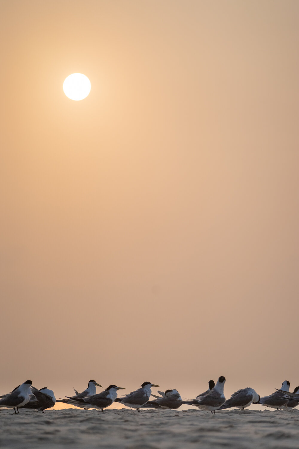
It is a funny how, when the moon is high in the sky it appears small. But as it gets closer to the horizon, it appears to grow, like a balloon being blown up. As it continues to drop it also changes colour from pearl white, like the pearls from Cygnet Bay, to a butter yellow. We continue to watch it melt into the water, and just before it disappears it gives a little nod saying “I will see you again tonight”.

As the last shimmer of light on the water fades, it passes the light banner to the sun which begins to rise on the opposite horizon, just over our shoulder. With the sun, the birds wake from their own sleep, the sun their own natural alarm clock.

These are the natural cycles that we don’t see as work and city life consumes us, barely allowing time to pause. A normal day is a whirlwind of alarms, bleary eyes, traffic, endless meetings, fluorescent light, more traffic, dinner, often more work, before falling into bed at midnight, to do it all again the next day.

Travelling allows you to discard all this, slow down and reconnect. As you do, you begin to notice the small patterns of nature. The rising and setting of the moon and the sun. The movement of the tides and the different patterns it makes in the sand. How the morning light is bright wakening the body, where the evening light is warm and calmIng, preparing you for sleep. Despite being a living being, we have somehow disconnected from this rhythm.

But today was a day to do just this. To relax and take in the patterns and rhythms of James Price Point. With no major waterfalls or hikes to conquer on the itinerary, we let the moment dictate our activities. This included going back to bed, allowing the body to wake naturally.

The rest of the day was spent with sand between our toes walking along the coast with no real destination in mind followed by a meander from one rock pool to the next getting absorbed by the little creatures lying just below the water surface.

But like all, cycles, we finished the day how it started - The four of us sitting on the beach looking out into the ocean.

Day 40: Blue Moon

We take our seats in the picture theatre and the lights dim. There is the usual smell of popcorn wafting through the air but we decide to go for the classic choc-top ice cream. But there is something different about this theatre that puts it in the Guinness Book of Records. Looking directly upward there is still a glow, not from any man-made light but the stars and moon overhead. Just as the trailer to Top Gun finishes, a plane roars overhead seemingly coming out of the picture screen, as it lands at the nearby Broome Airport.

There are no plush chairs, but the same kind of deck chairs you would see on a beach, their basic canvas providing a reclined view of the screen.

We are sitting in the ‘Sun Picture theatre’, recognised as the worlds oldest operating outdoor garden theatre. Originally built in the early 1900’s as a Japanese grocery store and some say a brothel, it was converted to a theatre in 1913. We walk past a procession of antiquated projectors that have been used over the last 100 years, each one chipped and dusty showing their active duty. Old photos of the the building and famous actors adorn the walls, some showing the tidal flooding lapping the front door.

The weather of Broome with its balmy nights allowed the outdoor cinema to flourish and continues as a Broome icon. But, apart from the film projectors being replaced with digital, little else has changed to the building, appearing to be stuck in a time warp. The building is its same ramshackle structure made of tin, wood and other scraps with the traditional sign ‘Sun Pictures’ made of simple individual lightbulbs precariously positioned on the roof.

Having decided to see the movie ‘Elvis’, there were many parallels to today’s adventure. Watching the early period of Elvis life, it was difficult to fathom the racism and segregation that dominated America in the 50s and 60s. And while Australia was a melting pot of cultures, especially in Broome with the Chinese and Japanese pearl divers, we followed in their footprints of shame.

Back then, Australia’s own form of segregation played out in the theatre with the white people getting the front row seats, the asians, the rear seats and the indigenous Australians could only watch from the sides or through the fence. This only finished in 1967.

But the movie had other more positive messages from today.  Elvis formed his first band called the Blue Moon Boys and Sun Studios was where they began recording. The constant references to the moon and the sun has been a theme of much of this trip.  And no more so, than earlier this evening when we visited Town Beach and the stairway to the moon.

Once a month between March and October the tourists, including us, flock to the shore to watch the moon rise over the mud flats. The evening takes on a festival feel, with picnic blankets and chairs spreading out over the grass, the smell of hot doughnuts coming from the markets behind, and the chatter of holiday makers joining the cacophony of noise.

But the buzz all of a sudden goes quiet as the moon peaks over the horizon. As it slowly rises it casts a reflection across the sand and water ridges creating the illusion of steps or stripes, and the crowds all let out a sigh.  While we had our own moon-set all to ourselves yesterday, this party atmosphere is another way to experience one of natures phenomena.

Getting up to leave the theatre at the end of the movie, with the song ‘Blue Moon’ humming in my head, I look up over the building roof and their is the moon again, our constant companion for the trip so far.

Day 41: Friends

The last 27 days has been an overload of the senses with: waterfalls and gorges; hikes and rock hopping; sunsets and moon rises; walking on the beach and swimming; lots of driving and corrugations; campfires and yummy dinners; cocktails and movies; helicopter rides and water crossings; rock and shell collecting; the emotions of breakdowns and repairs; laughs and thankfully no crying; and finally good times.

However, what made this part of the trip more memorable was sharing all of these experiences with the most amazing friends anyone could wish for.

Today is Karen’s last day as she prepares to head home.  The day is spent in Broome doing the housekeeping ie; shopping and more repairs on the car (we finally got the parts to replace Graeme’s sway bar that we removed 31 days ago).

To top it off, like the sweat icing on a cake, we spent the evening at the Mangrove Hotel drinking cocktails, a beautiful dinner and watching the moon rise for the last time over Broome.  While tomorrow we wave goodbye to Karen, i feel privileged to have shared this time together. Thanks for the memories.

Now this is where any good fairy tail normally ends.  But not today.

As we leave the Hotel, discussions commence around dropping Karen at the airport, our next stop travelling south and getting somewhere to stay.  But it seems the gremlins of El Questro water crossing are coming back to haunt me.

Remember how I was making completely unfounded comments about a ‘Ford’.  Well, jumping in our car to go home for the night ………click.  That is it.  No hum of the engine.  Nothing.  Apart from the exact same silence Graeme’s car suffered with the dead starter motor.

Luckily we were not only in a town that had good phone and internet reception, but we were also parked outside a hotel.  So one drink and an NRMA call later, followed by a head under the bonnet the news was broken - “your starter motor is stuffed mate”.

While we managed to get it temporarily started, I am once again in the position of finishing today with no idea what tomorrow brings.  What we do know is mechanics in Broome are booked out 6 weeks in advance.  But that is for tomorrow to solve. Tonight I just want to remember all of the good things over the last 4 weeks and how fortunate I am to have the most amazing friends.

Kimberley calling part 3: the gibb

Day 22: Gorging on more gorges

We stripped off (not fully) and waded into the water, my toes going immediately numb from the chilly water.  Before allowing the brain to start having a logical conversation that this was not the brightest of ideas, I take the plunge immersing myself in the depths of the bottomless pool.

The initial shock of the plunge has subsided and my breath has finally comeback.  I’m floating in the centre of the pool the size of an ice skating rink that has melted and left behind its icy water. Looking up, vertical walls surround me in an arc on three sides and I can only just see the top of the waterfall - enough to take my breath away again. Water droplets are falling from the rim of the entire length of the cliff, each droplet racing each other to be the first to dive into the pool. The walls are covered in layers of ferns, each reaching out to capture a wayward droplet.

This is Emma Gorge, the last of our hikes in El Questro. The morning started with the sounds of either some cattle having a romantic encounter or Graeme snoring. Cattle have been run on the station since 1903.  Many realised that this land was difficult to make a living out of cattle so the land was going cheap.  One entrepreneurial couple purchase the property in 1991 and set about turning this pastoral lease into an outback tourist attraction that it has become today.

It is not really known how El Questro got its name and its mystery is likely to stay with Torrance McMicking who named it in 1958.  But the name of Emma gorge is known, as it was named after one of the daughters of the previous owners.

The hike to the gorge was a much simpler walk than our previous ones.  When I say simpler, I mean the rock hopping only involved traversing boulders the size of fridges, not houses. But with each step you soon realise you are walking on an ancient seabed with the waves and ripples of the ocean floor frozen in time millions of years ago.  Half way up the valley a turquoise pool greets us with inquisitive fish of all sizes that would get any fisherman excited.

While saying goodby to El Questro is not easy, we head off on our next adventure along the Gibb and it is not long before we get a taste of the thousands of corrugations we are going to experience in the next 13 days. Reaching the famous Pentecost River crossing, the expectation of a deep crossing with the Cockburn Ranges as a backdrop has been etched on my mind ever since I planned this trip.  However, today was not one of those days with barely enough water to reach the wheels. I guess this is just one more reason to come back here during the wet season.

While the plan was to stay on the Pentecost River, the idea of setting up the tent for just one night was not welcome so we decided to push on to Ellenbrae Station -  although I think the real reason was Karen’s fear of crocs wanting to snuggle up to her in the tent.

Setting up camp we re-live today’s adventure with lots of talk about how nipply the water really was - and no I promise we did not strip off fully.

Day 23: Little gem and scones

The four of us have just had a swim in our own personal swimming hole with a feeling we are the only ones on this planet. Around the edges of the river are hundreds of iridescent green lilies with small feather like white flowers. On one side is a beach with sand Bondi would be proud of, and on the other is a staircase or red rock stepping out of the water. We are now all lying on the rock like lizards warming themselves in the afternoon sun.

To get to this remote waterhole we have taken a track off another track that becomes no wider than the 4WD. But at the end of this little known path we have reached a swimming hole that likewise has no name. It is memorable moments like this where we are privileged to experience and discover these little gems that are not on the tourist bucket list.

But there are some bucket list experiences that you must do.  And when you are travelling in such a remote part of Australia it is the little things that make a difference.

Thanks to two young brothers, Thomas and Edward Terry, we are at Ellenbrae Station enjoying warm scones with lashings of thick red jam and whipped fresh cream. In the early 1980s the two bothers turned a run-down property into a Gibb River Landmark. While they provided the foundation for this Station, it is the scones that now attract travellers to pause on their dusty adventure and savour the sweat warm little luxury.

Having enjoyed our little piece of swimming paradise, we head back to camp at Ellenbrae Station. With Ord river beef and crocodile burgers sizzling over the campfire we reflect on the little things including a decision to enjoy their crumbly scone goodness for breakfast one more time tomorrow.


Day 24: Don’t mention the war

When chatting to fellow travellers the inevitable question always comes up one or two minutes into the conversation - “so, what’s the road like?”  This is always a dangerous question as the response is clouded by a persons travel experience.  For someone who’s only experience of dirt is the car park of their local football ground, then the response can be filled with terror and expletives.  For a seasoned local who lives in these parts, then a million corrugations the size of mountains is just a daily commute.

So here I am, parked up on the side of the Gibb having a well deserved break, and I strike up a conversation with a fellow traveller who has come from the opposite direction. Before deciding to ask the fatal question I size up his car. Toyota - tick. Well set up vehicle but not too well (ie; more money than sense) - tick. Suitable amounts of mud and dirt covering said vehicle - tick.  And most importantly a calm manner having almost completed the Gibb from Broome.

Plunging in, I ask -“so, what’s the road like to a Mitchell Falls?”  With eyes of a beaten man he responds calmly - “ABSOLUTELY SHIT - especially the bit from the turn off at King Edward River”.

The Kalumburu road not only has the potential to break your vehicle but break you mentally. Resigned that we are about to travel several hundred kilometres on a road destined to destroy any kidney, we set off with gritted teeth putting our hands in the Kimberley gods.

5km…..10km…..30km…..still not that bad.    50km….. what’s going on here?  60km…..70km…… wow this could be a lot worse.  As I round the bend a billow of dust gives an indication that there is more than just a car ahead.  As we get closer over the radio we are informed there are 2 road trains and a grader ahead.  It turns out we have been fortunate enough to be in the path of a delivery to Kalumburu with a grader at the front to ensure the sheds get there in one piece.

Arriving at King Edward River for the night, surprisingly with no bruised body organs, we have time to explore the surrounding waterfall with rocks like lava twisted, folded and rounded over millions of years of monsoon rain. While the water is inviting, the plan is to save this dip on our return.

Instead we spend the last light exploring the Munurru Art Site. This ribbon of blue water is culturally significant to the Wunambal people and includes significant burial and artwork sites. Walking through the woolybutt trees and rocky sandstone outcrops, under each ledge we discover a gallery of art from the Jebarra (emu) to  Wulumara (long neck turtles) adorning the walls.  But most startling are the Wandjina paintings of heads with large eyes and elaborate head dresses that look more like past images of aliens with halo like faces.

So for all the fear and dreading we were expecting for this part of the journey, thankfully the Kimberley gods shined on us.  But…… as the old saying goes “don’t mention the war” as tomorrow we are about to take on another side track into Mitchell Falls which is rumoured to be created by the dreamtime Gwion and Malan Argula (devils). May be a time for a sacrifice over the campfire?

Day 25: One day at a time

Sometimes you can get a sense of how the rest of your day is going to go by the way it starts.  Today was one of those days.

We were already nervous about the conditions of the track to Mitchell Falls, but despite this we packed early ready for the slow drive there.  All packed and jump in the car and hit start……… nothing.  Try again……….nothing.  Insert several expletives here.  We pull Graeme’s car around and connect up the car with fingers crossed it is a flat battery………NOTHING.  It is at this moment all the other options go through your mind - and none of them fixable this far from civilisation.  Guessing it could be the starter motor potentially spells the end of the trip here.  Running out of options I try jump-starting one more time, while praying to the Kimberley gods……bingo!

So decision time - do we push on, travelling the hardest track in the Kimberley or head back to Drysdale Station? But we have come this far.  May be it is just the battery and something was left on?

Out of shear foolishness or pride we push on into the depths of the unknown.

Now this is where the good news would normally come.  But not today.  As the corrugations got bigger and the potholes and rocks bigger, for some reason I stopped and had a good look at the trailer only to discover that the thousands of km of corrugations have almost destroyed the suspension.

By this stage we had committed and there was no turning back.  Any resemblance of coming across other people was likely to be at the campground at Mitchell Falls. Slowing to a crawl, we travel at a pace where we could be overtaken by a pensioner in a zimmer frame.

78km and 4 hours later we make it. While there is still no chance of repairs here, at least we are not by ourselves and have access to pit toilets and a waterfall to wash in.

I could be very pessimistic now but sometimes you have to just deal with the cards before you.  Instead we all take a walk to Little Merten Falls where I fully submerse myself in the cool water in the hope of not only washing off the sweat and dust from today, but also washing away the emotions.

While I don’t have a solution yet to the predicament we are in, we will cross that bridge in a couple of days.  For tomorrow, I will focus on the here and now as we plan our hike to Mitchell Falls.

Day 26: Punamii-unpuu

Flying over the Punamii-unpuu Falls like an ancestral spirit, below us the Mitchell River water plunges four times consecutively over rocky cliffs into a bubbling cauldron of white water.  With its energy seemingly sucked from its life, the river then meanders over the horizon on its way to join the Indian Ocean.

You can only imaging the deafening noise of the cascading water as the sounds are drowned out by the rhythmic throbbing of the helicopter blades.  With no doors on either side, and only a strap 5cm wide preventing you from tumbling out to certain death joining the spirits, this is one unique way to see the falls.

The reason we are able to get this once in a life time perspective is due to some entrepreneurial person who has set up an operation which flies hikers into the Punamii-unpuu falls (also known as Mitchell Falls named after the then Western Australian Premier) so that you only need to do the hike in one direction. Having touched down above the falls on a rocky outcrop, we duck our heads low for fear of a major scalping, and watch the chopper disappear into the distance until it becomes a dot in the sky.

From here we explore the cliff tops, with every corner a different perspective of the quadrupledecker cascade.  As we did not want to upset the Wunggurr serpent (and the fact there are saltwater crocodiles in the bottom pools), we cool off at the top of the drop with the hope that crocs can’t climb.

Reluctant to leave but knowing there are more falls to experience we meander back through the savannah woodland of eucalyptus and green grass that looks soft until it slices your shins with its fine blade like leaf - now I know what this is called spear grass.

Walking past rocky outcrops, the walls come alive with art only found in the Kimberleys.  In particular, what are known as the Bradshaw paintings - intricate ornate human figures with head dresses and spears and other objects, some known to date back 17,000 years. It is no wonder the traditional aborigines chose this place a we continue further around the rock ledge to be greeting with a cascade of water flowing directly over head.  It is hard to describe the 50 metre wide cave with water plummeting 15 metres from above. Standing behind the waterfall looking out you can feel the rush of air as each droplet races past you.

While the hike is graded as a 5 ( and yes the hardest is a 5) what better place for a rain shower and plunge in the pool at the base - but don’t worry - there are no saltwater crocs in this pool and the serpent is friendly.

Today is a lot of what this trip was about.  Visiting some of the most spectacular scenery in the most remote of places and undertaking experiences that will stay with us forever.

Day 27: The sound of silence

This mornings plan was to leave camp early and gingerly make our way out of Mitchell Falls. The target is Drysdale station to get some phone reception and decide what can be done about the suspension - if anything. Little did I know that suspension would be the least of our problems.

Having done some temporary repairs we start our way out, twisting and turning through washouts, river crossings and the relentless bone shattering mountains of corrugations.  The condition of the track, in addition to not wanting to put stress on the camper trailer, meant we were lucky to get above 20km an hour. Being conservative I stopped every 10km to check my bush mechanic skills.

10km down and 70km to go. All good.  At this pace it should only take us 4 hours. 20km……. Still holding.  30km……..mmmm-  something does not seem right and it is NOT the suspension.  A strange smell was emanating from the trailer.  Getting closer I feel the wheel hubs and it was hot enough to cook an egg on.  It seemed the relentless corrugations of the Tanami, the Gibb and now this section was enough to say goodnight to the wheel bearings.

While I am not mechanically minded there is one thing I have done a couple of times and that is replace the bearing on the trailer.  And while this has been done in the comfort of the garage at home and not the side of a track in the middle of nowhere, at least I had some inkling of what to do.  And the good news is, I carry spare bearings!

So with wheel off and tools scattered everywhere I begin open heart surgery on the wheel hub.

Now one thing that is unique in remote travel, is the willingness of fellow travellers to lend a hand.  In Sydney, I would’ve been abused for blocking the road but out here there is an unwritten rule, much like sailors in distress, to lend a hand.  And luckily James (yes another James) turned up.  While he had only done wheel bearings as part of his course in the navy, having 2 brains definitely helps in these situations.  Now I am not doubting the brain of Hux at this moment, but the need for maths or facts was not high on the needs status.  But with encouragement from the onlookers the mechanics set about a road side fix.

There are a couple of simple things in life that you get excited about in these situations.  The first is the smooth and silent spin of a wheel following an hour and a half repair.  For those that never been in this situation, another way to think about it is the sound of silence means we are not having to abandon the trailer with the likelihood of it not being recovered, leaving behind everything but the essentials we can squeeze in the car.

The second is a simple sign that says “grader ahead” and finally making it back on to the maintained Kalumburu track. All up, it took us five and a half hours to do 80 km!

While it did not end here, as we still had to get to Drysdale Station, the worse was hopefully behind us. Eventually, arriving at the station, we were able set up camp and let out one huge breath. Not wanting to let fate determine the future of the other wheel, the evening is spent replacing the other bearing. This time with the knowledge of a warm shower and a much deserved cold beer breaking the silence at the end of a long day.

Day 28: Mustering on the Gibb

Parked on the side of the road we are knee deep in grass collecting firewood for tonight, hoping not to disturb and slithering snakes from their slumber. In the distance a throbbing sound can be heard from between the trees, getting louder and closer.  All of a sudden 3 cattle burst out from the tree line in full gallop crossing the road escaping from the loud beast getting closer. Not far behind, the throbbing sound reveals itself as a muster helicopter weaving in and out of the tree line in hot pursuit.

Thank goodness the helicopter ride we took to Mitchell Falls was not with this pilot as the chopper lurched left, appearing to fly sideways, it’s blades brushing the nearby tree branches.

Then, like we are caught in a movie set of mad max, 2 machines drive past, each one a Frankenstein of car parts, steal and iron.  Attached to their front is a mechanical arm that is designed to reach out like a hand and capture any wayward bull.  Both machines ignore any concept of a road and drive into the spinifex, somehow dodging trees, stumps and rocks.

As quick as they came, the noise, cows, and mechanical machines disappeared off into the shrub leaving us all bemused if this really happened.  Realising there were no cameras, and this was just another part of normal life in the Kimberleys, we continued our way along the Gibb River road, thankful the corrugations were only large enough to be annoying, not fatal.

Having returned to the Gibb River Road, today was a driving day with a quick stop at Hann River.  While this was going to be camp for the night we pushed on and set up camp at Manning Gorge. With some more running repairs, this time replacing the trailer brake cable that was hanging on by one single fingernail, it was another reminder of not only how brutal this road can be, but the importance of carrying spares.

Sitting by the fire, I did ponder for one moment what the cowboys we saw earlier today would be doing.  While I am sure they would not be enjoying a MasterChef meal and sipping a nice bottle of red wine saved for such occasions like we are, the fire and a million stars in the sky would be just as relaxing after a hard day on the road.


Day 29:  Gorgeous Gorge

With backpacks loaded up into a half plastic barrel, Karen takes the plunge into the river, rope firmly in her hand, to prevent it floating downstream. The water is so clear you feel like you can reach out and touch the bottom with your feet, but this calls for full submersion requiring you to swim across. The water is invigorating and a quick way to get the blood flowing for the hike ahead.  This is definitely one unique way to begin a walk to Manning Gorge.

Once on the other side, we set out, weaving through fields of native grasses and wildflowers with their feathered button flowers forming a knee high carpet.  This is slowly replaced with rocky outcrops and native grevillea’s with red flowers imitating a Christmas holly. Reaching the top of the ridge,  we past Boab trees standing tall and lanky, looking out over the Barnett Range.

While the views are eye popping, sometimes it is the small things that are just as memorable on these walks.  Like the lizard the size of a finger scampering from rock to rock, it’s head bobbing up and down, searching for insects. Or the checkerboard pattern of reds, yellows, browns and whites of the tree bark, reminiscent of an aboriginal art painting.

The sights are replaced with the sounds of finches flittering from bush to bush, the crows calling each other with their drunken drawl, and eventually the noise of a waterfall in the distance.

Passing a fellow hiker, they respond - “you will love it - it’s such a gorgeous gorge”.

Arriving at Manning Gorge we are greeted with an amphitheatre 15 metres high and 50 metres across with a cascade of water almost its full length. Not wasting time, we dive in to the pool, disturbing the red tailed fish who must wonder what this strange animal is disturbing their peace. Swimming over to the falls it is not possible to swim directly into the path of the falling water due to its force creating currents and eddies constantly pushing you away.   But, entering from the side, I slip behind the curtain of water and enter a large cave, the deafening sound of water echoing off the walls.

We spend the afternoon swimming, relaxing, exploring and soaking up one of the best gorges the Kimberley can muster. While much of this trip has been about visiting waterholes, there is a point you ask yourself if this one will be worth it.  But each time you are left mesmerised, with each one having their own unique identify, much like your children, making it difficult to say you have a favourite. Gorgeous yes.  But aren’t they all.


Day 30: Hat down under

Standing on the limb of the tree, it’s branches reaching out over the pool, I look down and get a feeling of vertigo.  While it feels like I am 10 metres above the water I know it is not this high, but my sweaty hands are holding the rope-swing for dear life. To distract my mind I look out towards the waterfall, following the origin of the cascade of water up the cliff face, with a Boab tree standing proud at the very top. You only live once they say, and hoping this is not the end of mine, I swing out not so gracefully and fall into the deep olive green water of Galvins Gorge.

It is moments like this that you know you are truly alive.

Hux, who willingly admits the idea of throwing one self off a cliff or a tree from heights is not his strong point, decides to take the safer option immersing himself at the base of the falls, almost hidden under the shower.

Now this is where a major catastrophe happens.  We have survived major breakage of a vehicles, damage to the trailer and a heavy fall leaving significant bruising and scar (yes Kathy was only running on a footpath and tripped at Kununurra but it still hurt).  But this is one of those moments that will make this gorge memorable for all of the wrong reason.

Hux, deciding he wanted to emulate my jump, leaps off the 20cm high rock shelf into the water, even less gracefully than me.  However he forgets one of the first rules of liquid dynamics.  When ones precious hat is left on said head, and jumps into a liquid without some from of physical attachment, H2O has an ability to flow into said hat, acting as a weight, sending said hat to the bottom of the dark, deep pool.

As memories of all of the good times come flooding back, like loosing a childhood pet, he frantically dives underwater in a desperate attempt to go against the law of fluid dynamics.  But alas, a sacrifice is made to the waterfall gods and the hat is never to be seen again.

Only someone who has experiences such a deep loss would understand this situation, such as the time I lost my 15 year old akubra hat somewhere on the escarpment in Arnhem Land.  So I was well equiped to offer a shoulder to cry on and a caring few words.

If only he had decided to stay out of the water like we did earlier today at Adcock Gorge (yes another gorge!).  If this was your first experience of a gorge you would be overwhelmed by its palm lined, jade green water and red shear cliffs.  However, like a spoilt person visiting too many five star restaurants, we were beginning to get picky so opted to just sit any enjoy this one, rather than swim.

But Galvin’s Gorge and that fateful jump is all we talk about around the fire tonight. The rest is spent sharing fond memories of the first time they met, the special moment they realised they were made for each other, the places the hat had been, and the laughs they had shared together.

But now get the friggin hell over it, and go by yourself a bloody new hat will ya!   

Too soon……….?

Galvins Gorge

Adcock Gorge


Day 31: Road to nowhere

I am about to quote directly from Day 25:

“…….  All packed and jump in the car and hit start……… nothing.  Try again……….nothing.  Insert several expletives here. ……”.

If you recall, this was my car several days ago.  Luckily, we got it started and were able to keep going on our travels.

Now let me start Day 31.

“…….  All packed and jump in the car and Graeme hits start on HIS car……… nothing.  Try again……….nothing.  Insert several expletives here. ……”.

Its ok, it’s got to be the battery……. Doesn’t it?  The multi-metre says it’s very low so this should be just another simple jump start.  Pulling my car around I get the jumper leads and connect it up…….nothing.  Try several more times…….NOTHING.  Day 25 floods back where I guessed I may have had a starter motor issue. Now it looks like this voodoo may have transferred over to Graeme’s car.

Turning my car off we spend the next 30 minutes trying other possible causes from blown fuses to trying to find where the starter motor is to try the classic “if it don’t work hit it with a hammer” solution.

With no luck we decide to try jump-starting one more time.

Now this is where it gets worse.  My car now won’t start!  We now have 2 dead cars.

Pulling out the local currency (beers) we are lucky a fellow traveller comes to the rescue and manages to get my car jump started.  But absolutely no luck getting any life out of the other car.  Not even a heart beat. A flutter. A whir.  Nothing. Despite multiple heads under the bonnet the options were running out.

While we are approximately 300km from the nearest town, luckily we are staying at an outback Station which has limited phone reception.  We are also 20km to an entrepreneurial person who has set up a shed approximately half way along the Gibb to do tyre repairs, shock absorbers and batteries. Could this be our saviour.

Now this story could have 2 endings for today:

Ending 1:  we drive the 20km, pick up a new battery and we continued on our travels

OR

Ending 2: after several more failed attempts at getting a battery or getting it started, followed by 2 frustrating hours dealing with NRMA, we have re-set up camp where we were this morning.  Despite NRMA, we have managed to arrange a flat bed truck to drive 4 hours from Derby tomorrow morning to meet us and then take the dead car 4 hours back again to Derby.  At this stage we do not know if it is fatal or fixable. Could it all end here?

Like a good novel I will leave you in suspense and you can guess which of these endings occurred.  You will have to read Day 32 to find out what happens next.


Day 32: I survived the Gibb…… or did I?

If you had read day 31, I left you on a cliffhanger.  Would we make it out? Was the trip over for Hux? Was this what happens when you drive a Ford?  While I can’t give you an answer to all of these questions at the moment I can update you on a couple of these.

By now you will have all guessed that all was not well and we have had to resort to an extraction.  I must say this type of extraction was less dramatic than a poor girl who slipped at Manning Gorge when we were there who suffered a compound fracture hiking. She needed to be carried out, them pick up by the Royal Flying Doctor to transfer her to Derby hospital.

Our extraction involved a flat bed truck coming to pick up the stricken ‘Ford’, with Dennis from KW Tilt’n’Tow (yes a shameless plug) coming to the rescue.   Scull dragging the ‘Ford’ into position (after a bit of digging following a slight issue of getting the tilt truck bogged in the sand) we said good bye to Graeme and the ‘Ford’.  Did I mention it was a ‘’Ford’?.

So this is where there are 2 divergent stories, one of which I can only pass on from what I heard. While we took on an extra passenger with Karen joining us on the trip into Derby, Graeme spent the next 4 hours listening to the wisdom of Dennis who was happy to share stories of the Gibb. He is a proud local, passionate about this land and sharing everything it has to offer. With fingers pointing out the window on each turn, he shared stories of the most beautiful watering holes, the tallest boabs and best fishing spots. This sharing of knowledge was best summed up with his words - “this is our country - yours and mine”.  I was listening to a podcast interview with Albert Wigan, a traditional owner and guardian of the Kimberley who said we are all ancestors of this country and have our ancestors DNA in all of us.  A great reminder from both Denis and Albert of the important role we all need to play in protecting this land.

So that was the Gibb. There are multiple shirts, beer coolers and stickers that have “I have driven and survived the Gibb” on them. Despite the challenges, millions of corrugations, flat batteries, broken wheel hubs and suspension held on by a thread, I can say I have driven the infamous’ ‘Gibb’ and survived.

Now I don’t think a marathon runner who is carried the last 400m on someone else’s back is able to say they completed a marathon.  So I know there are some feelings of regret from Graeme, who technically ‘did not survive the Gibb’.  But we all can take our own unique experience from any journey, and for him, he has had the opportunity that no other traveller has - time with Dennis.

So back to my initial questions posed. Would we make it out? Yes we have all made it to Derby.

Was the trip over for Hux? We don’t know yet as the ‘Ford’ is currently with an auto electrician.

Was this what happens when you drive a Ford? I think this is one answer you can determine yourself.


Day 33: Rocks and Crocs

While I could continue the suspense, sometimes a good book needs a fairy tail ending.  And today we had one.  Thanks to the spirit of the people in the Kimberley, Daren from Western Kimberley Auto Electrical (yes another shameless plug) managed to bring life back to the broken ‘Ford’ all within 24 hours.  We had been warned that car repairs in this part of WA can be a one month wait so we were uneasy on what the outcome might be.  But fortunately it was a dead starter motor, he had one on stock, and was willing to drop everything to keep us moving.

So here we are continuing our adventure.  While the delay meant we were not able to stay at Windjana Gorge, we jumped in my car (did I mention it’s a Toyota) and backtracked the 130km to experience this last site on the Gibb.

If I was here 360 million years ago I would be floating in a sea with algae and lime secreting organisms slowly building a lime reef.  As the sea levels changed, the reef ultimately extended 2km deep. Then tectonic forces thrust this land upward creating a unique limestone range trapping the fossilised past in its rocks.

But even more unique is the forces of water that has carved a 750 metre long tunnel through the heart of the range. Donning head torches we enter the large cave, stalactites hanging from the ceiling like chandeliers. As the natural light from the entrance slowly disappears until it becomes a mere dot, the only light penetrating the black is the small beam from the head torches.

Following the natural creek that flows through the subterranean world, there comes a point where you have to enter the freezing water, it’s depth coming up to your sensitive bits depending on how tall you are. But the cold is not the thing consuming your attention.  It is the fact that these caves are also home to freshwater crocodiles.  As the torch moves back and forth scanning the water ahead all of a sudden a flash of 2 red dots on the waterline breaks the darkness.   I Spend the next 5 minutes explaining to Karen where the tail and head is and it’s eyes but I assume she is in denial as she can’t make it out.

It is not until we exit the cave later that Karen questions what the mouse was in the cave.  I said “mouth” not “MOUSE”!

With time running out we had one last stop before returning to pick up the car. The Lennard River has taken millions of years to erode Windjana Gorge out of the limestone cliffs.  While the rock faces are spectacular enough, the gorge is more famous for its abundant freshwater crocodiles. This time Karen surely can’t miss them as we watch at least 20 warm themselves in the sun or glide in the river looking for careless fish.

Luckily we were not here 10 million years ago when the Quinkana (like a crocodile but up to 7 metres long), would have been watching us as possible pray.

With the Gibb now officially done, we prepare for our next chapter from Broome to the Dampier Peninsular. And I promise to never mention the ‘Ford’ issue again.

The End of the Gibb - What an adventure!

Finishing the Gibb (well some of us anyway)

Kimberley Calling Part 2: Lake Argyle to El Questro

Day 15: The Girls Arrive

The four of us are sitting on the edge of Lily Creek Lagoon, a beer in hand and watching the sun go down as the Black Winged Stilts jump from lily pad to lily pad looking for insects. It is easy to see how they get their name with long slender legs and broad toes appearing to allow them to walk on water.  Every now and again a purple swamphen disturbs the peace making a loud crowing call preventing you from drifting off to sleep in the warm evening air.

This is part 2 of our adventure and it is hard to believe this day has come with Kathy and Karen arriving this morning by plane. Today was largely shopping and preparing for the next week as we get prepared to go to Lake Argyle and El Questro. Although we did manage to sneak off to the hotel for a meal and some drinks - we couldn’t really expect the girls to cook dinner on their first night could we …..?

Kununurra is a unique town of lush green in an otherwise arid landscape. According to the Mirima Language, where we are currently staying could have been called "Goonoonoorrang", which simply means big water.  I think this is more appropriate but the Public Works Department initially chose ‘Cununurra’ in 1960, only to change it to Kununurra as it sounded to close to Cunnamulla in central Queensland.

Doing a bit of reading as I had the rare chance of internet access, I soon discovered that the origins of the Ord Irrigation Scheme and the town of Kununurra, was not driven by courageous early explorers wanting to create a food bowl for Australia, but politics and pork barrelling.  Menzies needed votes in the north and was wanting to fund a major project.  With little justification, the damming of the Ord River to irrigate crops was created.

Despite its early setbacks with failed crops, the area now grows all manner of produce including melons, avocados, mangos, sandalwood, chia, citrus, and sunflowers.  Water is what has created this town and also attracts the diverse and abundant wildlife (and travellers).  Hence why we are fortunate enough to be sitting here looking out over the Lagoon and enjoying watching the Black Winged Stilts continue with their carnival act on the Lilly pads.

Day 16: are there crocs in there?

Water is barely lapping at the bottom of the door as the car takes a long sweep across Ivanhoe Crossing. Just before jumping in the car I was reminded by a local fisherman that there was a 3 metre croc just upstream on the left. While this is one of the easier crossing, unless you manage to breakdown half way across and have to swim for it, it is still one of the most scenic and photographed of the Kimberley.

Having survived our first croc encounter, we headed to Ngamoowalem Conservation Park to see if we are brave enough to go swimming.

First stop is Mayiba (Middle Springs) for a swim putting our trust in the local knowledge that these are safe. While this watering hole is marked on the map we chose to venture further afield to a place called Secret Springs. Now I would love to tell you where these were but they would no longer be a secret. What I can share is these cascading pools flow from high up in the escarpment all being fed by natural groundwater springs. As a result there are pockets of water that are just warm enough to take the edge off an otherwise refreshing dip. Just as Karen decides to take the plunge I can hear her asking Graeme tentatively - “there aren’t crocs in here are there?”

Taking a narrow 4wd track we continue on, winding our way through the woolybutts to Black Rock Falls. As the name says, this 42 metre high cliff face, black with algae, has a clear but chilly pool at the bottom. Despite the 30 degree heat, it is 15 degrees cooler under the shade of the wet rock face so we decide to sit together and enjoy this place as the traditional custodians have welcomed us:

Gamallwang, berrayinga Miriwonong Dwang yoowoorriyantha. Yawoorroobtha woorrb yarrenkoo ngoondengi-biny.

“Dear Visitor, This is our Miriwoong country. Let’s all sit together here in harmony”

The final watering hole for the day is Galjiba ((Molly Spring) set amongst the reads, paperbarks and pandanus. With the temperature still warm but not unbearable we decide to take another splash under the waterfall with native fish swimming between our feet. Just as Karen decides to drop into the dark water I can hear her asking Graeme again - “there aren’t crocs in here are there?”.

While today was all about swimming holes we did stop by the Waringarri Aborigional Arts centre. It is well known how the aboriginal people of the Kimberley have used artistic creativity to tell stories and hold celebrations with everything from rock engravings to painting. Now this creativity is continuing on new mediums including screen printing, canvas, and even engraving of boab nuts. Purchasing our own reminder of this special place we spend the rest of the time walking and chatting to the local artists.

As the day ends like the previous couple of days, we watch the sun go down on Lily Creek Lagoon. However there is one difference tonight. Sitting on the bank of the lagoon also enjoying the last rays of light is the local crocodile named jaws. While there is no need to panic, as it is a freshwater croc, for once when Karen asks “there aren’t crocs in here are there?” - the definitive answer is - “yes”!


Day 17: a pool with a view.

While yesterday’s constant conversation was weather there were crocodiles, I have not had the heart to tell Karen that Lake Argyle is home to 35,000 freshwater croc’s.  I will probably save that until tomorrow after we spent the day on the lake swimming.

But for now we are perched on the edge of an infinity pool located at Lake Argyle.  This is no ordinary pool. If you ever browse a tourism site for the Kimberley it won’t be long before you come across a stunning female wearing a broad brimmed cane hat staring into the distant range, glowing red with the setting sun and the turquoise lake below. Inevitably she will be in a skimpy swimsuit.

So here we are emulating the same photo, although I must say the g-string swimsuit does not look as good on me. While I must make it clear we are definitely not the first to take this photo, there is no doubt it it is a once in a life experience to be swimming here (with no crocodiles) with such a spectacular view.

Day 18: Winter Solstice

I thought I would start today’s post with a quote from the news paper today :

The air temperature was 5 degrees and the water about 11, but that did not stop about 2,000 swimmers from plunging naked into Hobart's River Derwent to celebrate Dark Mofo or the passing of the longest night.

Obviously we are not in Tasmania but this was our version of events today:

The air temperature was 30 degrees and the water about 23, but that did not stop 4 swimmers from plunging naked (no not really) into Lake Argyle to celebrate The Kimberley OWL or the passing of the longest night.

The reason we are bobbing around, with beers in one hand and pool noodles in the other, with a backdrop out of a movie set, is we have hired a BBQ Pontoon to explore just a small section of this mammoth lake.  While most people can only experience a tour of the Lake on an organised boat trip, I managed to book several months ahead one of only 2 vessels that can be privately hired to explore the Lake.

As mentioned previously, this inland ocean was created after the damming of the Ord River.  John Williamson sang a  song about ‘damming the mighty big river’ in reference to the Snowy’s but that is small in comparison to Lake Argyle at 980sq km or enough water to fill Sydney harbour 21 times.

Despite the size, it does not take long for us to spot several freshwater crocs basking on the shore.  As we approach they slowly slither into the depths leaving barely a ripple. Having just seen the crocs, we soon realise we have done things in the wrong order, but throw caution to the wind and find a place hopefully away from snapping teeth for a swim.  It as this point I decide not to mention a news story to Kathy, that I will share at the end of this post.

As we slowly motor our way along the coastline where the red escarpment appears to disappear vertically into the sapphire blue water, we decide this is as good a spot as any for a swim. Climbing the rock face we jump like squealing children into the lake.  While it feels like 10 metres high, but is likely to be 2, it is reassuring knowing that at 20 metres deep, there is no chance of me touching the bottom.

Back on the boat, we head out looking for more wildlife. Rounding another rocky bend in the lake we come across 2 short eared rock wallabies perched on the cliff edge peering down wondering what this floating tin can was doing in her territory.

As the sun was slowly sinking and getting ready to put on its nightly show lighting up the escarpment, we fire up the BBQ with the best view in the world. The only sounds are the lapping of the water on the boat and the sizzling sausages and lamb.

Reading the article further on the swimmers in Hobart, a swimmer is quoted as saying "feel the fear and do it anyway".  I think this quote is much better suited to our swim with freshwater crocodiles as I will finish with another news article from 4 May 2022:

4 may 2022: A 38-year-old woman sustained a serious leg injury on Monday after a 2.5 metre long freshwater crocodile attacked her while she was swimming in Lake Argyle.

Ps: thought I would give our version of todays event

22 June 2022: a fifty something woman sustained a serious scare after she mistook a pool noodle for a freshwater crocodile while she was swimming in Lake Argyle.

Day 19: Master chefs and steep hills

The wheels are spinning trying to obtain any form of traction as the car is pointing skyward removing any visibility of the rocky track ahead. We are crawling our way up Saddle Back Ridge in El Questro trying to race to the top to watch the sunset. Although there is no chance of racing as we crawl as slow as a snail up the switch backs, trying to avoid the deep ruts and rock ledges for fear of giving the diff a good headache.

Arriving at the top of the ridge, the full expanse of El Questro Station and the Pentacost river is below us. El Questro is over 700,000 acres, just a bit bigger than your standard house block, making the idea of replacing your boundary fence very daunting.

Having watched the last glow on the horizon, the hard part was getting back down. What was near vertical going up was now vertical going back down and the fear of a run-a-way car hurtling over the steep ridge is always there. Putting trust in the 4WD we slowly crawl back down with little more than a rush of adrenaline to assist.

We are here at El Questro, having left Lake Argyle after a slow get away. This was also the official begining of our trip on the Gibb, although Part 3 of this story will focus just on El Questro. you will have to read Part 4 to find out how bad the track really is.

It seems just when you are packed and ready you notice something about the car is not right. Looking at Hux’s car it has a lean that the leaning tower of Pizza would be proud. We know it is not the sway bar as that is still on the back of my camper roof. We soon realise that rear tyre is looking a bit deflated and on inspection a screw has decided to screw our early departure. So off with the wheel and out with the tyre repair kit.

What I am sure will not be the last tyre plug of the trip we are finally back on the road, stopping via Kununurra for a quick shop. Now I say quick, much like a snail pace of climbing Saddle Back Ridge. I soon realise the reason is the girls are buying enough food in case we get stuck for three months. Not that I am worried as they have decided that each night we will be eating better meals than what you see on MasterChef.

Having set up camp in our own private site on the banks of the Pentecost (an advantage of booking months ahead) we have just finished a deconstructed fried rice with chicken that would surely get us through to the finals. Time to plan tomorrow’s adventures.

Day 20: Now that is a nice boulder

Often I write about the various things that have either broken or not working on the car. But today, it seems a similar story but our own aching bodies. We have one dodgy ankle on the old man (not me); a badly bruised shoulder on the better half, and all of us with sore feet and knees. While I know our bodies are not what they used to be, we have just completed a gruelling 7km walk.

Now I know you are all thinking what is he talking about - its only 7km - but there a a reason for the copious voltaren being taken and the smell of physio-cream in the air. We have just completed a challenging but spectacular walk to El Questro George.

Many walks have easy access or a well laid out walking track. But this had neither. In fact you not only need to travel all the way to the Kimberleys, but you then need to take a small 4WD track and then make a crucial decision. Do I risk driving my 4WD through a river crossing near 100 metres long where water laps over the bonnet of the car? It is a long way from anywhere and a possible quick way to end the trip here.

Throwing caution to the wind (and fingers crossed, holding my breath, and promising I will be good next time), we take the plunge. With wheels trying to maintain some sense of grip on the bouldery stream bed, the engine groaning as we push the full weight of water more than waist deep, we make it to the other side and I let out a deep breath.

Now if this was not enough to stop most people doing the hike the next barrier often does. The beginning of the hike is a mixture of crystal clear streams, swaying palms, fern lined red cliffs and lots of picking our way up the gorge. Eventually we get to ‘Half Way Pools’. Now don’t be confused by the name as this is where many turn around. But for those young, flexible, fit and healthy it is the starting point for a level 5 hike to McMicking Pool.

While I know we really don’t fit any of these categories we push on through the first challenge. This begins by a refreshing swim with bags precariously held over your head to a boulder bigger than a house. Luckily we had someone tall enough to stand on to thrust ourselves up and over the rock.

This was the beginning of a further 2 hours of rock hoping, bolder climbing, ankle tripping, water slipping, waterfall climbing hike.

But the end was all worth it with spring water cascading down from the rock face into a plunge pool clearer than any home swimming pool. With the water temperature just cool enough to give respite to the throbbing legs we flop into the pool proud of our achievement of getting this far.

While the thought of leaving this little oasis is made harder with the knowledge we need to do it all over again on the return, we know a cold beer (and some drugs) are waiting back at camp.

While our bodies just want to collapse into bed we drag ourselves in to the car and head to Pigeonhole Lookout to watch the sun set over the confluence of the Pentecost and Chamberlain rivers, followed by a tasting plate of beef, char-grilled vegetables and an assortment of condiments that would likely beat last nights MasterChef meal. All washed down with one extra voltarin for good measure.

Day 21: Z before A

Sitting in the bath the water is a warm 26 degrees. There is the opportunity to use the jets to get a good massage if just lying there relaxing is not enough. It is a much needed break from yesterday and an opportunity to wash off the dust from the last week. But this is no ordinary bath. We are sitting in Zebedee Springs in our natural bath warmed by the spring water emanating from deep underground. Surrounding us is a greenery of tropical ferns and palms like they have been transplanted from a tropical island.

While we could have stayed here all day there is a clear reason why it is only accessible until midday. While they say it is to protect this fragile watering hole, I am sure it is just a way to ensure people don’t stay.

While the day started with a Z, it finished with an A as we donned the walking boots again for another hike, this time to Amalia Gorge.

Walking through the Gorge the Woolybutts and Cabbage Gum spread their canopy providing much needed shade. But it is the water loving Weeping Paperbarks that line much of the gorge that make this such a special walk. This versatile tree and its bark is used by the aborigines for shelter, bedding and temporary food wrapping or cooking.

The contrast between the white trunks of the Paperbark, the vivid blue skys, rich red rocks and green vegetation is mesmerising. This is only broken by flashes of gold from the sickle leaf wattle.

The hike follows small pool after pool up the gorge until you can travel no further. Here you are greeted by a sheer cliff face with an Olympic sized pool at the bottom. Looking up you can only imagine the volume of water that must cascade over the falls in the wet season. In 2002 they had 500mm of rainfall in just one day - definitely enough to fill up our bath from this morning.

With this being our last night we decided to spoil ourselves and ventured into the main Station for dinner. While it was definitely not as good as the last 2 nights and was sure to be eliminated from MasterChef, it was still good to not have to cook and clean up for the night.

Kimberley calling: part 1 - Coober Pedy, The Tanami & Purnululu

Prologue- The day before

I said this trip I would not keep a daily diary but here I am.

I have spent the last 2 years planning for this trip to the Kimberleys. A trip that may never happened as COVID-19 took over and borders around Australia slammed shut.  While a date was set, every day we watched the news to see the WA Premier McGowan proudly say he was going to maintain their bubble.  All we could do was watch and wait, praying someone from NSW would sneak in and spread the virus.

As the days got closer, the bad news for Western Australians, but good for us - there was a breach. COVID was loose. Reluctantly the Premier unlocked the padlock - game on!

All the planning and organising had come down to this last day. A day to do the last minute packing and spend time with  the kids and Kathy. Well it seems the travel gods had a different idea.

For the last week there was a strange smell in the car and it was getting worse.  At the same time my fuel consumption was going up and I was worried something sinister was brewing. After several days of poking around I could hear a fizzing and bubbling from the spare battery not minutes before it - and the car - went up in flames.

So the smell was explained, but not the consumption, so into the mechanic with 1 day before driving away. After several hours a call back saying nothing could be found and a friendly - “she’ll be right mate” as I leave.

So here I am 12 hours before I am driving into the most remote part of Australia head under the bonnet playing pretend mechanic  with a hunch it was either the fuel filter or the MAF sensor.  Toss of the coin and, having never done it before, I gingerly pulled apart the sensor to clean. As night settled in the next challenge was replacing the battery which of course was a different size. As midnight approached the pretend mechanic finally finished with fingers crossed that nothing else will go wrong…. “she’ll be right mate” - I hope so!


Day 1 - Was this the end already?

What was meant to be a 7 am departure turned in to 8 but it was finally great to be on the road. And the nerves were getting better as the fuel consumption was better - ….Until 2 hours in to a 10 week trip the fuel warning light comes on!

No need to panic - it’s a Sunday and I am 50km from the nearest town with a potential risk that the engine will seize without notice. So was this where the trip was going to end? 2 hours in, and on the side of the road?

Knowing it was not flashing ( a sure sign to abandon ship and call the tow truck) I limped the 50km knowing I should have listened to my hunch and changed the fuel filter.

As each distance marker passed, time slowed down, and it seamed I would never get to Goulburn. But over the hill the big Marino came into sight at last. Not knowing what to do I asked the sheep what was the chances of finding a mechanic open on a Sunday? He just said, “baaaaahhhhh!”

Next option NRMA. Now I know you all think they are road side assist but in reality they carry just enough to jump start your battery or change a tyre.  Definitely not enough tools to change a fuel filter.

Luckily the friendly NRMA driver who was eighty in the shade had a plan. Knowing he could not do the job with his tools he replied, “no problem - give me 5 min”. Not sure if he was just heading to the pub or going to find someone 5 min turned into 30 minutes. But true to the NRMA advertisments he returned with the news - if I was willing to do a cash job a mate would open up his garage for me.

Which is why I am now camped on the side of a river somewhere north of Wagga Wagga very relieved and ready for our adventure.  Let’s hope this is the last of any issues……

Day 2  - The km role by

It was a still balmy night and all that stirred was a mouse.

Wait a minute - let me start this again.

It was a ferocious dark night and the gale force winds would make an old seadog quiver in their boots.

Lying in the tent at 11pm, the storm could be heard coming closer like an out of control freight train reaching the end of the tracks.  When it hit, all I could do was pray that I not only hammered in those tent pegs well, but there were no window makers above the tent. After an hour of relentless rain and wind, I was too scared to venture out to see what had been blown away.

Morning I woke, and to my surprise there was little sign of last nights storm, apart from the swimming pool sized puddle miraculously between our tents and 20lt of rainwater precariously sitting above me in the awning.

Breaking camp 2 hours after getting up, I am definitely going to have to improve my pack-up timing if we are ever to make it to Kununurra to meet up with Kathy and Karen.

Hitting the road I settle in to the hum of the tyres on the pavement as we make our way across the Hay Plains. Next stop as far as the light will allow us. As the intermittent showers rolled by, the mix of rainbows and sun-showers cast a golden light across the endless plains.

Drive. Stop. Drive. Stop. The rhythm of the day was slowly coming to an end as we opened WikiCamps on the lookout for another free camp by a river.  This time Merbein Commons on the banks of the Murray River was calling.

So here I am again, by the fire looking over water, Guinness in hand,  having just finished a flame cooked steak.  And the good news is it looks like we have seen the last of the rain for a while.

Day 3 - Border Crossing

You know when you watch an episode of border security and the airport quarantine person asks “did you pack your own bag sir?” How many of you question what stupid person lets someone else pack when they know they are going to cross a border.

So here we are, 2 km out of the South Australian border and Hux realises he is carrying enough fruit to prevent scurvy for the rest of his life. It seems ‘someone’ let ‘someone else’ pack for them. There are only so many bananas you can eat before going around the bend yourself.

Having deposited half a grocery store in the bin we entered South Australia and finally turned the steering wheel north for the first time.

Needing a break, and stretch of the legs we pulled in to Port Germein which is famous for its 1500 metre pier (and not much else). 1490 metres later it would have been nice for them to tell us the last bit was fenced off, but a nice walk non-the-less.

As the sun began to drop below the horizon it was time to find another free camp. This time there was no river, but a remote little tree lined valley we had all to ourselves.

While I would love to say the night ended there by the fire, it seems I am not having the best luck - this time not the car but the new battery in the camper. After transitioning from pretend mechanic to pretend electrician, I think (hope) I found the issue and with a bit of luck, will be recharging when I get on the road tomorrow. But that is another day.

Day 4: From somewhere to a big hole in the ground

Imagine yourself asleep in a tent just big enough to sit up in.  Imagine it being pitch black with not even the moon to cast some light. Imagine having drifted off to sleep with thoughts of what adventures will happen tomorrow.

Now imagine being woken with an uncomfortable feeling something was moving in your tent.

As I lay here I am not sure if it was a dream, until I feel something scurry across my chest - argh! Scrambling out of my sleeping bag and throwing myself into the corner I rummage around looking for my torch just as I feel something brush by my back.  Catapulting myself to the other side I hit the torch button to see the eyes of a mouse looking back at me in disgust.

It is at this point I realise I am in a space not big enough to swing a dead cat - although I wish I had a cat at this point. Uncertain how to catch him (yes I am assuming it was a him due to the beady eyes) I opt for the - throw a shirt on him and hope.

Now this is no ordinary mouse.  I swear it must of trained in the circus as it launched itself into a half somersault, somehow jumping off both sides of the tent then to the ceiling and back under my bag.

I spend the next 5 minutes playing cat and mouse, with the cat finally winning as I fling my new sleeping companion out the door.  As we both sit there exhausted all I can hear in my head is rule 29 of camping - never leave your tent unzipped, even a small amount.

So began day 4 as we made our way from the free camp in the middle of nowhere to Coober Pedy.  Along the way we stop into Woomera which at various times has been used as the location for experimenting with rockets. Here they would shoot all manner of toys into the 122,000sq/km desert (roughly the size of North Korea who also seem to like playing with rockets).

As we head further north the first signs of red dunes appears, a sure sign we are finally in the outback (apart from the big sign we just passed that said - “You are entering the Outback”).

Just as the sun begins to dip below the horizon we roll into Coober Pedy and our camp for the next 2 nights.  This is no ordinary camp.  Like everyone who lives out here, the homes are underground to escape the heat (and cold) so we do likewise, pitching out tent in a deep cellar like hole cut into the mountain side.

I think the mouse is having his last laugh as I drift off to sleep in a hole in the ground, hoping a giant mouse does not come and join me.

Day 5: From Mesas to Mines

“I only had enough money to purchase my water ration, a case of dry spaghetti and potatoes for food and gelignite and a fuse to hollow out the hill”.  This is how many miners started their life in Coober Pedy in search for the elusive opal.

While some came to make it rich, and others to escape the law (or their wives), the reality is most of them never leave any richer. But the thrill of the chase is what keeps them returning to the mine each day, disappearing down a narrow shaft, only to resurface once the last light has gone.

Many say Coober Pedy is like a desolate moonscape with thousands of small mounds across the horizon having been discarded from the earth shafts below.  I more liken them to termite mounds in the knowledge that under them are miners with opal in their eyes and hope in their heart.

The closest we would get to this was on a mine tour, but it was enough for me to realise that gambling (another name for opal mining) is definitely not in my blood.

The reason this part of the world produces 90% of Australia’s opals is not really known, but one factor, is it’s ancient seas. What was once covered by water is now a flat desert floor.  The only thing that interrupts the horizon is the mesas which rise up out of the plains having survived millions of years of erosion. Here the colours of the sand vary from porcelain white to ochre red giving them the name the Painted Desert.

Sitting watching the sun set over these ancient rocks got me thinking - I wonder if there is opal in “there dem hills”.

Day 6: sunrise sunset

The sun is penetrating my drivers window provided some extra warmth despite the chilly air temperature outside the car. There is something about a driving day where you begin to notice the little things. Like the slow arc the sun takes from the early morning golden glow on your right cheek, to the midday glare in front of you, and finishing its journey outside the passenger window.

You also realise that a road is rarely perfectly straight with a constant drift left then right then left, despite there being no discernible reason for the change in direction. I sometimes wonder what the road builder were drinking the night before.

There is the annoying squeak somewhere in the back of the car that no matter what you do you will never be able to find its source. But the one constant is the hum of the wheels, every now and again changing tone as the road surface changes.

This was the pattern of today as we traveled from Coober Pedy to Henbury Meteorites Conservation Reserve, located not far from Alice Springs. Pulling into camp, the sun was telling us the day was almost over so we began setting up - then packing up - then setting up camp again (let’s just say someone did not think it was going to be necessary to book a site).

Walking out to the craters edge I am glad I was not standing here 14,700 years ago when several chunks of rock not much bigger than a fridge slammed into the earth at 40,000km/h.

As the golden orb dropped below the horizon it gave us one last parting gift as the sky and clouds burst in to a kaleidoscope of reds, mauve and yellow. A fitting end to our journey today.

Day 7: Preparing for our own Race.

“There is a lot of shit you can’t even break at home but it manages to break out here”

At any normal time of the year the Alice Springs Caravan Park would be full with a mix of gray nomads and their large home on wheels and overseas German tourists in their hired Winnebagos. But today was no normal day. Instead we are surrounded by hundreds of motorbikes, off-road cars with wheels taller than me and a procession of American 4WDs towing all manner of machines that could be found in a Mad Max movie.

Once a year 480 off-road motor bikes and 350 buggies descend on Alice Springs to compete in one of the most gruelling desert races in the world. Here, machines (and the human body) are pushed to their limits along 226km of the most extreme tracks in the country from the small Aputula (Finke) Community to Alice Springs. If this was not bad enough they then do the trip back the next day.

While today we arrived in Alice Springs to prepare for our own remote adventure, let’s hope it is less challenging than the Finke Race. After doing the last minute shopping and one beer (I promise) from the Alice Brewery, we sit and listen to the wisdom from some of the competitors that may come in handy over the next couple of days. While I think I have already experienced the quote at the beginning of today’s post, the one that I will try to remember as we hit the Tanami tomorrow is -

“Pick a side and stick to it - if you go down the middle you will DIE!”


Day 8: The Tanami and it’s 10 million corrugations

The fire is creating a golden light on the surrounding spinifex but it can’t compete with nature’s own torch as the full moon lights up the surrounding Tanami desert.  We are currently camped approximate 400km from Alice Springs with a further 600 km to go to Halls Creek. It definitely feels like a million miles from civilisation.

The Tanami Track is one of those “must do” adventures due to its isolation with more than 1000km between Alice and the small outpost of Halls Creek in Western Australia. While it could be considered a short cut, the size of the corrugations ensures that time (and the car) slows down.  I can only imagine some poor overseas backpacker following Google Maps in their Wiked Camper only to find themselves stranded in the desert.

As the car shakes enough to dislodge any loose fillings, there is a point I begin to question if this was a sensible plan.  Based on the number of dead shredded tyres discarded on the side of the road I’m beginning to think two spare tyres is not enough.  More discerning is the skeletons of cars in all manner of dismemberment left to rust and nature to consume it.

In the heat haze in the distance I see a car heading towards me. - although the closer I get I realise it is not moving, but parked directly in the middle of the road.  As I slow and pull up beside it there is no one to be seen.  It is as though an alien has swooped down during the night and abducted the driver.  It is only the sign of a fully destroyed tyre that gives this away.  You know you are a long way from nowhere when you just have to abandon your car where it is. I am left in awe at Micheal Terry who was the first to cross the Tanami in a Morris Truck, no doubt with none of the technology of my Toyota.

Pushing on into the unknown, the dust billows from the tyres obscuring everything behind me, and the haze on the horizon begins to play tricks on my mind. At some point I think I can see two humans walking along the track. It is not until I get closer that these figures turn out to be 2 Australian’s who have decided to walk from Alice to Broome.  It is at this point I stop complaining about the luxury of sitting in a 4wd.

As the last embers of the fire dance in the night, I begin to imaging how long it will take them to walk to Broome with the knowledge we will likely be back at work before they get there. May be they are not that mad after all.

Day 9: Life in the Desert

Three pelicans slowly glide over the water, a small ripple being left in their wake breaking the mirror reflections of the surrounding river gums. Above them, the constant squark of the corellas echo across Stretch Lagoon.  It is hard to believe that in the middle of a desert is this oasis. This is our camp for the night having spent 9 hours crossing this remote part of Australia.

The concept of a desert brings up various images including barren sand dunes or flat lifeless plains.  But the Tanami, while being a desert, still has an abundance of diversity from the low scrubby acacia woodlands to the open spinifex grasslands. Every now and then small cities rise out of the red earth with thousands of termite mounds, some as tall as a house, stretching into the horizon.  Then there are the rare granite mountains.  Now I use the term mountains loosely as these are mere hills, but are equally fascinating being made up of multiple rock marbles stacked on top of each other. Like a game of Ker-Plunk, pulling out one feels like the whole hill will collapse.

The Tanami track is one long scar that cuts through these ecotones with barely a bend to keep you awake. If you can imagine travelling from Sydney to Brisbane but having no petrol stops, let along anything in between.  Now imaging passing only a couple of cars in that entire journey.

At 129 degrees longitude east we decide to pull over for a break and pull out the bocce.  While this may appear to be in the middle of nothing and nowhere, this is not your random stop but the exact border of Northern Territory and Western Australia. What better place for the inaugural World Tanami Bocce championship. I am disappointed to say I was not the winner, but even more disappointed, that I am not planning on driving all the way back here next year to take the title.  I guess ‘someone’ will be able to bask in the glory for a long time yet.

As you drive along the track you come across numerous flood markers. You can only imagine once every 10 years the floods wash through this land and the plains come alive in a flush of green for that fleeting moment, and then return to their dormancy until the next rain.  But there is one unique spot, along the even more infamous Kanning Stock Route,  where the water does not dry up. So here I am watching the Pelicans and the sun go down over the moisture loving paperbarks, amazed in nature’s resilience and beauty in an otherwise arid landscape.

Day 10: When things go wrong

Now let me begin by saying I am only writing this now because Karen and Kathy will be on a plane and won’t be able to read it.  I have obviously posted this so it does mean we have not perished in the desert. But I digress.  Let me go back a bit.

The sounds of the corelllas wake me from my sleep.  Unzipping the tent fly the early morning rays of the sun are just caressing the lagoon water.  We do a leisurely pack of the car and then an easy drive to our next stop……..Stop.

Let’s replay this.

The sounds of the corelllas wake me from my sleep.  Unzipping the tent fly the early morning rays of the sun are just caressing the lagoon water.  Rising early I decide to check nothing has rattled loose from the car. It does not take long to discover that the front bash plate protecting the engine from certain death from a wayward rock is hanging on by one fingernail.  Somehow 4 of the 6 bolts have decided to throw themselves to certain oblivion somewhere along the track.

Luckily, I carry some spare bolts so a quick fix and we are on our way…………..Stop.

Let’s replay this last bit.

Luckily, I carry some spare bolts so a quick fix.  We decide to check Hux’s car as it surly could not have suffered the same fate.

So now there is some good news and some bad.  We discover a similar thing with only one of four bolts holding his in place.  But that was the good news.  Looking more closely we notice some much larger bolts missing that appear to have disconnected from a much larger piece of the steering.

Clambering underneath with little idea of what I am really looking at, it becomes uncertain if this is terminal and the end of the road literally. Realising that, not only are we not on the Tanami, but on the more remote Canning Stock Route, one thing for certain is NRMA is definitely not coming here - even if we did say we are somewhere up ship creek.

So there was only one option but to become bush mechanics again and go to work to see what we could repair, remove, gaffer tape or zip tie to at least get the car going again.

For some reason out of dumb luck or fools confidence we removed what I assume was the sway bar and not the steering column and did a temporary hold to the connectors using multiple zip ties.  Fingers crossed and a gently drive, surprisingly he did not go careering off the road and into the Lagoon.

So next step is to nurse the car 200km along unknown deadly corrugations to the nearest civilisation of Halls Creek. Now any sensible person would decide now is the time to get help as soon as possible.  But what about Wolfe Creek Crater? It’s only a 40km diversion.  We have managed to survive so far. What could possible go wrong at Wolfe Creek?

Throwing caution to the wind we head to the Crater and hope we don’t break down again and have to accept a lift from a person called Mick.

Luckily the day ended very benign compared to the start of the day.  Despite travelling on the worst road so far it was worth it standing on the ridge formed from a meteorite deciding to obliterate it self into the earth 300,000 years ago creating the second largest crater in the world.

Pushing on until darkeners began to catch us, we have set up camp approximately 50km from Halls Creek. While the corellas may wake us again in the morning let’s hope we find no more missing bolts!

Day 11: The Long and Winding Road

John Lennon sang a famous song about a long and winding road but I am not convinced this is a good enough description of today’s drive. Using the similey of a winding road being like a snake seems so parse but there are not many better descriptors of our journey into Pernululu - or what some may know as the Bungle Bungles.

But now imaging the same snake with skin covered by thousands of large lumps and his body constantly rising and dipping like a roller coaster as you travel on his back.  While Purnululu is from the local Kina Aboriginal language and means sandstone, I am sure they would have also called this road after a snake.

The drive into the Park is in stark contrast to the previous week of monotonous straight lines. There is a good reason why this road is restricted to 4WD’s and only single axle trailers, with its single lane track weaving left and right through the range, down through rocky river crossings and up the other side.

The only reason we made it here is due to the brilliant mechanics that got the car working (us).  In a finale to yesterday’s adventure we managed to nurse the car into Halls Creek and found a mechanic to look at the car. Surprisingly, he was impressed with our work commenting that is exactly what he would have done. 

Unfortunately being a ‘Ford’ he did not have spare parts. Quoting the mechanic -  “If only you were driving a Toyota I would have had it in stock”. But the good news he said we could continue on with no problem as long as we don’t do any thing ‘crazy’. His advise was to even leave our bush mechanic temporary zip ties in place. A few phone calls to Kunnanurra all ended with the same response - a minimum 4 weeks wait!  So it look like the rest of the trip involves me carting a 100kg sway bar on the camper roof and us checking zip ties every day!

Day 12: Bees and Snakes

Walking up the dry river bed of Piccaninny Creek, white sand gives way to thousands of smooth fist size rocks. Like a sock tumbling in a dryer, each rock has eroded over eons by the in-frequent rush of water.

As pebbles and sand crunch under our feet we eventually reach the end of Cathedral Gorge to a crescendo with a cavernous amphitheatre and vertical red walls reaching to the heavens. It’s hard to describe the visual wonder but the sound is even more mystical. With only the two of us sitting in silence, the smallest noise reverberates off the canyon walls giving it its cathedral like qualities. This is clearly nature’s own church.

This morning we wake before 6am for a 14km hike in the southern section of the park.  For those that don’t know me, I am not a morning person but luckily I am still on Sydney time (and we are going to bed at 9pm) so it’s not long before we are on our first hike to Cathedral Gorge.

From here we retrace our foot steps in the sand and continue further up Piccaninny Creek walking between mountainous red and black striped sandstone walls, like the front of an Essendon football jersey. Often referred to as bee hives, they must have been some gigantic bees to create these domes of wonder. The reality is, the covering is caused by bands of algae and iron oxide eroded over the melennia.

Taking a side stream, it slowly gets narrower and narrower, with the walls appearing to grow higher and higher.  At the same time the stream winds its way back and forth between the domes like honey oozing between them. It is easy to see why this is called Whip Snake Gorge, and reminds me of yesterday’s drive into the park.  Again we are greeted at the end with a termination of shear cliffs.

Many people know that Uluru and the Great Barrier Reef are World heritage items, but it is clear to see from today’s hike why this is given the same rare status.  One that every Australian should see in their lifetime.

Day 13: A Sore Neck

My feet are slightly aching from the hiking but it is nothing compared to the soreness in my neck.  I have just spent the entire day and night looking skyward.

This morning we rise early again, this time to venture out to the northern section of the Park.  Now this section does not grace all the tourist brochures and there are no beehives here.  But what it lacks in bees, is more than made up for in an altogether different experience.

Many people like fast food and fly in to taste the southern park and its domes, snap their Insta-photo, then move on.  But I think the northern section of the Park is its best kept secret, and I am sure the locals want it kept that way.

Here the escarpment is made of conglomerate and could easily be a twin sister of Kata Tjuta ( the Olga's) in the Northern Territory.  They rise out of the plans in near vertical walls with their tops carved into the shape of bowler hats. In between these blobs of stone fused over 300 million years are hidden valleys and gorges.

Our first hike is Homestead Valley which cuts deep into the range.  What was one pastoral land, management was returned to its traditional owners in 1976. Walking further into the bowels of the mountain we pass livistona palms that grow like jack and the bean stalk, reaching for the light.

If my neck was not getting sore yet, the next gorge was going to fix that.  If anyone has seen images of Antelope Canyon in the United States, they are narrow slot canyons where the shardes of sunlight illuminate the walls in the middle of the day.  Well we have our own, if not better and more appropriately named Echidna Chasm.

After walking up another palm lined creek, the walls begin to close in on you.  The further on up the stream the narrower they get and the taller the walls until you can barely fit sideways between them (well Hux anyway).  Vertically above you the narrow slit of blue sky now becomes your only natural light source.

But the light show really comes alive as the arc of the sun slowly moves over the slot. Light rays bounce around like a ping pong ball creating multiple shades of orange and red on the shear walls.

Reluctantly leaving, we make our way up another creek line, this time to Mini Palms Gorge. Now there is nothing mini about this with the track requiring you to negotiate over fridge sized boulders.  And the end is also far from mini, with a natural amphitheatre big enough to hold the crowd at the opera house. With very few people doing these hikes we were fortunate to have them largely to ourselves.

If we had not had enough of craning our neck skyward, what better way to finish our experience of Purnululu than spend the evening watching the sun light up the range followed by star gazing. As the last visitor packed their car and disappeared into the dust of their vehicle, we set up our chairs to take a front row seat to the best theatre show around.

As the sun sets behind our backs the rocky monoliths light up in a blaze of reds and orange.  But it does not end there as it goes through several metamorphosis as the light changes.

With no one else for miles around, the birds enter a flurry of song before settling into bed for the night. As darkness sets, the reds of the rock become ink black and even darker than the night sky.  Above these shadowy cliffs a million stars turn on their own lights.

Despite the dulness of pain moving down my spine I could easily spend the rest of the night gazing skyward into the depths of space watching the shooting stars trail from one horizon to the other, and giving names to every one of the stars above.

Day 14: a short post

With all that has occurred so far, I will give you a rest for today.  This was a travelling day as we left Purnululu and made the drive to Kununurra.

Technically this is actually the beginning of our trip with the last fortnight just a prelude to the main event.  Karen and Kathy arrive tomorrow having taken the easy option to fly in to join us.

We are currently camped on the banks of Lily Creek Lagoon but have all the luxury of a caravan park. I suppose that means I need to actually have a shower tonight!

April 2022: Barrington, NSW

Not a camping trip, but a great weekend away for our Wedding Anniversary to Barrington in NSW. We stayed in a cute hertiage listed church converted into accomodation. A bit different to the camper trailer but sometimes you just need a bit of luxury.

The plan was to spend some time hiking in Barrington Tops Natonal Park but the rain, flooded rivers and overflowing causeways prevented us from getting there. Instead we ventured to Copelands Tops State Conservation Areas in the foothills of Barrington Tops.

Gold was first discovered in Copeland by timber getters looking for red cedar trees. Miners flocked to the area and the population reached over 4,000. Copeland had 12 pubs, a police station, courthouse, school and a gaol. There is not much that remains except for the long abandoned mine relics scattered through the park.

Despite the rain it was a great weekend escaping the big smoke and getting the feet connecting with the earth again.

March 2022: Kiama, NSW

As the old saying goes, a long time between drinks. With COVID putting a halt to all travel plans my poor website has been devoid of any updates.

With things clearing up (apart from the weather which decided to deliver the highest rainfall we have seen for years) we escaped to Kiama for the weekend.

Luckily we had one day where the sun decided to make an appearance. And with it, a light show in the morning that i have not seen for a long time.

But it was not long before the rain returned and it was time to go home. Lets hope it is not as long between drinks ad we can get back out to explore this amazing Country …. and may be even…. they will let us in to Western Australia????

April 2021: INSTA-Gostwyck, NSW

As the cooler temperatures start to take hold what better thing to do than go on a road trip to country NSW in the hope of capturing some of reds, yellows and oranges of autumn.

On the bucket list is Gostwyck Chapel, a magnet for insta-photographers at this time of year. Officially known as 'All Saints Anglican Church', the Chapel was built in 1921 in memory of Major Clive Collingwood Dangar who lost his life during World War I.

Gostwyck Chapel is located on a small country road not far out of Uralla in New South Wales. What a great excuse to book into the nearby Thunderbolt Inn (also known as the ‘Bottom Pub’ to distuinguish it from the other pub up the road) for the night. This quintessential pub sums up the numerous watering holes in this part of NSW - A huge ‘chicken snitzy’ for dinner, comfy bed and a beer on tap that has continued to serve a cold ale since 1909.

Waking early (although probably not early enough), we pack the camera gear for the short drive. With the golden orb rising over the surrounding Poplar trees it was a quick stop as the landscape exploded into a sea of yellow.

What we forgot is that this time of year it can get very cold in the morning……. And i mean -2 Degrees cold!!

With the fingers partly frozen in place I was contemplating the need to push the shutter button with my nose. My sister decided she needed to warm her feet so proceeded to put her hand gloves over her toes in the vein hope of recovering blood flow.

Despite the cold, we pushed on to capture some of the colours that make this chapel famous.

What stands out most is the Virginia Creeper covering the chapel that is normally an apple green colour for most of the year. As temperatures cool the leaves turn a brilliant crimson.

Luckily for us there was only one photographer who was there when we arrived - obviously more dedicated than us - and a couple of others who came and went after capturing their snap to put on Instagram. As we were here mid-week we managed to avoid the crowds that can often turn up, shoulder to shoulder, to secure their ‘unique’ image.

I know it is hypocritical of me to trash the Insta-phenonium as I click away like thousands of people before me.  But there is no denying the mad rush to copy other images that flood the internet. There is a famous site (Insta Repeat) that highlights the repetitive sameness of many pictures and the influencers who ‘wear the same yellow jacket on a lake in the canoe with a large sun hat’ pretending to be original. Today’s fast paced digital culture is driven by the mili-second finger scroll between photos taken by those who look no further than capturing that famous snap already captured by thousands before them.

Having gone through the drug phase of posting photos to get the adrenalin kick of ‘likes’, I am now a reformed social media addict, who has kicked the habit.

Now I know if anyone scrolls through my images (including these ones), you can equally accuse me of a lack of originality. I could argue that this is no different to the days of film photography (yes I was around for that) when you stood in front of the iconic land mark building like the Eiffel tower, to show where you have been. Equally I could argue that any image has already been captured by someone else, especially in those ‘scenic’ popular places to visit, and it is not possible to be unique.

But my self justification is that for me it is not the idea of capturing that one image, then moving on to the next, like a fisherman trying to catch the biggest fish – but the experience in between the shutter being pressed.  The time with family and friends (such as this trip with my brother and sister) or the stories that lie behind an image.  This is ultimately why I enjoy writing about my photography adventures (even if no one actually reads them).

While the Gostwyck Chapel is the cutest of the churches, we also spent some time exploring Armidale with its numerous churches surrounded by the many hues of autumn - and generally not on the Insta-bucket list circuit.

The day was spent exploring the back roads of places with names such as Saumarez, Ballydine, Walcha, Terrible Billy, and Hanging Rock (no NOT the one in Victoria bro) on our way to Nundle.

Amongst the paddocks and fields there is a constant streak of canary yellow as the Poplar trees reach for the sky. These large, stately trees are widely used for shelter belt planting and along driveways. At this time of year they explorde in a flush of colour providing an attractive landmark visible from miles around.

We spent 2 days exploring the backroads and country towns taking in the intoxicating colours of autumn. At the same time, we sampled the home-made apple pies and local jams freshly made by members of the Country Women’s Association and dined out on sausage rolls and vanilla slices from the corner bakery. We drank in the local pubs surrounded by more bush hats than a rodeo, and got lost in second hand stores overflowing with antiques.

While these may not make the ‘Insta hall of fame’, the flavours and hospitality will last much longer in my memory than any single image.

POST SCRIPT:

While the purpose of the trip was to photograph the colours of autumn it was hard not to capture some of the other classic images of this part of country New South Wales. So I will end this post with some images that you will hopefully not see on ‘Insta Repeat’……unless i start an amazing trend that everyone will want to copy?

Thanks for another great weekend with my brother and sister. While the photography is fun it is spending time together that makes these a great weekend.

April 2021: Campdrafts and Cutting

The early chill is in the air so what better time for another road trip, this time in the hunt for autumn leaves. Now don’t get confused as the following is not a story of the amazing colours of autumn (that will be for another post) but a serendipitous side trip to not one, but two horse events that we stumbled upon – the Nundle Campdraft and the National Cutting Horse Association event at Scone.

Horses, drovers and stockmen have played a pivotal role in the history of this country. Over 100 years ago the pioneering stockman relied on their skills, and that of their horse, to muster thousands of head of cattle on the open plains of the Australian outback.

One skill essential for any stockmen was the need to separate or ‘cut out’ a cow from the rest of the mob (herd). This might be to remove it to another holding yard or carry out branding or some other procedure with much protest from the cow. With natural instincts to huddle together, it not only takes patience and skill to separate the cow, but even more to prevent them from doing everything they can to return to the mob.

What was an essential tool of the trade, quickly became a competition between riders to see who could do this the quickest. It has now transitioned to a modern day sport testing horse and rider against the cattle.

While the process of ‘cutting’ is not unique to Australia, Campdrafting has similar origins but could be claimed to be one of our own. One rumour is that the original competition was one station owner who thought he had a better stockman than another so they put some money up and the contest was to cut 20 head of cattle out of one yard and take them 300 or 400 yards individually and put them in another yard. While there is no doubt this probably occurred acorss many stations, the first formal Campdrafting competition was held at the Tenterfield Show in 1885. I have copied an extract of what happens in a Campdraft below.

One mounted rider moves into a small yard, called a camp, and selects one beast from a small mob of cattle. He or she then proceeds to move the beast towards the camp opening – which is blocked by two gates. The mounted rider blocks and turns the beast several times across the face of the camp. When the rider feels they have shown the Judge enough of their horse’s ability to hold the beast clear of the mob, they call for the gates to be opened so they can take the beast out into a much larger area to complete a course.

The course consists of two pegs (usually small trees) set apart, one on the left and one on the right, directly out from the front of the camp. Some distance from these pegs are another two pegs that are set close together and represent the gate. The judge declares at the beginning of competition whether the course is left hand or right hand. If the course is right hand the rider must complete a circle around the right hand peg first, then changeover in the middle and complete a circle around the left hand peg. The rider then drives the beast out behind the gate and pushes it through the gate. At this point, the rider has finished the ‘run’, which must be completed in less than 40 seconds.

The scoring is out of 100 points. The camp section carries a maximum of 26 points, the course, a maximum of 4 points and a further 70 points can be allocated for horsework.
— (https://www.australiancampdrafting.com.au/)

Sitting watching rider and horse manipulate the cow around poles and through gates, it did not take long before we were almost professionals, scoring the good riders from the unfortunate who’s beast got the better of them.

We watched (and photographed) for several hours the dance between the beast, the rider and the horse, dust filling the air as each rider made their run.

While photographing the action in the ring was exciting, it did not take me long to get distracted with the smaller things that make these types of event unique.

At the heart of any event is the people. The organisers, the riders, the spectators, the families and kids. What i love about this is that it is a family event. It does not take long to see several generations of the one family all sharing their passion for campdrafting. From the smallest child in boots and a hat 5 sizes too big, to the old wiry grandfather who has mustered more herds over thousands of kilometres than he can remember. It is the coming together of not only families, but whole communities.

Events such as these often rely on volunteers and everyone gets involved. Even the canteen is looked after by a group of elderly ladies who no doubt, are active in the Country Womens Association.

Having grown up in the ‘big smoke’ I think we have lost a broader sense of community and looking out for each other. Breaking down on the side of a country road, it would not be long before not only someone stops to see if you need a hand, but equally likely, a willingness to not only help repair your car but then take you back to their place for dinner. You can only dream of this as you stand on the side of a busy city road with thousands of drivers, eyes fixated in front of them on their rush to where ever they are going, hardly glancing at the stranded driver.

(A special thanks to Emma for taking the time to share her knowledge and experience when we stopped to chat. It is people like this that demonstrate the friendliness and warmth of those that live in the country)

One thing that is ever present, no matter the age or gender, is the essential broad brimmed hat that is permanently affixed to everyone’s head.

As Aussie icons go, the Akubra hat is as well recognised as the Sydney Harbour Bridge or Vegemite. In 1874 Benjamin Dunkerley arrived in Tasmania from England and decided to start a hat making business in Hobart. It was not long before he realised he could use cheap rabbit felt, which continues today. The trade name "Akubra" came into use in 1912 and is now to be found in nearly every ute, truck or 4WD in the outback.

Traditionally the hat of choice for anyone in the country, these are slowly being replaced by ‘trucking caps’ and American Cowboy Hats’. A part of me is sad to see this small emblem of Australia being consumed by global forces.

They say a hat tells a lot about the person. While the following photographs may not reveal the full story, there is no doubt they are a quintessential part of who we are as a country.

2021 - Autumn trip-103.jpg

A lot of emphasis is placed on the skills of a rider, but all good horseman know that it their trusty ride that can make all the difference.

Campdrafting requires a horse with a multitude of skills. It needs to have the intelligence to read the movement of cattle, the athletic ability in the camp, the ability to gallop fast to rein in any loose beast, the ability to stop and turn on a dime, all while remaining responsive to the rider's control.

The Australian Stock Horse is the ideal mount that meets these demands. The history of the breed began with the arrival of the First Fleet which brought the first horses to Australia in 1788. Through successive breading they developed the strength and stamina to survive and work in the harsh Australian environment.

Explorers, stockmen, settlers, bushrangers and WW1 troops all relied on these magnificent animals, some of them becoming folklore in stories such as The Man from Snowy River and Clancy of the Overflow.

Another essential companion is the working dog. Every good ute will have a kelpie or cattle dog hanging off its back tray.

The origins of the blue heeler, or Australian cattle dog, are mired in myth and mystery but it is believed to be the offspring of a dingo and an English drover's cur. It's believed to be the only instance in the world where a wild dog has been bred with a domestic dog to achieve an easily trainable working offspring. There are similar stories of the origin of the Australian kelpie being developed by crossing the Scottish collie with the dingo. While there may be no certainty in its origin, what is known is that a lot of farms would be lost without them.

2021 - Autumn trip-569.jpg

Walking through the sea of horse floats, there are many other ‘tools of the trade’ that accompany any rider. The smell of leather from the freshly dubbined saddles, the boots and spurs to both protect and control the rider and the assortment of bridles and leads - each one bearing the marks of hundreds of rides.

And finally, i cant forget you cant dance without a partner. And in campdrafting, the partner is the cow. for any good score to be achieved you need to select a cow that will bring out the best of both horse and rider. They can’t be slow or easy or the scores will be low. They also can’t be scattery or nervous as they will not be able to be controlled. Like a good dance, it is the pulsating relationship between both where the magic occurs.

All of the above photos were from the Nundle Campdraft. Below are some more images from the Scone Cutting. While I would have loved to get more photos from the ‘Cutting’ (there is a story there I wont get in to) it did not have the rawness and friendliness of Nundle campdraft. Maybe they will invite me back to actually do a positive story in the future.

March 2021: Kosciuszko National Park, NSW

Climbing Mount Kosciuszko must be on every Australians bucket list to do atleast once in their life. Well, the second time for me anyway. There are harder hikes, and higher mountains, but to say you have stood on the top of Australia’s highest mountain is a pilgrimage not to be missed.

For us we have tried to do the walk a couple of times in the last few years but events prevented us. The first time was cancelled due to the fires that sweapt through a large part of NSW, followed by COVID forcing us in to lockdown.

But luckily for us, the weather gods were on our side, so it was a quick pack of the camper for three nights camping in Kosciuszko National Park.

Top of the world…. well Australia any way

While many people take the simpler up and back road from Charloette Pass or Thredbo, we chose the slightly longer, and much more scenic, 24km Main Range Walk departing from Charlotte’s Pass.

Deciding the take a few days off from work we avoided the easter crowds so had much of the walk to ourselves.

Heading in an anti-clockwise direction, the track makes its way down a well laid path to the Snowy River where it is a simple rock-hop to the other side. We were walking in early April so there was not much snow melt but I am sure when the river is running you may need to get ready for a brisk wade across.

Once you cross the Snowy river, the track slowly climbs past alpine meadows and tarns. Unfortunately many of the wildflowers had finished blooming but the shades of green against the sky blue still kept my camera busy.

The track makes its way down over Carruther’s Creek before rising again to the ridge overlooking Blue Lake. Here there is a short detour to the Blue Lake lookout, and slightly further on to the Lake itself. This is only a short detour but well worth it - although i am not really convinced of it being blue in comparison to the amazing blue lakes of Canada, but nice never the less.

From here, the path becomes more rustic with laid stones preventing you from getting lost or wondering off onto the sensative high alpine meadows.

We did not have time to take a detour to Mount Twynam (the third highest mountain in Australia) as we were keen to bag the highest, so we gave it a miss. As you reach Carruthers Peak, the layers of blue ranges disapears into the distance.

From Carruthers Peak, the trail joins onto a metal boardwalk further preventing erosion and trail damage. While these are not very natural, they are somewhat photographically beautiful as they wind their way over the hills.

Eventually you come to Albina Lake and probably the highlight of the walk. What better place to rest and have lunch.

From Lake Albina the track changes back to a stony path as you get your first glimpses of Mount Kosciusko, with small ants standing on its summit. Now dont get excited thinking you will be seeing any grand peak or rocky spire. It is more a hump than a mountain.

The track finally comes to an intersection with the main trail from Thredbo where you turn right and join the crowds making their way to the summit as the track winds around the final metres to the top.

While 100,000 people summit Mount Kosciuszko each year, we were lucky to visit out of holidays with only 5 or 6 people on top when we arrived. Luckily it did not take long for us to have the roof of Australia to ourselves.

Mount Kosciuszko used to be spelled Mount Kosciusko (without the z) but i think it should have been renamed as Wikipedia pronounces it - KOZ-ee-OS-koh. At 2,228 metres (7,310 ft) above sea level it hardley a mountain in world comparison, but it is our little hill and we are proud of it.

Like all good ozi legends, there is a rumour that the adjacent Mount Townsend is the highest mountain but the names were swapped rather re-educate the populace of the name of the highest mountain - but just a rumour i promise.

Having bagged one of the ‘7 summits’ i think i will just be happy knowing i have seen and not climbed three others, Denali, Kilimanjaro and Everest. From the summit, back down you pass 2 landmarks. First is Australia’s highest toilet - I had to at least give it a go. Then you pass Seamans Hut. This is named after Laurie Seaman who died with his partner, Evan Hayes, in a ski trip in 1928. This hut was erected in 1929 for the use of those who might need emergency shelter in the mountains. It was renovated in 1938 due to fire.

From hear you follow the service road which is a tedious 6km trudge back to charloette Pass. The only real scenic point is the Snowy River crossing - (no rock hopping this time with a wide bridge) until you reach the snow gums, a sign that you are almost back to Charloette Pass.

The next day we chose a much easier stroll along the Snowy river. While many people come here to try their luck at a bit of fly fishing, we chose a more leisurely walk.

We spent three days camped at Threadbo Diggings campsite. This was a bit of a drive to get to Charloette’s Pass, but it is small and well set up, an ideal spot to star gaze by the fire.

Thanks Gabe and John for a lovely few days and here is a photo of the friend you made on the trip :)

I only want one sip of the wine I promise!

January 2021: Lennox Head, NSW

What was meant to be a week enjoying the sun and beach ended up being several days of torrential rain and overcast skies. Not the most exciting for photography.

Luckily I managed to get at least one morning of colour in the sky.

This is why they call it the Golden Hour

While the rain kept the camera in the bag it was still great spending time with the family.

September 2020: Silos and Stations, NSW

While we had a great time taking photos of abandoned buildings on our trip around the Warrumbungle and Gilgandra Shire (see here), it was hard to go past some of the other sights that make up this part of country NSW. And one structure that is the ubiquitous in the food belts of NSW is the ‘grain silo’. These sculptural towers can often be seen from miles in all directions, their concrete grey curves making some interesting photographic compositions.

LONR - abandoned-240.jpg

While they already have a unique sculptural element these agricultural landmarks have also been turned into a canvas of art.

What started in 2015 in Western Australia as a way of attracting travellers to visit far flung towns, has now grown in to more than 40 murals across several trails in most states in Australia. With more towns wishing to join the art trail 2 retirees have dedicated their time to setting up a website with a wealth of information on where to find them and the story behind the gigantic murals.

The one below is from Merriwa with an image of sheep wearing red socks in a canola field. In June each year the 'Running of the Sheep' is held down the main street - and yes they wear red socks!

LONR - abandoned-245.jpg

While the art is fascinating, there is something unique about the raw untouched version that tells its own story in the rust and weathered structures.

LONR - abandoned-139.jpg
LONR - abandoned-186.jpg

While the silos often mark the smallest of towns, they are also associated with the rail line that connects these far flung outposts.

LONR - abandoned-173.jpg

These little stations would have once been a hive of activity. You could almost imagine the farm hands arriving with little more than a bag over their shoulder looking for work during the harvest, or the wife waiting in anticipation for the weekly mail drop bringing some of the luxuries not available in town. There are echos in the wind of families waving goodby to their children as they board the train, heading back to boarding school having spent the holidays helping on the property.

LONR - abandoned-250.jpg

Unfortunately, many of these small stations have not seen a passenger train for many years, and only the rattle of the freight train wakes the lone sleeping passenger waiting in vein hope for a ride.

LONR - abandoned-300.jpg
LONR - abandoned-163.jpg
LONR - abandoned-71.jpg
LONR - abandoned-247.jpg

I have already shared some of the haunting images of farm houses long abandoned (see here if you missed it), but it is no more evident than walking down the main street of these towns with their closed shops and boarded up windows. We all moan the loss of a bank from the suburbs in the big smoke but spare a thought for these communities that have not only lost their bank, but many of the essential stores that hold a community together.

LONR - abandoned-179.jpg
LONR - abandoned-131.jpg

While the towns are struggling, it seems that recent rains have been kind to this area.

LONR - abandoned-198.jpg
LONR - abandoned-83.jpg

While the majority of the country is a mix of crops in full seed or lush green pastures, a flash of yellow colour cuts through the landscape out of the window of the 4WD. These canola fields have become an Instagram overnight sensation with flocks of wannabe photographers with their i-phones wanting to snap a copy cat photo of themselves looking like every one else. Unfortunately, they leave behind a trail of destruction, not only to the farmers annoyance, but also more importantly to their livelihood. The most famous of these is the Riverina’s Canola Trail, taking in Coolamon, Junee and Temora shires. But for us we had our own peaceful version without all of the Instagramers - and no we didn’t trample any crop!

LONR - abandoned-238.jpg
LONR - abandoned-194.jpg

A few other random images that typify images from the roadside, such as the classic iron gate or the lone letter box, each one a demonstration of both the harshness and resourcefulness of country life.

LONR - abandoned-64.jpg

Any road trip could not be undertaken without a quick visit to a country pub. Well, 12 to be precise! Not only did we contribute to the economy drinking in these establishments, but we also experienced the hospitality staying overnight in several on our trip. If you want to get ‘close and personal’ to life out here there is no better experience.

LONR - abandoned-325.jpg

September 2020: Brackens Hut, Coolah Tops, NSW

Where the Warrumbungle and Liverpool Ranges meet, Coolah Tops National Park rises out of the surrounding farmland like an island volcano out of the ocean. I wont go into any details on the Park - if you want to read more about Coolah Tops have a look at this story from last time we visited: Coolah Tops 2015.

This trip was the first night on our search for old abandoned buildings through out the Warrumbungle and Gilgandra Shire (click here for what we found). However we thought, what better place to begin this journey of old buildings than spending a night at Brackens Hut, located in the park.

LONR - abandoned-202.jpg

But the story does not commence in the National Park. Rather it starts with our road trip to get there.

One thing I always tell my self is not to rely on Google Maps to navigate my way. Normally I would pull out my ‘old school’ hard copy maps and plot our journey. But having visited Coolah before I figured I knew the area well enough to plug in the destination and hit the road.

Looking at Google Maps (Map 1) it decided the most sensible thing was to take the shortest route turning right off Vinegaroy Road to eventually join on to a fire trail in the Park. Sounds simple. By this description, I am sure you have already realised this was not the most sensible plan.

The road meandered along, through green rolling hills lush from the recent rains. As each kilometre past the tar road turned into a dirt road which then turned in to a dirt track. Eventually reaching a few farm houses I was beginning to question ever listening to Google. Rounding the next bend we reached the first closed gate. What to do? Do we turn around? Or do we trust some U.S. controlled technology telling us to go straight ahead? Having traveled on may public roads that travel through farms we pushed on ensuring we left the gate as we left them. Soon one gate turned into two, turned into 5, then 6. I am not sure who was getting more confused. The three of us, or the onlooking cows.

LONR - abandoned-302.jpg

With each gate, not only were we entering deeper into the farm, the track was progressively getting narrower eventually turning into a faint two wheel track. By this stage the sun was beginning to slide towards the horizon. With the fading light, the paddocks all of a sudden became alive with large moving boulders. 20 or 30 brown mounds the size of a microwave started to roll then run from the car as we approached. It turns out the rains have provided a bounty of fresh grass for the wombats that obviously make this home. Having damaged my car in a previous encounter with a wombat, the thought of colliding with another boulder, or even worse dropping a wheel into a cavernous wombat hole was becoming more of a worry.

Luckily Google was saying we were only 2 kilometres from the Hut and we just needed to pass through one more gate. Or so Goggle said! Reaching the tree line of the Park (map 2) we scan the fence line looking for any resemblance of a gate or access. …..Nothing.

The idea of driving straight over the fence was not going to happen so there was no other choice but to make our long way back to follow the ‘proper’ route. Retracing our steps we finally get to the farm house and a tall slouching figure against a ute, half lit cigarette out of his mouth glowing in the fading light, watches us approach. Slowing to a stop we wind down our window.

“You lookin for Brackens Hut? “ the farmer drawls, with what appears to be a slight grin from his weathered face. Without even waiting for an answer (because he likely knows it) he goes on…. “Naa…. you can’t get through this way. Gota go back to Coolah”.

Apart from the obvious statement under my breath, we politely thanked him and head into the darkness. There is no doubt we were his nights entertainment and not the first to trust stupid Google! It was a fun, if not long 90km diversion - You have been warned!

LONR - abandoned-306.jpg

While we did not manage to get there for sunset, we finally made it to Brackens Hut as a thousand stars lit up the night making it perfect for a bit of astro photography.

The Hut itself is available to stay via the NPWS office. Now don’t expect facilities you would get in a 3 star hotel. Probably a tent would have more amenities. It does however, give you the chance to experience what it was really like in the 1900’s without any of the luxuries of things such as electricity, running water or a flushing toilet. With only the inside fire to keep you warm, cook and light the room it makes for a fun experience. What it lacks in services, it makes up for in its amazing location and rustic charm.

Nailed to the inside wall is a typed report written by Roy Cameron which tells an interesting story of this charming tin shed. The original Hut was built in 1937 for James Hamilton Traill who owned the nearby Tuwinga Station. The area was leased from the Lands Department as an improvement lease for his sheep. Iron sheets were packed on to horses along with all of the other building supplies to create a shelter for the herdsman to escape the occasional snow that would blanket the range. These hardy mountain men would bring up to 3000 head of sheep from the lower Cox Creek Valley to Coolah Tops to spend the summer months grazing before returning them in March to be shorn.

LONR - abandoned-227.jpg

As the morning mist rolled in over the Hut we sat and pondered what life would have been like for one herdsman, William Bracken (who obviously the hut has been named after) and his wife and three children who spent 11 years living in the three room Hut into the late 1940’s.

LONR - abandoned-222.jpg
LONR - abandoned-225.jpg

From above you can also see the orchard which would provide the occasional fruit supplementing what would otherwise have been a sparse diet. You can almost hear the chickens and jersey cows in the distance that kept the family alive with the basics. You can see the shadows of Bill Bracken sitting on the verandah playing his fiddle, the music echoing out over the surrounding forrest. Thinking of the large rambling house we live in now with a room for everything, it’s humbling to think a family of five lived in these three small rooms.

A short walk over the old paddock you come to another similar hut, this one made from huge split logs. Unfortunately there is little information on this hut, but looking at the size of the internal fireplace you can imaging the snow falling outside and a group of weary herdsman huddled around the roaring fire adding to the copious rum keeping them warm.

We spent the morning enjoying watching the mist entwine it self through the the surrounding eucalypts and the occasional kangaroo and deer looking on at their temporary visitors.

While we could have spent a whole week here exploring the rest of the park, this was not the real reason for this trip so we had one quick stop at the Pinnacle Road Lookout before making our way out of the park via Cunningham’s Pandora’s pass on to our hunt for long left relics. To see what we found click here.

LONR - abandoned-311.jpg
LONR - abandoned-309.jpg

September 2020: Abandoned Adventure

Decay is a part of nature. It is a way of returning to mother earth the resources to rebuild life. Nothing is immune from this. Not a tree, a bird, a person. Not even a building. These human structures equally pass through a transition from a once new sturdy structure, into a rotting, crumbling, lifeless skeleton invaded by nature. While some of these unique places are restored there are many that are left to wither and die.

And it is these mysterious creatures we decided to go searching for in a trip through the Warrumbungle and Gilgandra Shire, in Western NSW.

LONR - abandoned-285.jpg

Chances are, there’s an abandoned eyesore that you already know. While first impressions are that they are rat infested, filthy, dangerous places, upon closer inspection they can be a thing of mystery….and dare i say it - beauty.

Abandoned houses and buildings have always drawn my curiosity. As a photographer these are a treasure trove of compositions. It can be the smallest detail such as the peeling paint, to the lonely forlorn building being consumed in a thicket of blackberry, or the way the light casts its rays through a broken window.

LONR - abandoned-266.jpg

This trip was about roaming the countryside in the hope not just capturing a single image, but telling a story of life and decay in the country. What quickly became apparent was the hunt was easier than initially thought, with every small country town, and backroad filling up the camera memory.

We waded through chest deep grasses hoping to not disturb a sleeping brown snake, crept in and out of buildings, tested spongy floorboards, and - in one instance - were invited into a property by the owner to see what we could find.

Many of the buildings we explored were as creepy as they were fascinating. Ghost stories and haunted houses are the first thing that enters a child’s mind when they see a building such as this. Bu it is not just a child’s mind that starts to hear noises, or sees moving shadows when walking through these homes.

With every abandoned building we photographed there was no shortage of questions that hang over its roof: what caused someone to just get up, walk away, and leave this building behind? Who used to sit in the wicker chair in the shade of the verandah? How long have the news papers been accumulating on the front door step? Where did they go? Why hasn’t it been demolished yet?

If only it was as simple as the old saying - “if these walls could talk”. But it is much more complex than that.

As we silently circle the buildings we whisper to each other, unsure if we are keeping quiet so we dont disturb someone who may somehow be still living amongst the squalor, or for fear of waking the ghosts. Should we knock on the door to see if there is still someone inside? We decide not to in case we discover a human skeleton still sitting in the armchair, the dust filled coffee cup perched on the side table where it was last sipped 20 years ago.

LONR - abandoned-14.jpg

Peering through the broken windows it is an odd feeling of being in a distorted time warp. The cup left in the sink. The newspaper on the fireplace mantle. A lone pair of shoes outside the bedroom door. In some instances it is as though the person has up and left taking nothing but themselves. While anything of any value or use has been removed long ago, what is left behind still leaves the traces of the last few seconds of habitation.

LONR - abandoned-157.jpg

Sometimes it is not easy to tell if there is life inside. While it may be easy to assume that the owner has long gone, there are many examples where physical incapacity or mental illness allows the home to deteriorate around their feet. Unfortunately there is little to differentiate between a deserted house and that of an unfortunate hoarder. Or, maybe the owner still comes back to check on it, not wanting to let something go? But in most instances the reality is that they are left to the possums and mice to make their den, the homeless traveler to squat, or more disappointingly the bored gang of teenagers to scrawl profanities on the wall or light a fire in the middle of the loungeroom floor.

It is not just old homes that are left to the ghosts. Venturing through the many small country towns that dot throughout the miles of farmland, it is equally likely you will find a disused shop or business that has equally succumbed to the ravages of time. Some, like the example below, have tried to sustain life by converting in to a home. But not even this could prevent its ultimate demise.

LONR - abandoned-267.jpg

Behind every closed shop door is a deeper story. Not just the individual tale of why fresh bread is no longer being passed over the counter, but a bigger story of why so many of these country towns are joining the graveyard. Our ever growing demand for cheaper meat, bread and clothing is ultimately killing our farms. We were once proud to say “Australia rode on the sheeps back”. Now we are unwittingly destroying one of the unique characteristics of what makes Australia, Australia.

Many farms cant compete with overseas cheap products, or the squeeze of the supermarkets demanding more for less. The thirst for efficiency drives the amalgamation of farms which means less farmers. This is being made even harder due to the onset of drought and floods as a result of climate change. Sons and daughters can no longer see a future. The population declines along with the homesteads left behind. With this, money leaves the town resulting in a cascade of business closures. What was once a flourishing bakery covered in a dusting of flour, is now just covered in dust.

LONR - abandoned-118.jpg

While there are often random personal belongings that get left behind, many items make their way into second hand stores, ‘opp. shops’, or sometimes into the bigger city “antique shop”. The same item usually triples in cost the closer you get to the City, so it is always fun to explore any of the remaining country second hand shops in search of something unique (such as a bread tin). The good news is, anything you find here will last a life time compared to the modern, cheap, imported, plastic ‘thing’ that is lucky to last 12 months before being relegated to the dust bin. What is certain that many of the goods of today will never be found in a second hand store or antique shop in the future.

Empty shops are not the only thing that you will find as you travel throughout the countryside. Technology brings with it many advantages. One of these is safer and more fuel efficient vehicles. The down side is these cars are more complex meaning the outback mechanic can no longer rely on a hammer and wrench to fix them but require an IT degree to access the car computer chip. In some cases now the farmer no longer owns the tractor but merely receive “an implied license” to operate the vehicle.

Fuel efficiency is also meaning that we no longer need to stop every 200 km to fill up. This is exacerbated in those instances where new motorways completely bypass a town and large multinational ‘Service Centres’ lining their edge meaning there is no reason to call in to the the local ‘servo’.

LONR - abandoned-45.jpg

In the short term we may value the efficiency of a ‘Service Centre” with their multiple self-serve petrol bowsers, self-serve slurpees and fast food. But good luck speaking to the pimply 16 year old at the counter when your car actually has something broken and you need some assistance to repair it. Or worse still, you crave for a true pastie or vanilla slice baked that morning at the local bakery, compared to a mass produced packaged one that has travelled two weeks to get to the Service Centre.

It seemed the further away we travelled from the towns, the more decrepit the buildings became. While some were left to nature to take over, in others examples farm animals have decided to occupy the lounge rooms and kitchens. I could almost imagine the goat cooking dinner over the stove only to pause and bleat out the window to the horse that it was time to come in for dinner.

In other instances, the animals pay little attention to the human artefacts that coexist in their paddock.

So why do many of us have an interest in these buildings? I suppose it’s similar, in some ways, to the fascination we have with shipwrecks. The mystery around why and how the ship came to lie on the bottom of the ocean. The excitement of a chance finding of something valuable.

 While this all may be true, I really think the reason I like searching for these buildings is just an excuse to go driving through the countryside with no plan or destination.

LONR - abandoned-93.jpg

The popularity of exploring old building is a world wide phenomenon. You will find a huge number of photos on the internet if you search for Urban Exploring or ‘Urbex’ . Many of these focus on large abandoned buildings such as hospitals or power plants found in the urban environment. While this has its own unique allure, it is the smaller homes and buildings that grab me the most.

LONR - abandoned-121.jpg

While we managed to explore many homes, the associated sheds perched on the hillside amongst the fields are just as fascinating. Their sheets of corrugated red rusted iron, with curled openings as though a giant can-opener had just been used. While some still manage to be useful, many are no longer in use due to the elements taking their tole, or being replaced by bigger and newer colourbond sheds.

LONR - abandoned-74.jpg

Much like our trip coming to an end, we discover homes that are nearing their own end. The termites have consumed everything they can and moved on and the walls have either rotten away or been removed for firewood. What remains is a lone chimney rising out of the vegetation, like a gravestone leaving a reminder of memories that once were there. But like many cemeteries, the occasional blooming flowers bringing new life and colour to an otherwise somber moment.

LONR - abandoned-79.jpg

We could have spent many more weeks exploring but the camera memory was getting full sot it was time to turn east and head for home. I will leave you a small selection of other images from the trip and allow you to imagine your own story on what lies behind each of these.

A quick thanks to my brother and sister who joined me on this adventure. While the photography was great, the real value from the trip was spending time with you both, sharing a passion and having some laughs along the way.

ps: where is our next adventure???

202AbandonedMap.jpg

August 2020: Hill End, NSW

With COVID forcing many of us to hibernate inside, at some point the thought of ‘the great escape’ takes over. While we did not have the luxury of disappearing in to the outback for months, we did manage to escape for a few days to Hill End. Taking the winding road out past Sofala (must stop here next time) it is not long before you reach the town where time has stood still. What sprung out of gold fever and slowly grew into a thriving town of 8000 prospectors, thieves and misfits has slowly returned to the earth with only a few of the hundreds of building remaining. One of them is the 1872 Royal Hotel which is only one of 28 pubs that were originally here.

As a photogropher, it is a great place to explore the decaying relics of the past.

Love this image of the 2 kangaroos that were rudely disrupted as I was preparing to take a photo.

We stayed at the Pines Cottage - a rustic 1800’s home with basic but comfortable rooms and a great fireplace for those chilly nights.

We were only here for a short time so did not get a chance to explore many of the other areas such as the mines, go fossicking or venture down the Bridle Track. A good reason to venture back one day.

August 2020: A Secret Getaway

Normally in April we would go away for our wedding anniversary but with COVID-19 forcing us in to lockdown we had to wait until now to get away. While we spend most holidays camping in the camper trailer, our anniversary trips are usually somewhere with a bit more luxury. This time I thought I would try something different - a bit of ‘glamping’.

So we ended up staying at the ‘Bubble tent’. Located between Mudgee and Capertee the exact location is kept a secret until you book. There are three tents each well away from each other providing ample seclusion for those who are worried about the idea of being exposed in a clear bubble.

While it tries to give an impression of luxury, the facilities are generally fairly basic with less luxury than our camper trailer. Having said that they have tried to introduce some nice small touches from the hot thermos on arrival and definitely a comfy bed with a view to die for.

We are used to camping but it was still freezing as the night as a storm and high winds blew up the valley. Luckily the electric blankets and ample woollen blankets kept us warm. While the storm meant we did not get to gaze up to the stars, it did mean we had a spectacular sunrise to wake to.

We were only there for the one night so did not get a chance to try out the bath tub with the best view in Australia. It was also near freezing so the idea of spending three hours getting the wood fired bath going was not high on the list of things to do.

The occasional light shower brought with it an amazing rainbow - truly a bubble at the end of the rainbow!

With some high winds I only managed a quick fly of the drone to get a birds eye view of this amazing tent.

As mentioned before, the bed was cozy, and with views like this to wake up to, it was hard to leave.

Overall, it was a great experience to do once but i must admit, having the camper trailer means i have all the things i need as well as the ability to venture anywhere throughout this great country.

August 2020: Blue Mountains, NSW

While we did not camp, but I thought i would share some photos of a hike along Wentworth Pass and the Valley of Waters.

Starting at Conservation Hut, it is an easy walk along the top of the escarpment towards Wentworth Falls, with some great views of the valley below.

When you get to Wentworth Falls you join the crowds who have made the short walk from the car park.

From here it gets interesting. The near vertical climb down into the valley means you leave the day trippers behind.

It is from below where you can fully appreciate Wentworth Falls.

LONR - BlueMts-14.jpg

From here it is a rough trail that follows the bottom of the escarpment pass numerous waterfalls.

Towards the end of the Wentworth Pass trail you reach the Valley of the Waters. And based on these cascades you can appreciate where the name comes from.

A short hike but a great way to spend a few hours.

IMG_2278.jpg

July 2020: Bogee Nights

Winter camping may be cold but the clear nights and milky way make it worth it. This was a quick weekend away to a property hidden in the Capertee Valley. A good excuse to capture the world above us.

LONR - Boggie2020-23.jpg

I love the escarpment that makes up this unique slice of countryside. Someone told me that the valley is longer than the Grand Canyon. Now i will admit it is not as awe inspiring (check my photos out here ), it has it own majesty that lights up especially in the late afternoon light.

LONR - Boggie2020-14.jpg
LONR - Boggie2020-20.jpg

While the mountains are the first thing the camera turns too, it does not take me long to return to those images that tell a story of our relationship with the land.

LONR - Boggie2020-11.jpg
LONR - Boggie2020-9.jpg

There are also surprises, including this tree which has been painted blue in support of mental health. A timely reminder as those on the land do it tough putting up with natures constant challenges.

When you get away from the bright lights of the ‘big smoke’, and darkness settles over the fields, it is amazing how the night sky fills with a chandelier of million stars.

July 2020: Mungo National Park, NSW

2020Mungo-7.jpg

With COVID restrictions finally easing we pulled the dust covers off the camper and headed out west (in the hope of getting dust on the camper). While the borders were closed we still decided to head as far west from Sydney as possible, heading to Mungo National Park.

While camping in winter means less people, it also means freezing cold nights. So to convince the family it is all worth it, we eased into life on the road, staying for a few nights at Yarrabandai Creek Homestead. Located between Parkes and Condobolin, this is part of what was once a 520,000 acre sheep station. In the early 1990’s it was purchased by a Japanese construction company as a workers retreat. They built the homestead with formal dining room, lounge, bar and billiard room, a 20m swimming pool and boat house and four luxury accommodation cabins. It was then on-sold through several families and now operates as accomodation. Not a bad place to spend a few days exploring the surrounding country side.

While there are not many hikes to do, we did manage to climb Mount Tilga, which was once the geographical centre of New South Wales (until technology told us otherwise). We also ventured to Trundle and a quick stop at the historic Trundle Hotel which boasts the longest verandah in NSW on the widest main street in the state. Heading further west through Condobolin and another quick stop at the ‘Utes in the Paddock’. This has lost some of its charm as it was once located in Ootha, but was more recently bought by the Council and moved closer to town as a more easily accessible tourist attraction.

It is sad to see many parts of the Country in decline as farms conglomerate and life on the land gets harder. What is often left behind are the remains with far too many stories to tell. I have a fascination for these relics of the past (some more images here) and try to capture these when I can.

Heading further west, we leave the black top behind and spend the next 3 hours on dirt with not another car to be seen. What is normally a brown parched landscape, is unusually green having had recent rain - gold from the sky for the farmers that survive out here.

To adequately tell the story of this unique place, we joined a tour (Mungo Excursion), run by a local family. Mungo National Park’s World Heritage status is a result of a combination of cultural use, the forces of nature, early european land degradation and modern exploration.

The story begins as a result of the natural westerly winds which blew sediments out of the lakebeds to build up into the crescent-shaped dunes (lunettes) that lie on the eastern edge of each lake. These lunettes progressively, year by year, cover anything on the surface, entombing them in layers like a book, for thousands of years.

Over thousands of years the pages of the book remain closed but with the introduction of white man, sheep, goats and rabbits began to change the landscape for ever. Over time their hoofs stripped the top soil from the dry lake floor and the native trees were removed. The same natural forces that moved the sands, also eroded them, scarifying the lunette, slowly opening up the pages of the book again to reveal relics of the past.

While many pastoralists stepped over bones and shells with little thought of their significance, one geologist, Jim Bowler, began to read the landscape and discovered human bones in 1968, named Mungo Lady. Later in 1974, he discovered the full skeleton of Mungo Man. These have been dated around 40,000 to 42,000 years old, making them the oldest human remains found anywhere in Australia and some of the oldest modern humans in the world outside Africa. But many Aboriginal people say they have been here even longer, reaching back into the Dreamtime.

These are only two of several hundred human remains discovered along with the numerous middens, stones, petrified wood, animal bones and other signs of past occupation. This includes 20,000 year old footprints found in 2003 (the only Pleistocene footprints in Australia and the most numerous yet found anywhere in the world). Analysis by expert trackers reveals that they were likely an extended family who had walked across the soft clay around the lake, which dried like concrete in the sun, and then later covered by sand. Just from the prints it was possible to tell that one man had lost a leg and hopped with the aid of a stick, while another of a woman carrying a child on her hip.

The remains of Mungo Lady were returned to Lake Mungo in 1992, while Mungo Man’s remains were repatriated in 2017. In November 2017, a black vintage hearse trundled across the Australian sheep country inside a rough-hewn casket crafted from 8,000-year-old fossilized wood. A suitable return to Country.

At dusk, we climbed the Walls of China, crossing the rippling Sahara-like dunes. Although only 130 feet high, the dunes tower over the flat desert lake below. Peering to the south, where Mungo Man and Mungo Lady had once walked it is hard to fathom that an enormous hairy wombat called Diprotodons, and a nine-foot-tall kangaroo, Macropus titan, were drinking from the lake that was full of fish and shellfish.

Mungo also has a strong pastoral history which is worth exploring on foot. Starting out from the Mungo Woolshed, built in 1869 from termite-resistant White Cypress Pine logs by Chinese labourers, we weave in an out of the scrub passing numerous signs of past farming use. At the peak of the wool industry Gol Gol was shearing 50,000 sheep a season in 30 stands. It was the Chinese workers who may have given the name Walls of China to the Lake Mungo lunette. We were puzzled why a traditional name had not replaced this, however we were told that the language of the traditional Ngiyampaa, Mutthi Mutthi and Paakantyi people has not been passed on to current generations and the language has been lost.

As the walk heads north, what was once lush green wetlands of the past, have given way to small leaved tussocks and bluebush and saltbush that can survive on drops of water, 50 Deg C. summers and rising salt. The cyprus pines that were not removed for fence posts, along with the mallee eucalypts, create the last pockets of woodland that can be explored along the walking track.

LONR - Mungo-2.jpg

While COVID may have restricted us travelling further afield, it has provided a good opportunity to explore a bit more of our unique backyard - even if it is over 1000km away!

Recovering from the COVID blues: Top 10 Places to re-visit

With COVID keeping us isolated and indoors I thought I would list my Top 10 Camp sites I am looking forward to revisiting as the restrictions lift. A note up front, there are many other sites below that I would love to include but i have only focused on those i have already visited. That is the great thing about Australia - we are spoilt for choice.

1 - Uluru, Kings Canyon and McDonald Ranges

Yes I know I am cheating already by choosing these three but they are generally all done in one trip. This is such an iconic part of Australia that everyone must visit once in their life. Even better is going twice!

LONR - top10-51.jpg

2 - Cape York

There is something exciting about venturing to the extremities of our continent. And none more so than to go North as far as the track will take you.

LONR - top10-102.jpg

While the Telegraph Track and standing on the tip is on many peoples bucket List, dont forget the journey up including Lakefield National Park and the challenging Frenchmans Track.

LONR - top10-96.jpg

3 - Flinders Ranges

The Flinders Ranges is an amazing buckling landscape. with the afternoon sun lighting up the range it does not get much better than this.

LONR - top10-68.jpg

While The Flinders is the main attraction, dont forget to drop by the near by Gammon Ranges for an even remote adventure.

4 - Fraser Island

What can you say. White sands, blue waters, lush rainforests, awesome 4 Wheel Driving. If you own a 4WD this is one location where you need to take it to let down the tyres.

LONR - top10-84.jpg
LONR - top10-86.jpg

5 - Grampians National Park

Probably not on everyones top 10 list but it is probably one of my favourite spots in Victoria to go hiking.

6 - Lawn Hill National Park

This little National Park could almost be my number 1 must visit park in Australia. For those that have ventured across the Savannah Way or travelled through outback Queensland you should not miss this exquisite slice of paradise.

7 - Corner Country

Anywhere in outback NSW is worth visiting but I love the quirkiness of Broken Hill and Silverton, and the great camping at places like Stuart or Mutawintji National Park

LONR - top10-89.jpg

8 - Cradle Mountain National Park

Tasmania is full of gems, none more so than Cradle Mountain National Park. A hike here leaves a mark on anyones memory.

I am also going to sneak in Freycinet National Park and Bay of Fires here. Although breaking the rules it is hard not to mention these two amazing places.

9- Arnhem Land

When you cross the Alligator River you know you have entered a special land. There is something that overtakes you, and you are quickly reminded that we are custodians of this land that we must respect and look after.

10 - Anywhere along the coast

Yes i know this is cheating but there are so many great spots along our great coastline it is hard to choose which one to go to.

11 - Anywhere camping in the outback

With so many choices I had to include one more. There are so many iconic outback tracks. From the Birdsville Track, Strezleki, the Darling River Run. What I love most about these is the remoteness, the nothingness, and the thousand stars that light up the night.

Post Script

No i didn’t forget Western Australia. While i have visited Kalbarri National Park, and the southern parts I am yet to fully explore the west coast. This is our next major adventure in 2022 which cant come soon enough.

I have also not included the Snowy mountains or High Country. While I have visited a few camp sites, again I have not explored enough to do this justice.


January 2020: Byron Bay, NSW

January and the plan was to head to Kosciuako National Park. Unfortunately, wild fires have terrified residents and travellers on the south coast and the snowy mountains. A last minute change in plans saw us head north away from the fires for a few days at Byron Bay.

LONR - byron-3.jpg

Didn’t get much of a chance to take photos apart from the usual family snaps and one early morning shoot. While there was no spectacular sun rise, it was fun watching the dolphins among the surfers.

LONR - byron-8.jpg
LONR - byron-9.jpg
LONR - byron-13.jpg