6 Days hiking the Larapinta
DAY 1: Simpson Gap and Ormiston Pound
With my feet dangling over the edge of the rocky outcrop, I gaze at my boots, lightly dusted with the red sand that clings to their edges. I ponder whether I have walked enough to break them in for the hikes ahead. Beyond my feet, the vast natural amphitheater of Ormiston Pound stretches into the distance, enclosed by a spectacular ring of rust-red quartzite mountains, mirroring the hue of the sand on my boots. It is here that i sit at the beginning of a 10 km loop that gently rises to one of the Pound’s lookouts. It also marks the start of our adventure along the Larapinta Trail.


The Larapinta Trail is an epic trek of about 230km that winds its way through the west MacDonnell Ranges. But for us, we won’t be tackling the full 230km, rather a more manageable 70km over 6 days. While part of me has the desire to do this hike solo carrying everything I need on my back, the reason I am here is a motivating friend, Gabe, who invited me to join her on this shortened version. The upside is that the trip delivers the best parts of the trail’s conversation-stopping panoramic vistas and deep cool water filled gorges with only the need for a day pack. While less ambitious, this does not mean it was easy with enough elevation to get the heart pumping and the legs burning.
Our journey began earlier in the day when our guides picked us up from Alice Springs for a short 20-minute drive to Simpson Gap. As we leave Alice, the ever-present 4G bars on my mobile phone disappear, not to be seen until the end of the trip. While I miss my family, I don’t miss the constant pings of messages and emails or the habit of scrolling through meaningless social media. I am happy to be in a place where I feel at peace in the vastness of the Australian outback, reception-free and disconnected.
Arriving at Simpson Gap, we meander up to the shaded waterhole that the Arrernte people believe is the mythological home of a group of giant perentie (goanna) ancestors. Looking at the distinctive rock formation, dry sandy riverbed and white ghost gums, it’s as though I have been transported into an Albert Namatjira painting.


Standing in the dry riverbed, we pass sand through our hands as we share stories of why we are here, reminiscent of the storytelling traditions of Aboriginal people through the generations. Gabe, the motivator, managed to convince six friends to join her on this trip. While she may not have contributed much else to the process, we wouldn’t be standing here connecting to country if not for her. Unfortunately, it wasn’t enough to convince Kathy to join, but luckily a replacement, conveniently named Cathy, made up our party of eight.


This is not my first trip to the West MacDonald Ranges, having spent a week travelling here as part of a longer 4WD trip through the centre and up to Darwin. Bu it would be the first time immersing myself fully in a multi-day hike along the range.
Having shared our stories, it was back in the van and off to commence our first real hike of the trip around Ormiston Pound. Dropping down from the ridge lookout, we continue through the flat center, finding a rhythm as boots connect with the earth. It is not long before the shade of a large tree next to a waterhole signals lunch.


With bellies full, we continue into the pound occasionally stopping to breath in the vastness of the landscape. As the cliff walls converge, we mimic the flow of water, hiking along the riverbed. The last time I did this walk, it ended with a refreshing (read: freezing) chest-deep water crossing. I was somewhat disappointed (not really) that due to recent floods that had shifted the sand bars, we were able to cross with barely wet shoes. If Day 1 is a taste of things to come, I am certain by the end of the trip, we will be overflowing with awe.


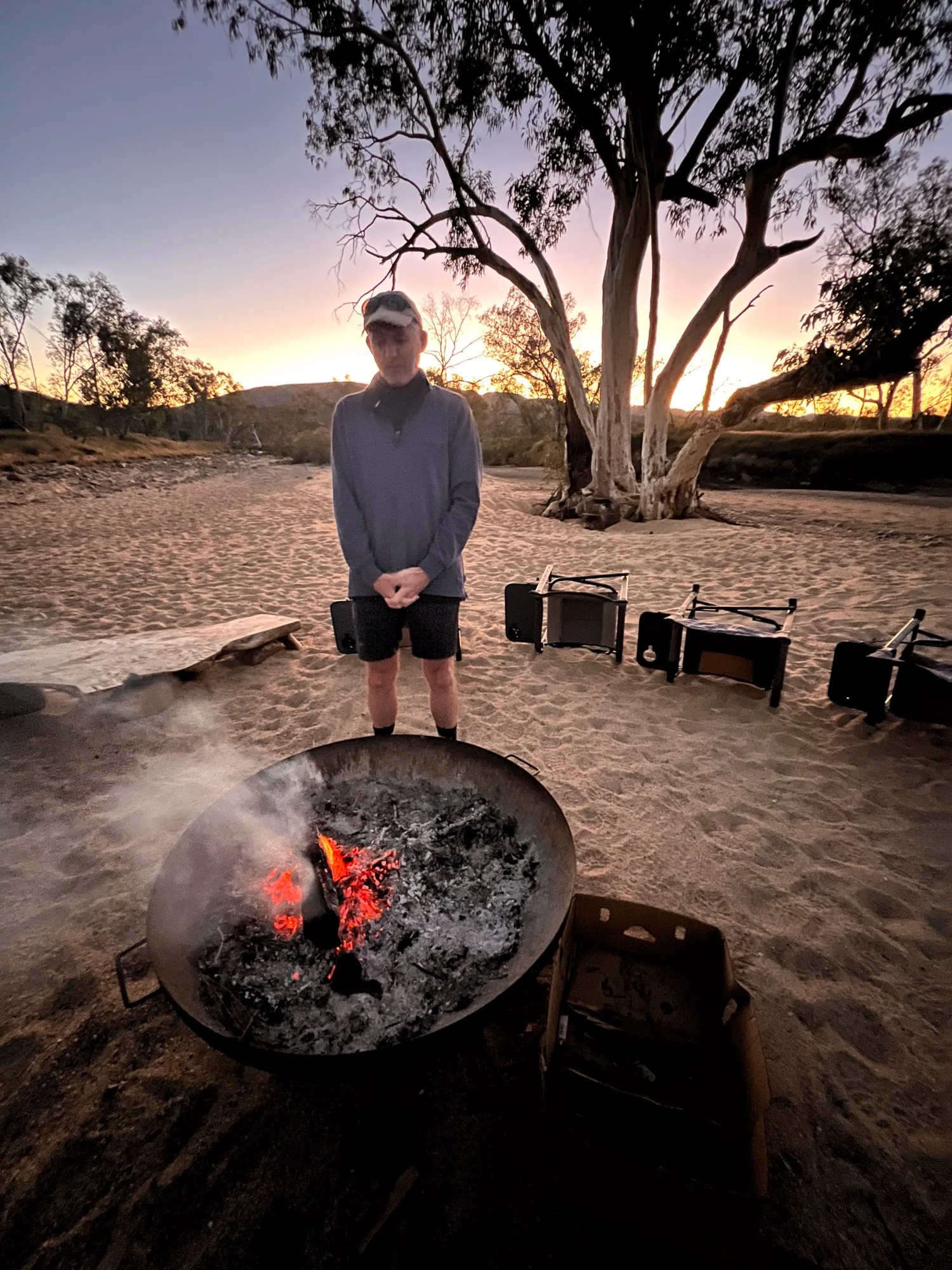
With a sense of acheivement already, we head off to what will be our base camp for the rest of the trip. It isn’t long before we are settled in, and the guides busy themselves preparing dinner. We, on the other hand, sit around the crackling fire, watching it like a primal television as we dine on hors d'oeuvres and wine.
At this moment, I appreciate Gabe’s choice of hike, where freeze-dried concoctions are replaced with gastronomic feasts of kangaroo, wild-caught barramundi, lamb cutlets, various vegetables and salads, followed by dessert. This is hiking in luxury. Thanks, Gabe, for being the motivator. I take it all back.


DAY 2: Heavitree Range and Count Point
As dawn's first light gently penetrates my eyelids, it takes a moment for my mind to remember where I am. Unlike the jarring blare of an electronic alarm clock, sleeping in a swag out in the open tunes you to nature’s own clock where the sun rouses you from your slumber. This is accompanied by the melodious chorus of zebra finches and grey-headed honeyeaters, serenading me into consciousness. Nestled on the edge of a dry riverbed, the soft sand beneath my swag rivals the comfort of any luxury hotel bed. Only the occasional buzz of a mosquito during the night serves as a reminder of my wild surroundings.


With an early start, we head towards Section 8 of the Larapinta Trail. While the full hike spans 12 sections, we only get to sample the menu, but what a taste it is. Section 8, through the Heavitree Range and Count Point, is undoubtedly the chef’s special.
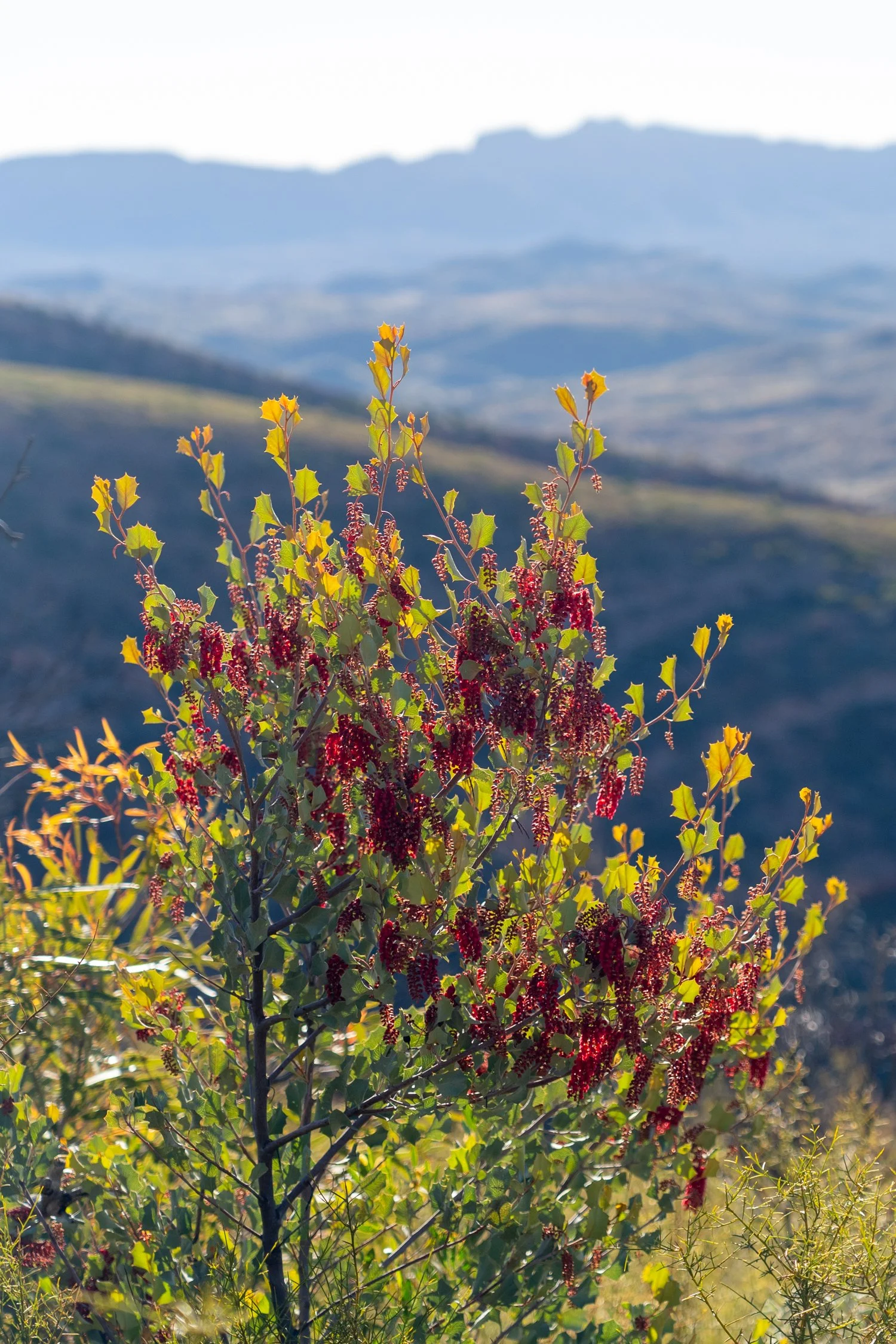
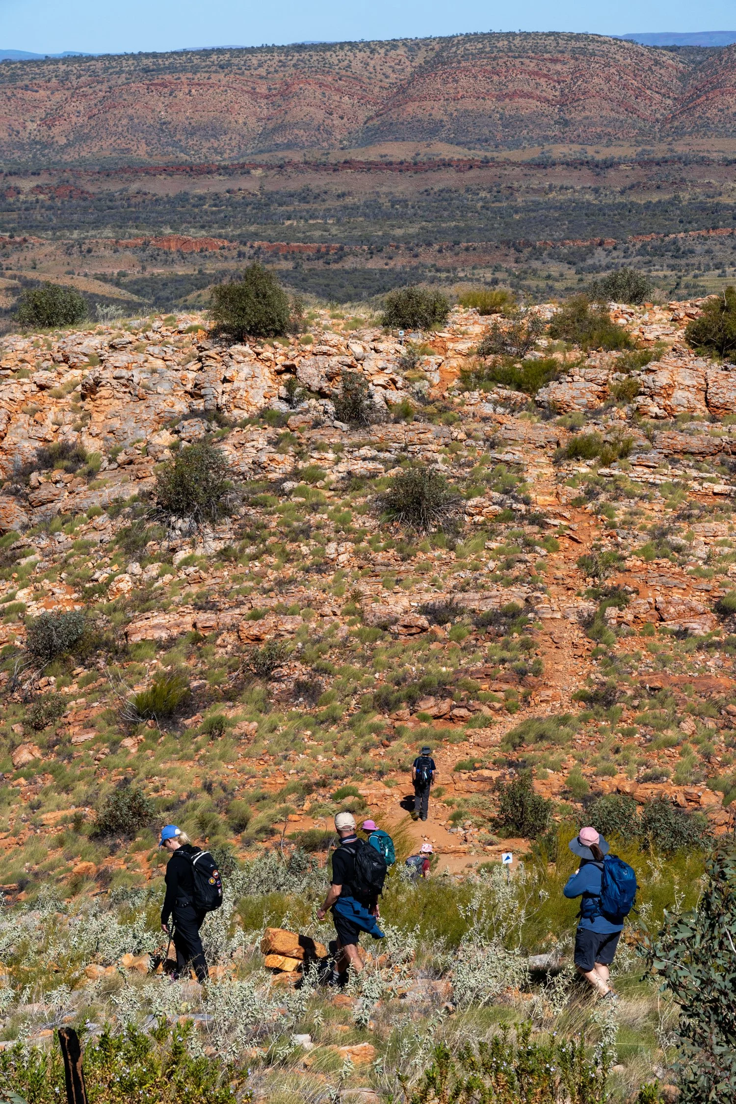
Our morning begins with a short yet steep climb up the Heavitree Range, navigating through a landscape dotted with desert fuchsias and brittle-branched cypress trees. The West MacDonnell Range unfolds before us in three parallel ridges: the Pacoota, the Heavitree, and the Chewings. Flying into Alice Springs, these ranges appeared flat and featureless from above, but the reality is far from it. As I huff and puff my way up the incline, my admiration grows for the trail runners who, only a week prior, braved the "West Macs Monster," a grueling 231 km non-stop race (the 2023 record was 39 hours, 56 minutes, 26 sec!). I find a momentary reprieve in the sight of a spinifex pigeon, its wispy crest mimicking the surrounding tufts of spinifex grass, basking in the gentle morning light.
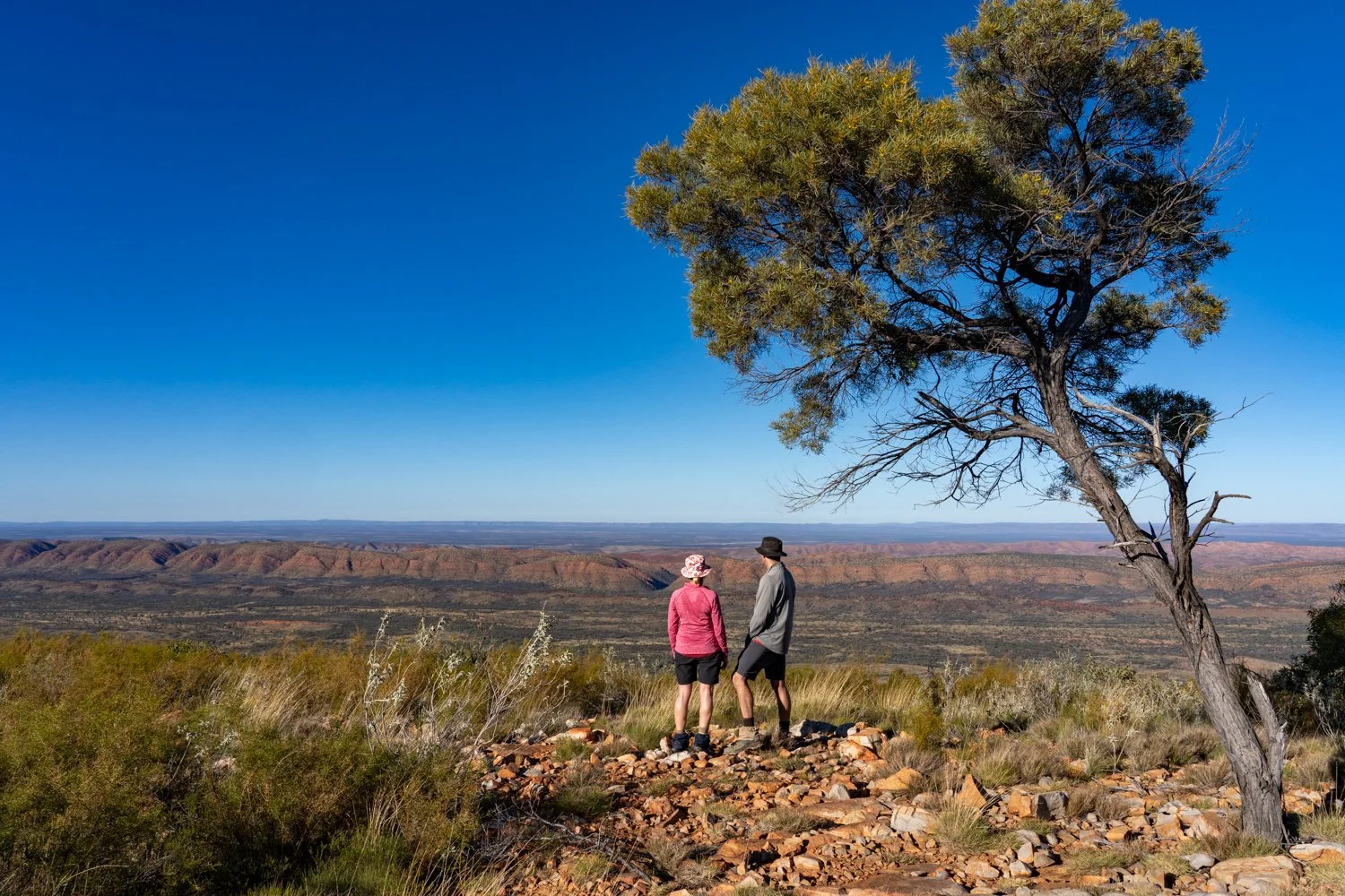


Reaching the ridgeline, the track levels out, allowing us to marvel at the undulating granite ridges stretching endlessly east and west. Segments of the range are chaotically beautiful, ancient rock formations bending and buckling like molten rubber. Below us, the valley hums with life, the distinctive whistle of the Whistling Kites piercing the air as they glide on thermals, ever watchful for prey.


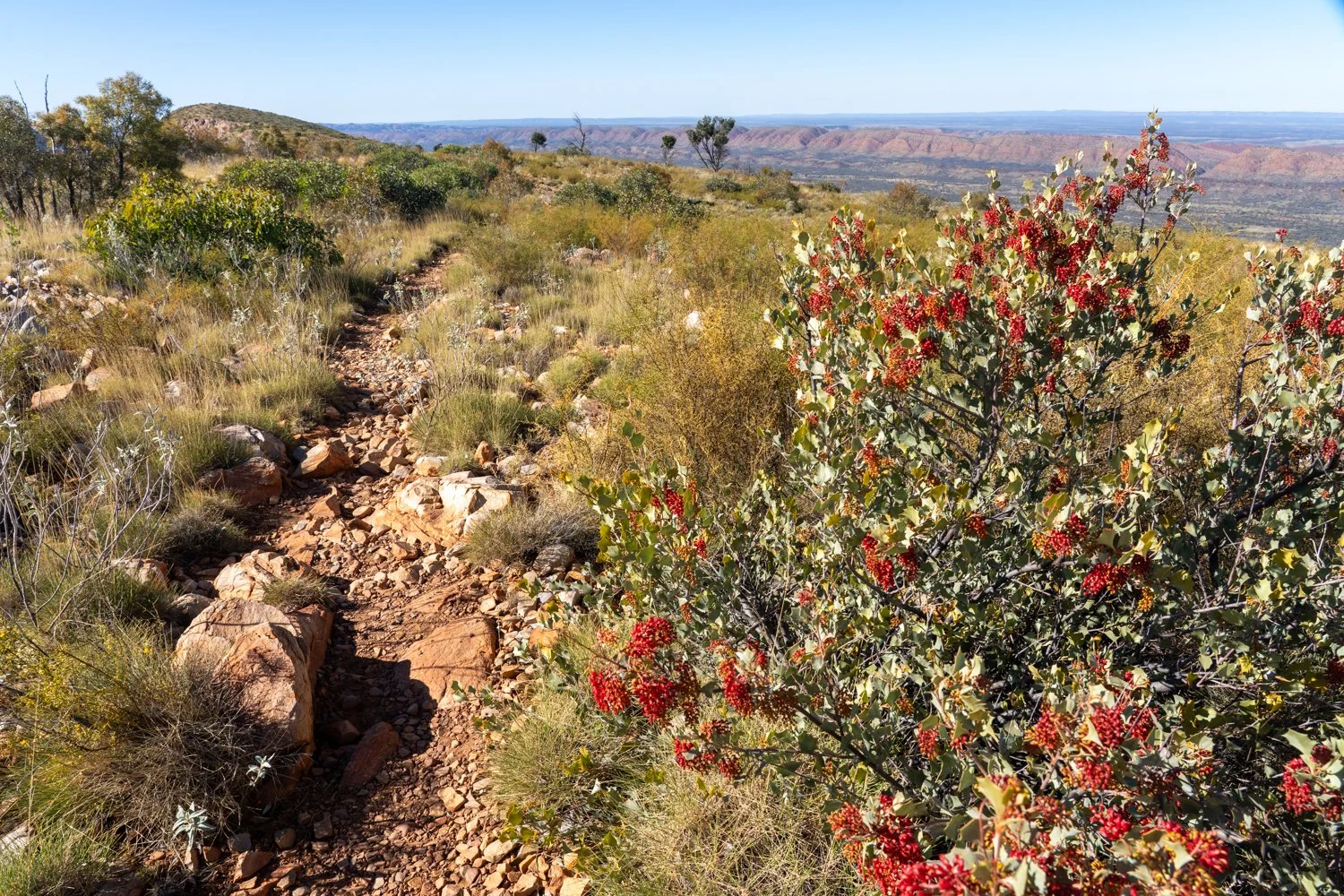


After several stops to drink in the breathtaking views, we drop our packs for a well-deserved rest and take a side trail up to Counts Point, standing at an elevation of about 1,000 meters. Describing this view is akin to describing a meal from a five-star restaurant: stunning, spellbinding, mesmerizing. Yet, even these superlatives fall short. The panorama from Counts Point is one of the most awe-inspiring on the entire Larapinta Trail. From here, three parallel ridges—the Pacoota to the left, the Heavitree directly ahead, and the Chewings to the right—stretch into the horizon, with the majestic Mt Sonder, our summit goal in a few days, standing sentinel in the distance. Counts Point earns its name from the sheer number of peaks visible on either side of the MacDonnell Ranges. While it’s tempting to stay and soak in the vista all day, the trail beckons us onward.


Despite the arid landscape, water’s ancient presence on the Larapinta Trail is undeniable. Descending from the range, we traverse slabs of ripple-marked rock, remnants of an ancient seabed now perched 1,000 meters above sea level and 1,300 km from the nearest ocean. These quartzite layers, formed 900 million years ago, predate even the earliest vertebrates.


As we continue, the landscape shifts dramatically. We move from a cooling forest of old hill mulga trees into a barren, rock-strewn expanse reminiscent of the Martian surface. These rocks, deposited haphazardly during floods, offer a stark contrast to the surrounding scenery. Eventually, we enter a gorge, climbing up to Serpentine Chalet Dam. Built in the 1960s in a failed attempt to create a tourist destination, the dam is a man-made intrusion in an otherwise pristine canyon.


While many Larapinta hikers would camp here for the night, we return to our base camp. Those on the overland trek often brave the dam's freezing waters for a wash, but we enjoy the luxury of a warm water rinse. With a bowl of hot water, I head to a small, thatched-screened area on a hill. There, a simple rock serves as a seat and a carved post holds my towel. Bathing naked under the open sky, with only the stars for company, is a primal and deeply satisfying experience.


Back in my swag, gazing up at the heavens of a million stars, occasionally streaked by a shooting star, I watch the moonrise until my eyes grow heavy. Exhausted and content, I drift off, ready to embrace another day in this magnificent wilderness.


DAY 3: Inarlanga Pass and the Orcha Pits
“Before the Dreamtime, there was nothing. The Earth was flat and lifeless; no stars glittered in the sky. The universe was dark and silent. The Ancestors lay sleeping, deep in the ground where they had passed the ages. But the Ancestors were restless; their long sleep was nearing its end. On the first morning of the world, they awoke, flexed their ancient limbs, and began calling the world into existence.
In the centre of the continent that would one day be called Australia, the Ancestors dreamed of a long chain of mountains stretching east-west across the red, level country of the desert. They dreamed of billabongs and rivers, ghost gums and animals. They filled the waters with creatures and the country with food. Then the people came and sang their songlines, which radiated out through the chasms and gaps to the distant corners of the land. And the Ancestors returned to their slumber.”


While the last two days have offered a visual feast, the Larapinta Trail’s allure extends beyond its natural wonders. This ancient path is rich with Australian history, echoing with timeless Dreaming tales and the sobering history of Indigenous subjugation that still reverberates today.
The Arrernte people have called this part of Central Australia home for tens of thousands of years. Their stories tell of the Caterpillar Dreaming that called their lands into being and it is these stories that are written into the landscape of the ranges and billabongs and cliffs of day 3.
The name "Larapinta" originates from the Western Arrernte language—Lhere-pirnte means "salty river," referring to the Finke River that carves through the outback. Today’s hike begins where we left off at Serpentine Chalet, continuing through part of Section 8 via Inarlanga Pass, and looping back via the Arrernte Walk. Departing the Chalet (don’t expect much—just a concrete footing remains), the track hugs the base of the Heavitree Range, its steep, rocky face a natural northern barrier. It is for this reason the rare gaps in the range have been, and continue to be, an important connecting point for any passage north-south.
One such gap is Inarlanga Pass, named after the elusive echidna. This narrow corridor was a vital route for local Indigenous tribes heading to ceremonies at Giles Spring, under Mt Giles. Only the men of the tribe were allowed through, as it marked the boundary between different tribal groups.
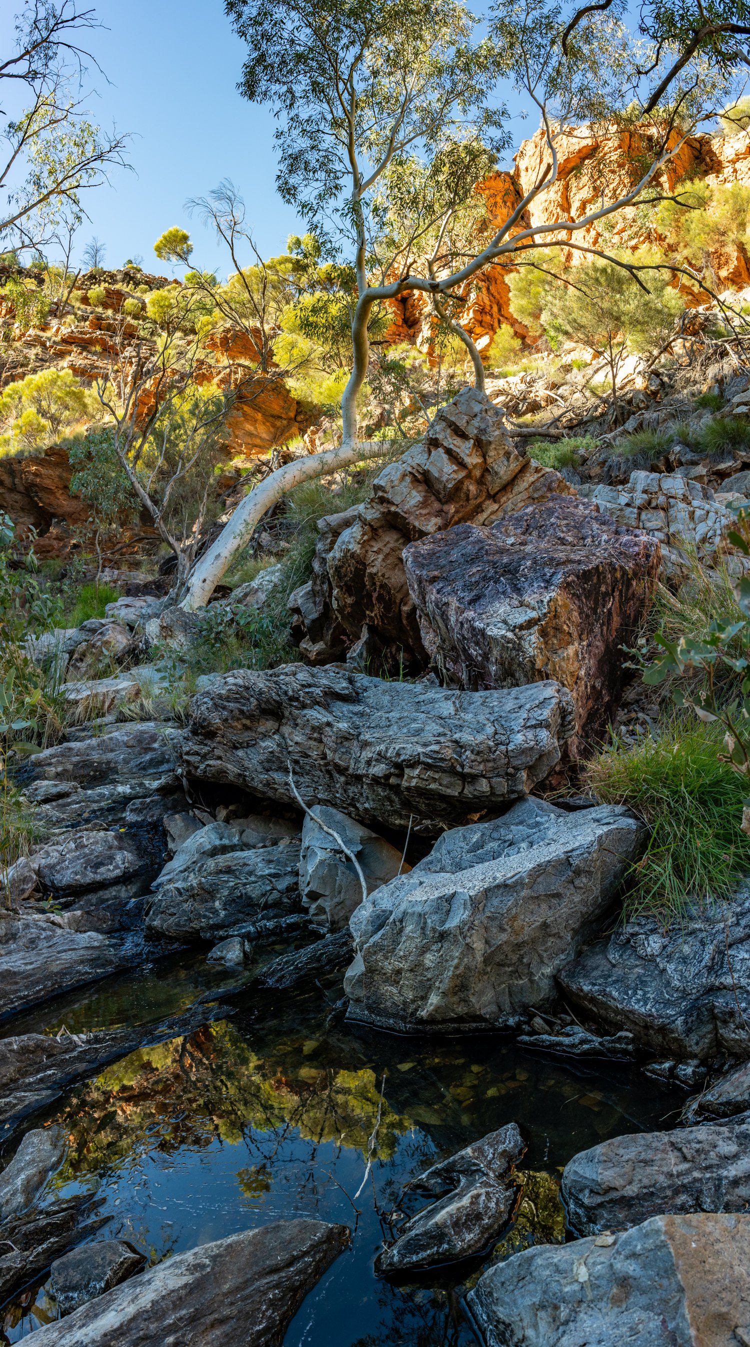
As we enter the pass, we pause to quietly seek permission, then proceed in solitude, allowing each person a moment of isolation. The silence gradually gives way to the soft trickle of water along the creek bed and the calls of Emu-wrens and Dusky Grasswrens flitting among the branches. Ghost gums sway gently in the cool breeze funnelling through the canyon, carrying with it the ancient Dreaming stories of the past.
Life seems more intense in the cool, protected creekline with hundreds of butterflies emerging from their pupa to fill the air. The sheer cliff faces rise either side, trees twisting skyward cling to its edge having somehow got a root hold in the smallest of cracks. Below the towering red rock prehistoric looking cycads, little changed since their ancestors 200 million years ago, line the creek. This rare endemic species has been isolated for millennia in refuges in the MacDonnell Ranges, it’s nearest relative located 1,400 kms away.


Like countless Aboriginal people before us, we eventually emerge on the other side of the range. Though not connecting with tribes or attending ceremonies, we recognise the profound significance of this narrow opening. We pause, feeling a deeper connection to the land and a more reflective understanding of humanity’s place in the timeline of this ancient landscape.
While the traditional owners have roamed these lands for over 60,000 years, it is but a blink in the eye of the 1.8 billion-year-old gneiss rocks. Over time, they have melted, crystalised, cooked and twisted with wind, water, fire and ice carving them like a wood turner sculpting and whittling away the rock over the eons.


Retracing our steps through the pass, we join the Arrernte Walk heading south with the Pacoota range in the distance. This gentle trail meanders through foothills, just above creek lines shaded by river gums. We eventually reach the Ochre Pits, another site of great cultural importance.
About 300 million years ago, dramatic mountain-building events heaved and rolled the earth thrusting the MacDonnell Ranges to heights rivalling the present day Himalayas. Horizontal sediment layers were upturned to near-vertical, exposing bands of yellow, white, orange, and red clay on cliff faces. The different coloured layers result from varying amounts of iron oxide, with higher iron creating red hues and lower iron yielding white, kaolin-rich clay. Aboriginal people mined these pigments for decoration and trade, exchanging them along ancient routes stretching from the north to south coasts of the continent.


After a day of trekking through the rugged beauty of the Trail, we return to our camp, weary but fulfilled. Instead of the customary warm birdy bath, we decide to embrace nature in its rawest form with a refreshing – and freezing – dip in Ormiston Gorge. As we wade into the icy waters, tired from the day's journey, our muscles experience their own version of an ice bath. The frigid water, the sharp intake of breath, the rush of blood – all heightened the sensation of being truly alive.
Surrounding us, the sheer cliffs of the gorge glow like embers in the late afternoon light, casting a warm, fiery hue over the water. The juxtaposition of the cold water and the warm light create a magical setting, making this natural bath a moment to remember.
As the sun begins to set, casting long shadows over the ancient geology, this fittingly marks the end of today’s adventure, reflecting on the profound and timeless Aboriginal stories etched into the landscape of the Larapinta Trail.


PART 2 to HERE